
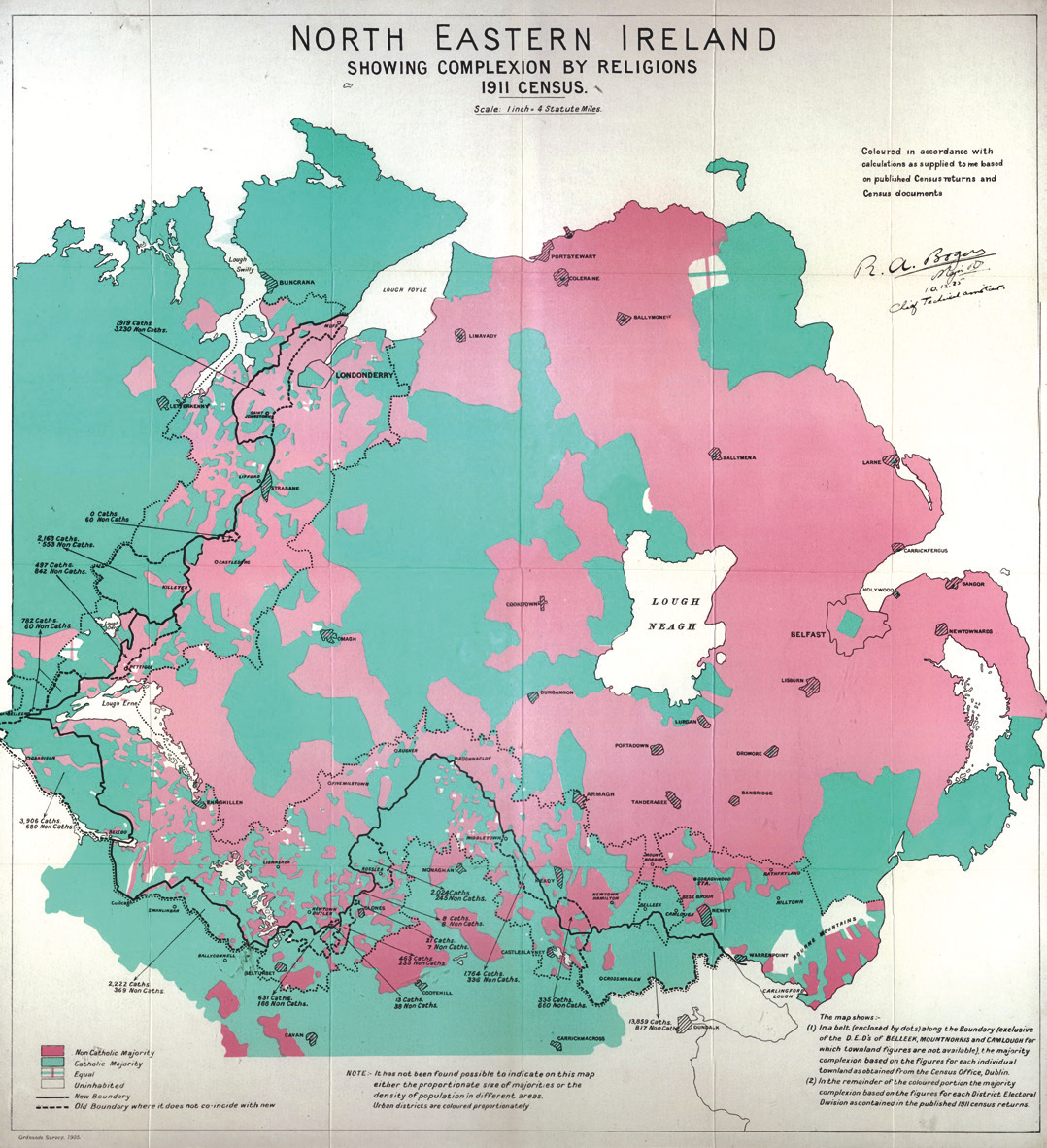
Image: Irish Boundary Commission final report map (1925) - religious distribution
Size of this preview: 547 × 600 pixels. Other resolutions: 219 × 240 pixels | 1,078 × 1,182 pixels.
Original image (1,078 × 1,182 pixels, file size: 2.31 MB, MIME type: image/png)
Description: Scans of map included with the Irish Boundary Commission final report, 1925 Available in B&W for free on National Archives (https://discovery.nationalarchives.gov.uk/details/r/C386829)
Usage Terms: Public domain
Image usage
The following page links to this image:

All content from Kiddle encyclopedia articles (including the article images and facts) can be freely used under Attribution-ShareAlike license, unless stated otherwise.
_-_religious_distribution.png)