
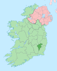
Image: Island of Ireland location map Carlow

Description: The island of Ireland, showing international border between Northern Ireland and Republic of Ireland, traditional provinces, traditional counties, and local authority areas in the Republic of Ireland and Northern Ireland.
Title: Island of Ireland location map Carlow
Credit: Island of Ireland location map.svg
Author: Island of Ireland location map.svg: Ireland location map.svg: NordNordWest Northern Ireland location map.svg: NordNordWest Northern Ireland - Counties.png: Maximilian Dörrbecker (Chumwa) Derivative works of this file: Rannpháirtí anaithnid derivative work: Mabuska
Usage Terms: Creative Commons Attribution-Share Alike 3.0
License: CC BY-SA 3.0
License Link: http://creativecommons.org/licenses/by-sa/3.0
Attribution Required?: Yes
Image usage
The following page links to this image:
