
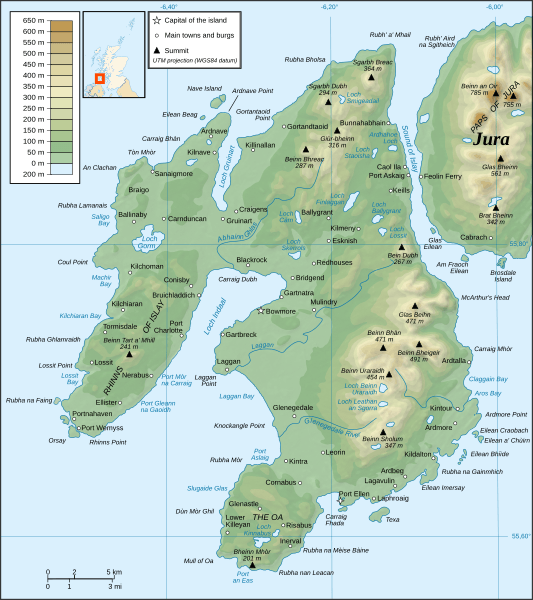
Image: Islay topographic map-en

Description: Topographic map in English of Islay, Scotland.
Title: Islay topographic map-en
Credit: Own work ; Topography : NASA Shuttle Radar Topography Mission (SRTM3 v.2) data (public domain) edited with 3DEM and dlgv32 Pro and vectorized with Inkscape ; UTM projection ; WGS84 datum ; shaded relief (composite image of N-W, W and N lightning positions) ; Bathymetry : USGov public domain data provided by Demis (see the approval e-mail and the Demis forum) ; Reference used for the additional data : Magic ; Locator map : Sting's composition of Image:British_Isles_Northern_Ireland.svg, Image:British_Isles_Scotland.svg and Image:British_Isles_Wales.svg (modified) created by Cnbrb under PD ; Note: The shaded relief is a raster image embedded in the SVG file.
Author: Ayack
Usage Terms: Creative Commons Attribution-Share Alike 3.0
License: CC BY-SA 3.0
License Link: https://creativecommons.org/licenses/by-sa/3.0
Attribution Required?: Yes
Image usage
The following 3 pages link to this image:
