
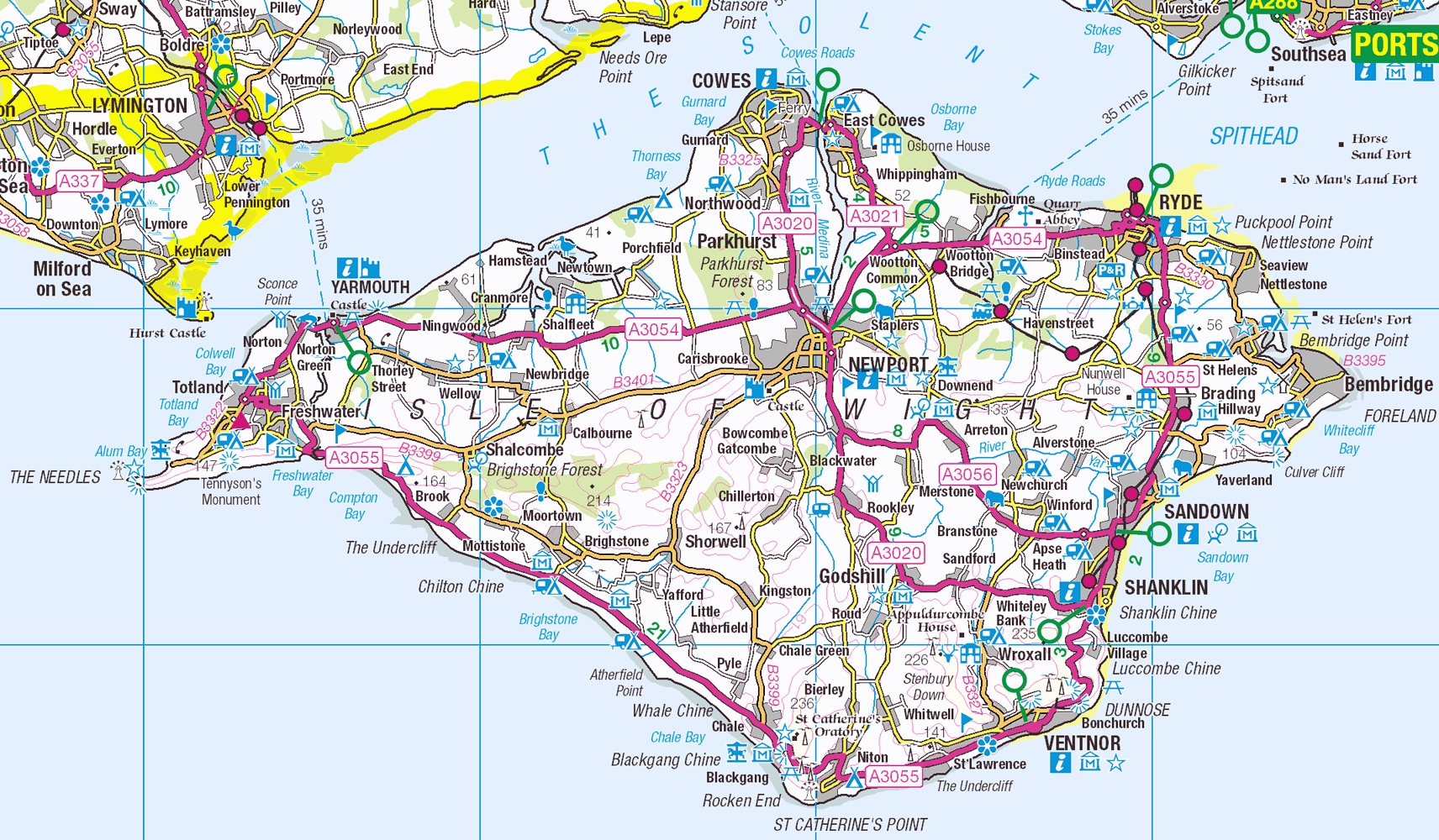
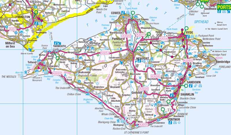
Image: Isle of Wight OS OpenData map
Description: Map of the Isle of Wight
Title: Isle of Wight OS OpenData map
Credit: OS OpenData → This file has been extracted from another file: Ordnance Survey 1-250000 - SZ.jpg
Author: Ordnance Survey
Permission: This file is licensed under the Ordnance Survey OpenData License. In short: you are free to distribute and modify the file as long as you attribute the Ordnance Survey. Attribution: Contains Ordnance Survey data © Crown copyright and database right Note: Derivative works can be licensed under any Creative Commons Attribution 3.0 Licence. Ordnance Survey OpenData LicenceOS OpenDatahttps://www.ordnancesurvey.co.uk/business-and-government/licensing/using-creating-data-with-os-products/os-opendata.htmltrue
Usage Terms: Ordnance Survey OpenData Licence
License: OS OpenData
License Link: https://www.ordnancesurvey.co.uk/business-and-government/licensing/using-creating-data-with-os-products/os-opendata.html
Attribution Required?: Yes
Image usage
The following page links to this image:
