
Image: Ivy City 1887
Size of this preview: 660 × 599 pixels. Other resolutions: 264 × 240 pixels | 759 × 689 pixels.
Original image (759 × 689 pixels, file size: 218 KB, MIME type: image/jpeg)
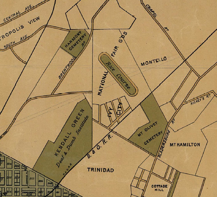
Description: A map of the District of Columbia from 1887, showing the location of Ivy City, the Ivy City Racecourse, and other local points of interest.
Title: Ivy City 1887
Credit: https://www.dcvote.org/sites/default/files/documents/articles/30_0.pdf
Author: Silversparre, Axel. Map of Washington, D.C., and Environs: With marginal numbers and measuring tape attachment for instantly locating points of interest within a radius of twenty miles from the Capitol. Washington, D.C.: R.E. Whitman, 1887.
Usage Terms: Public domain
License: Public domain
Attribution Required?: No
Image usage
The following page links to this image:

All content from Kiddle encyclopedia articles (including the article images and facts) can be freely used under Attribution-ShareAlike license, unless stated otherwise.