
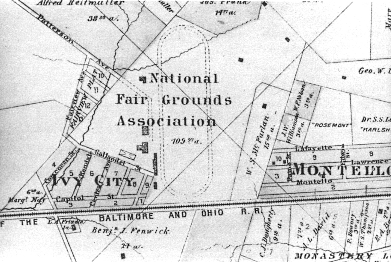
Image: Ivy City 1887 Hopkins map
Size of this preview: 800 × 537 pixels. Other resolutions: 320 × 215 pixels | 1,306 × 877 pixels.
Original image (1,306 × 877 pixels, file size: 375 KB, MIME type: image/jpeg)
Description: Depiction of Ivy City Subdivision, along with the National Fair Grounds horse racing track, in Washington, D.C., in 1887.
Title: Ivy City 1887 Hopkins map
Credit: http://hdl.loc.gov/loc.gmd/g3850m.gct00186
Author: Hopkins, G.M. Atlas of Fifteen Miles around Washington, 1887. Philadelphia: G.M. Hopkins Co., 1887, plate 43.
Usage Terms: Public domain
License: Public domain
Attribution Required?: No
Image usage
The following page links to this image:

All content from Kiddle encyclopedia articles (including the article images and facts) can be freely used under Attribution-ShareAlike license, unless stated otherwise.