
Image: JeffFryDetail

Size of this preview: 581 × 600 pixels. Other resolutions: 233 × 240 pixels | 656 × 677 pixels.
Original image (656 × 677 pixels, file size: 102 KB, MIME type: image/jpeg)
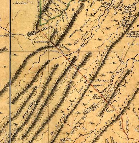
Description: Detail from the “Fry-Jefferson map” of Virginia (1751) showing “Lord Fairfax his Boundary Line”. (Full name: “A map of the most inhabited part of Virginia containing the whole province of Maryland with part of Pensilvania, New Jersey and North Carolina.” Drawn by Joshua Fry & Peter Jefferson in 1751, published by Thos. Jefferys, London, 1755.)
Title: JeffFryDetail
Credit: http://www.learnnc.org/lp/multimedia/7493
Author: Peter Jefferson and Joshua Fry (1751)
Permission: Public domain (1751 map)
Usage Terms: Public domain
License: Public domain
Attribution Required?: No
Image usage
The following page links to this image:

All content from Kiddle encyclopedia articles (including the article images and facts) can be freely used under Attribution-ShareAlike license, unless stated otherwise.