
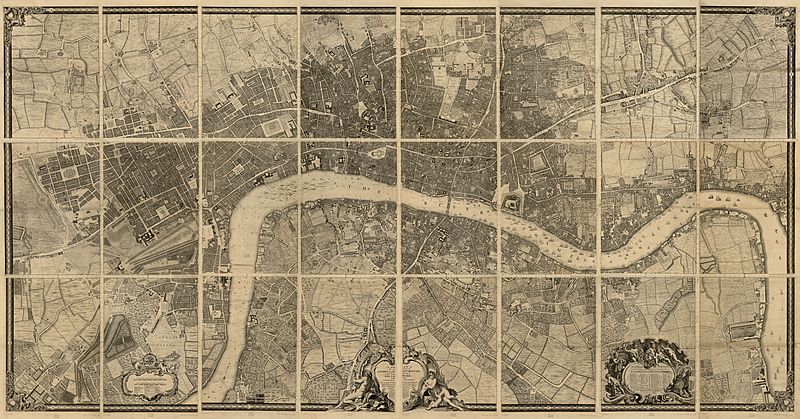
Image: John Rocque's map of London and Westminster, 1746 low res

Size of this preview: 800 × 419 pixels. Other resolutions: 320 × 167 pixels | 6,048 × 3,164 pixels.
Original image (6,048 × 3,164 pixels, file size: 5.6 MB, MIME type: image/jpeg)
Description: A plan of the cities of London and Westminster, and borough of Southwark, with the contiguous buildings
Title: John Rocque's map of London and Westminster, 1746 low res
Credit: Rocque, John, -1762, John Pine, and John Tinney. A plan of the cities of London and Westminster, and borough of Southwark, with the contiguous buildings. London, John Pine & John Tinney, 1746. Map. https://www.loc.gov/item/76696823/. jpeg 6048x3164 px
Author: Rocque, John, -1762. Pine, John, 1690-1756. Tinney, John
Usage Terms: Public domain
License: Public domain
Attribution Required?: No
Image usage
The following page links to this image:

All content from Kiddle encyclopedia articles (including the article images and facts) can be freely used under Attribution-ShareAlike license, unless stated otherwise.