John Rocque facts for kids
John Rocque (born around 1704 – died 1762) was a skilled mapmaker and surveyor from France who later moved to Britain. He is most famous for creating a very detailed map of London in 1746. His maps are still important today for understanding what cities and gardens looked like a long time ago.

Life and Career
John Rocque was born in France around 1704. His family, who were Huguenots (French Protestants), had to leave France. They first went to Geneva and then, probably in 1709, moved to England.
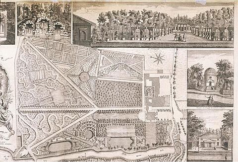
Besides making maps, Rocque also worked as an engraver and sold maps. When he was younger, he was involved in gardening. He lived with his brother Bartholomew, who was a landscape gardener. John Rocque helped create plans for fancy gardens called parterres. He made engraved plans for gardens at places like Wrest Park (1735), Claremont (1738), and Wilton House (1746).
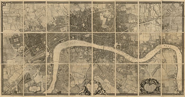
Rocque is best known for his amazing Map of London. He started working on it in 1737. The map was so big that it was printed on 24 separate sheets in 1746. It was the most detailed map of London ever made at that time. Today, it helps historians understand what London looked like in the 1700s.
Because of his excellent maps, Rocque was named the official mapmaker for Frederick, Prince of Wales in 1751. In 1750, a fire destroyed his workshop and all his maps. But he didn't give up! By 1753, he had ten people working for him. He then published The Small British Atlas, which was a new set of maps for all the counties in England and Wales. A second edition came out in 1762. He also surveyed and published maps of Middlesex, Oxford, Berkshire, and Buckinghamshire in 1760.
Time in Dublin
John Rocque lived in Dublin, Ireland, for six years (1754–1760). While there, he created many maps of the Irish capital. He also made county maps for Dublin and Armagh. He even made city maps for Kilkenny and Cork.
In 1756, he published the first very detailed printed map of Dublin. It was called An Exact Survey of the City and Suburbs of Dublin. A small part of this map was later featured on an Irish ten-pound banknote! Rocque also mapped the areas around Dublin in 1758. This map covered places like Skerries to the north and Blessington to the south.
Personal Life
John Rocque was married twice. After he passed away, his wife, Mary Ann Rocque, continued to run his mapmaking business.
 | Janet Taylor Pickett |
 | Synthia Saint James |
 | Howardena Pindell |
 | Faith Ringgold |


