Mary Ann Rocque facts for kids
Quick facts for kids
Mary Ann Rocque
|
|
|---|---|
| Born |
Mary Ann Scalé
c. 1725 |
| Died | after 1770 (aged at least 45) |
| Other names | Mary Ann Scalé, M. A. Rocque, Mary Ann Bew, Ann Bew |
| Years active | 1740s-1760s |
| Spouse(s) | John Rocque |
Mary Ann Rocque, born Mary Ann Scalé, (c. 1725 - after 1770) was an important mapmaker in London during the 1700s. Her special booklet, A Set of Plans and Forts of America (1765), showed two of the very first maps of Albany, New York. This booklet also celebrated how the British won battles against the French in North America.
Contents
Mary Ann's Family and Background
Mary Ann Scalé was born in England around 1725. Her father was Bernard Scalé, and her uncle was Peter Scalé. She was the older sister of Peter Bernard Scalé, who also became a mapmaker in Dublin.
Mary Ann married Edward Bew, who was an apothecary (like a pharmacist), before 1743. Later, in 1751, she married John Rocque. John Rocque was a famous mapmaker himself. He was even called "Chorographer to the Prince of Wales" and "Topographer to His Royal Highness the Duke of Glouchester." These titles meant he was a special mapmaker for the royal family. John Rocque passed away in 1762.
Both the Scalé and Rocque families were Huguenots. This means they were French Protestants who had moved to England. Mary Ann's sister, Margaret, also married a French mapmaker named Louis Stanislaus de la Rochette.
Mary Ann's Amazing Career
After her husband John Rocque died, Mary Ann Rocque took over his mapmaking business. She even kept his important title of "Topographer." She worked from their shop in the Strand area of London. She also teamed up with another person named Andrew Dury.
Mary Ann didn't just keep her husband's business going. She also created and published many new and important maps herself.
Publishing New Maps
In 1762, Mary Ann published her late husband's map called A survey of the County of Surrey. This was the first very large map of the English county of Surrey.
She continued to publish new works. In 1763, she released a new version of her husband's map, The Environs of London Reduced from an Actual Survey in 16 Sheets. This map showed the areas around London. She dedicated this new edition to a very important person, George Montagu-Dunk, 2nd Earl of Halifax.
Famous American Maps
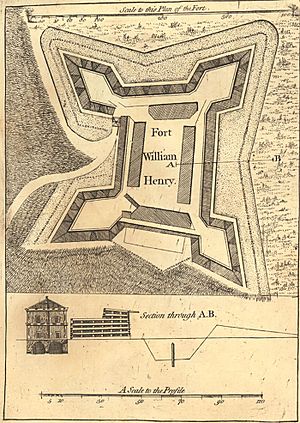
One of her most famous works came out in 1765. It was called A Set of Plans and Forts of America. This was a collection of thirty maps and plans. These plans showed forts and places that were very important during the French and Indian War. This war had just ended.

Her booklet included a small map called Plan of the City of Albany. This map showed where Fort Frederick was located in Albany. Mary Ann Rocque's maps of Fort Frederick and the city of Albany are thought to be the two earliest maps of Albany ever published. Experts have described A Set of Plans and Forts of America as a way to celebrate Britain's victory and its growing empire.
Around 1769, Mary Ann Rocque passed on most of her family's mapmaking business. She transferred it to a printer and publisher named Carington Bowles.
Today, you can find maps published by Mary Ann Rocque in many important places. These include the National Archives and the Massachusetts Historical Society. Some of her maps were published using the name M. A. Rocque.
 | Precious Adams |
 | Lauren Anderson |
 | Janet Collins |

