
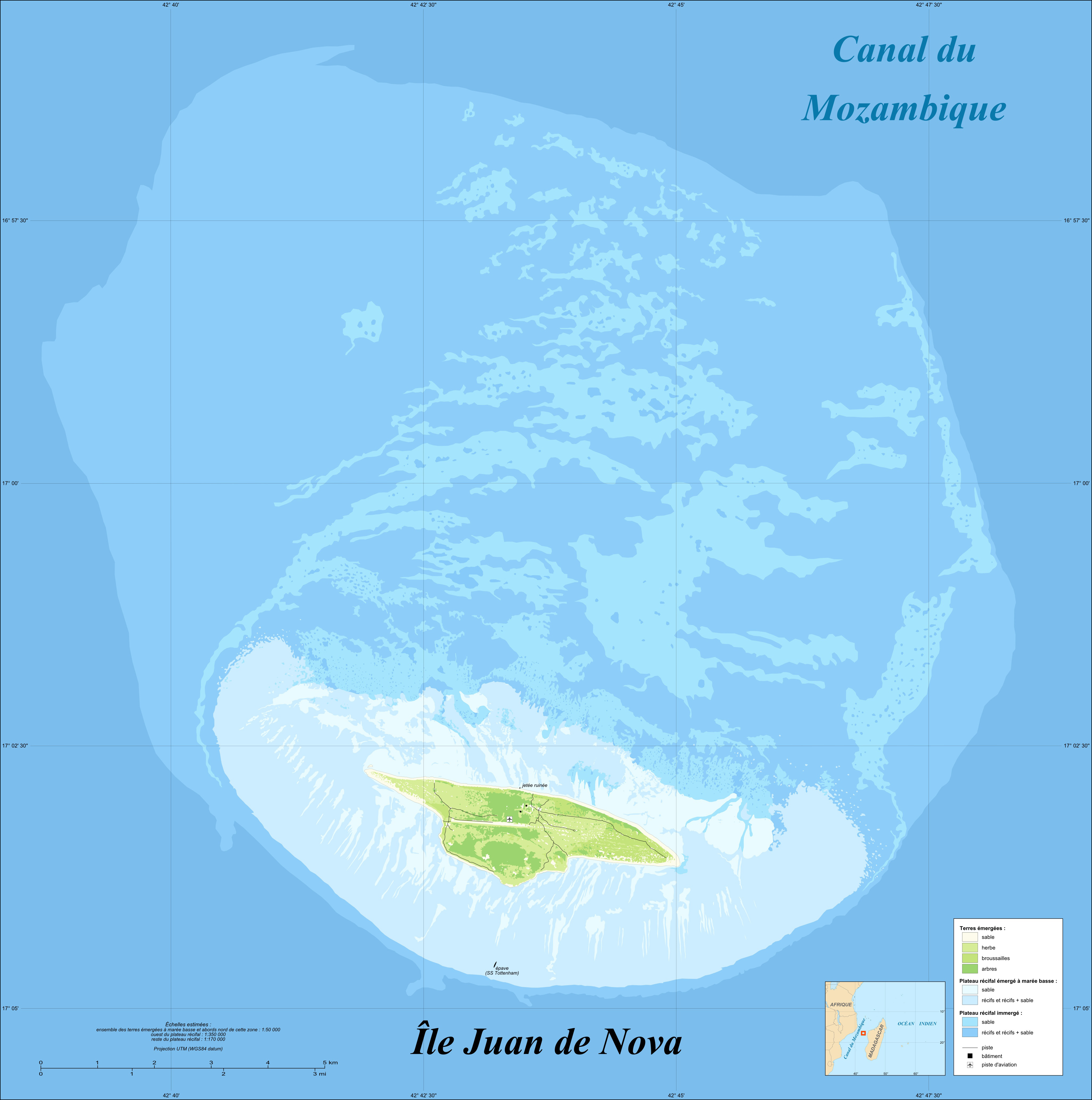
Image: Juan de Nova Island and reef land cover map-fr
Description: Map in French with the land cover of the French Island of Juan de Nova and its reef, Scattered islands in the Indian Ocean. UTM projection, WGS84 datum Precision chart of the map Estimated scales (see details on the precision chart of the map) : whole raised zone at low tide and north surroundings of this area : 1:50,000 west of the reef : 1:350,000 other parts of the reef: 1:170,000 Notes: The limits between the sandbanks and the areas of reefs + sand are approximated ; The location and shape of the sandbanks vary in time. The map represents them as in the years 2000 to 2002.
Title: Juan de Nova Island and reef land cover map-fr
Credit: Own work See complete description on the Image:Juan_de_Nova_Island_and_reef_land_cover_map-fr.svg's page.
Author: Eric Gaba (Sting - fr:Sting)
Permission: Attribution and Share-Alike required Any use of this map can be made as long as you credit me (Eric Gaba – Wikimedia Commons user: Sting) as the author and distribute the copies and derivative works under the same license(s) that the one(s) stated below. A message with a reply address would also be greatly appreciated.
Usage Terms: Creative Commons Attribution-Share Alike 4.0
License: CC BY-SA 4.0
License Link: https://creativecommons.org/licenses/by-sa/4.0
Attribution Required?: Yes
Image usage
The following page links to this image:
