
Image: Julius Rubens Ames, Moral Map of U.S. 1847 Cornell CUL PJM 2051 01

Size of this preview: 557 × 600 pixels. Other resolutions: 223 × 240 pixels | 3,500 × 3,770 pixels.
Original image (3,500 × 3,770 pixels, file size: 3.35 MB, MIME type: image/jpeg)
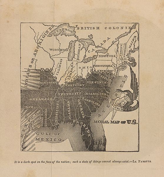
Description: This anti-slavery map was first published in 1837, before the annexation of Texas and republished several times up to 1857. It shows the slave states in black, with black-and-white shading representing the threatened spread of slavery into Texas and the western territories.
Title: Moral Map of U.S. 1847
Credit: Ames, Julius Rubens. 1847. The Legion of Liberty and Force of Truth, Containing the thoughts, words, and deeds, of some prominent Apostles, Champions and Martyrs. New York: American Anti-Slavery Society, 10th ed. Cornell University: Persuasive Cartography: The PJ Mode Collection
Author: Julius Rubens Ames
Usage Terms: Public domain
License: Public domain
Attribution Required?: No
Image usage
The following page links to this image:

All content from Kiddle encyclopedia articles (including the article images and facts) can be freely used under Attribution-ShareAlike license, unless stated otherwise.