
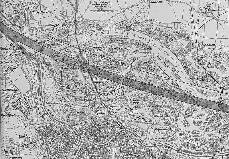
Image: Karte Donaudurchstich

Size of this preview: 800 × 556 pixels. Other resolutions: 320 × 222 pixels | 1,479 × 1,028 pixels.
Original image (1,479 × 1,028 pixels, file size: 855 KB, MIME type: image/jpeg)
Description: Plan of the danube-regulation
Title: Karte Donaudurchstich
Credit: Scanned by Geiserich77 from: Hinkel, Raimund: Wien XXI. Floridsdorf. Das Heimatbuch. Wien 1994.
Author: Unknown authorUnknown author
Permission: Public Domain because of age
Usage Terms: Public domain
License: Public domain
Attribution Required?: No
Image usage
The following page links to this image:

All content from Kiddle encyclopedia articles (including the article images and facts) can be freely used under Attribution-ShareAlike license, unless stated otherwise.