
Image: KelleyMap3Newtown-HistoricQueens-Marked
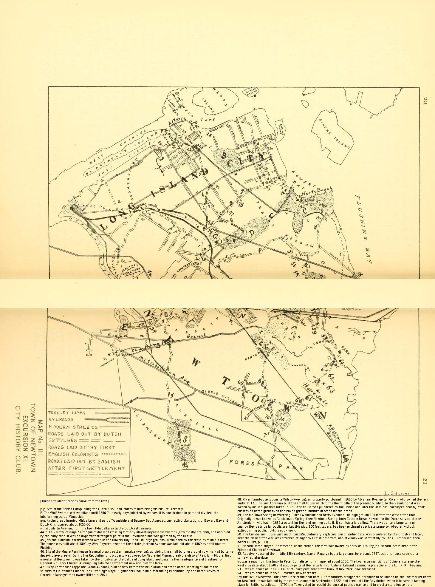
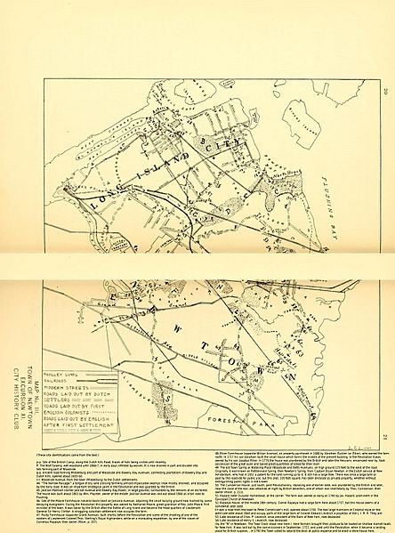
Description: Map No. III. Town of Newtown. Excursion XI. City History Club. Drawn by L.C. Licht. Due to tight a tight binding, this two-page map is missing its middle section. It shows locations in Woodside and surrounding areas of Queens in the mid-17th-mid-19th centuries along with streets, railroads, and trolley lines from the year in which it was made (1908). Modern Woodside is shown as "Woodside" and "North Woodside."
Title: KelleyMap3Newtown-HistoricQueens-Marked
Credit: Excursion planned for the City history club of New York by Frank Bergen Kelley; No. XI -- Historic Queens. Compiled from an unpublished manuscript entitled "Ancient Landmarks of Queens Borough." by J.H. Innes. (Published 1908 in [New York] by the City History Club of New York)
Author: Frank Bergen Kelley; the map is by L.C. Licht
Usage Terms: Public domain
License: Public domain
Attribution Required?: No
Image usage
The following 2 pages link to this image:
