
Image: Khalid ibn al-Walid's Desert March to Syria, ca. April 634
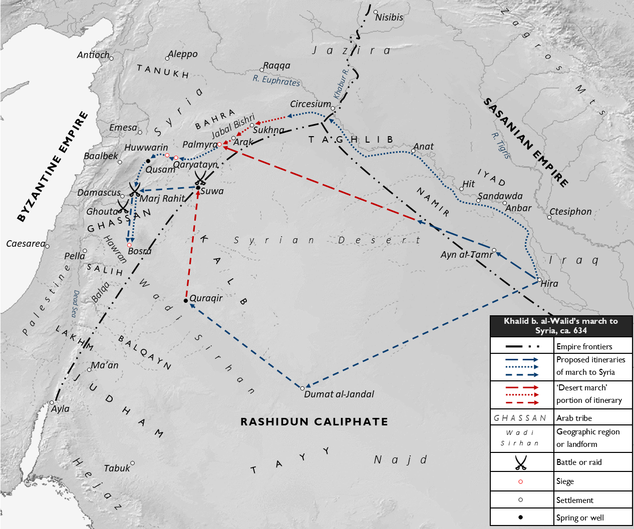
Description: Map of the three main, proposed itineraries of Khalid ibn al-Walid's march to Syria from Iraq, in circa April 634. The blue portion of the routes indicate his general itinerary to Syria, while the red portion of the routes indicate the 'desert march' phase of the itinerary. The routes traced in the map are based on the modern historian Fred Donner's summarization of the various routes cited by the 8th and 9th-century Islamic literary sources, namely Ibn Ishaq, al-Baladhuri, Sayf ibn Umar, Ibn A'tham al-Kufi and al-Ya'qubi. Settlements, place names and battles/raids associated with the Syrian part of the routes are shown. The identifications/locations of Suwa, Quraqir, and Qusam are based on the conclusions of Alois Musil in his Arabia Deserta (1927). However, these remain tentative. The general dwelling areas of the nomadic and semi-nomadic Arab tribes of the Fertile Crescent region are indicated, as are the approximate frontiers of the Byzantine, Sasanian and nascent Islamic ('Rashidun Caliphate') empires. Sources: Base map from DEMIS World Map. Donner, Fred M. (1981). The Early Islamic Conquests. Princeton: Princeton University Press. ISBN 0-691-05327-8. Musil, Alois. (1927). Arabia Deserta: A Topographical Itinerary. New York: Czech Academy of Sciences and Art and Charles R. Crane.
Title: Khalid ibn al-Walid's Desert March to Syria, ca. April 634
Credit: Own work
Author: Al Ameer son
Usage Terms: Creative Commons Attribution-Share Alike 4.0
License: CC BY-SA 4.0
License Link: https://creativecommons.org/licenses/by-sa/4.0
Attribution Required?: Yes
Image usage
The following page links to this image:
