
Image: Khmer Empire Expansion (cropped1)

Size of this preview: 800 × 580 pixels. Other resolutions: 320 × 232 pixels | 1,956 × 1,419 pixels.
Original image (1,956 × 1,419 pixels, file size: 144 KB, MIME type: image/png)
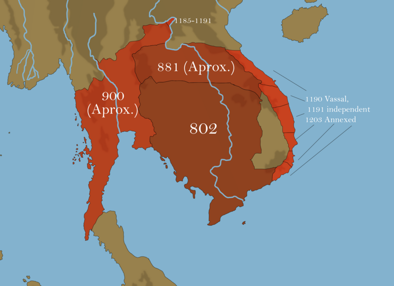
Description: This map shows the expansion of the Khmer Empire pheripheral to the years 802-1203. It includes expansion North, expansion into Thailand (Lavo Kingdom) and expansion into Champa.
Title: Khmer Empire Expansion (cropped1)
Credit: Own work
Author: Thames Mapping
Usage Terms: Creative Commons Attribution-Share Alike 4.0
License: CC BY-SA 4.0
License Link: https://creativecommons.org/licenses/by-sa/4.0
Attribution Required?: Yes
Image usage
The following page links to this image:

All content from Kiddle encyclopedia articles (including the article images and facts) can be freely used under Attribution-ShareAlike license, unless stated otherwise.
.png)