
Image: Kokoda track Papua New Guinea
Size of this preview: 800 × 600 pixels. Other resolutions: 320 × 240 pixels | 2,304 × 1,728 pixels.
Original image (2,304 × 1,728 pixels, file size: 1.86 MB, MIME type: image/jpeg)
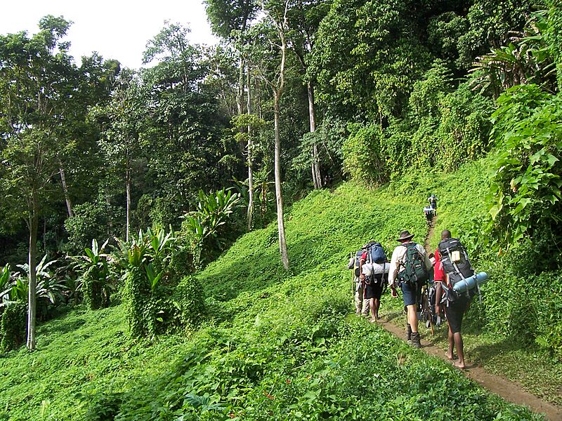
Description: Walking the Kokoda track, Papua New Guinea. This section of the track is known as the potato fields and is located between the village of Kokoda and the village of Isurava. The kokoda track was the scene of fighting between Australian and Japanese forces during World War II.
Title: Kokoda track Papua New Guinea
Credit: Luke Brindley's own photograph, taken by him (me).
Author: Luke Brindley
Permission: I own the file and give permission for publication on Wikipedia
Usage Terms: Creative Commons Attribution-Share Alike 4.0
License: CC BY-SA 4.0
License Link: https://creativecommons.org/licenses/by-sa/4.0
Attribution Required?: Yes
Image usage
The following page links to this image:

All content from Kiddle encyclopedia articles (including the article images and facts) can be freely used under Attribution-ShareAlike license, unless stated otherwise.