
List of World Heritage Sites in Oceania facts for kids

A World Heritage Site is a special place recognized by UNESCO. These places have amazing cultural or natural value. They are important for everyone on Earth! The World Heritage Committee has chosen 37 such sites in Oceania. These sites are found in 14 different countries. Most of them are in Australia.
The first three sites from Oceania were chosen in 1981. These were the Great Barrier Reef, Kakadu National Park, and the Willandra Lakes. Oceania is home to the world's three largest sites. These are the Phoenix Islands Protected Area, Papahānaumokuākea, and the Great Barrier Reef. Also, the Tasmanian Wilderness is super special. It meets seven out of ten rules for being a World Heritage Site.
Every year, the World Heritage Committee can add new sites. They can also remove sites if they no longer meet the rules. Sites are chosen based on ten rules. Six rules are for cultural heritage, and four are for natural heritage. Some sites are "mixed" because they have both cultural and natural value. In Oceania, there are 11 cultural, 19 natural, and 7 mixed sites. UNESCO can also say a site is in danger. This means something is threatening what makes the site special. For example, in 2013, East Rennell was put on the "in danger" list. This was because logging activities were a threat to its unique value.
Contents
Understanding the Sites List
This section helps you understand the list of World Heritage Sites in Oceania. The list includes all sites located in the Oceania region. Some sites belong to countries outside Oceania. For example, sites in Chile, France, the United Kingdom, and the United States are included.
- Site – This is the official name given by the World Heritage Committee.
- Location – This tells you the country and region where the site is.
- Criteria – These are the specific rules the site meets. They can be cultural or natural.
- Area – This shows how big the site is in hectares (ha).
- Year – This is the year the site was added to the World Heritage List.
- Description – This gives you a short summary about the site.
![]() In danger
In danger
Amazing World Heritage Sites in Oceania
| Site | Image | Location | Criteria | Area ha (acre) |
Year | Description |
|---|---|---|---|---|---|---|
| Australian Convict Sites |  |
New South Wales, Norfolk Island, Tasmania and Western Australia, 33°22′42″S 150°59′40″E / 33.378333°S 150.994444°E |
Cultural: (iv), (vi) |
1,503 (3,710) | 2010 | These sites show where British convicts lived and worked. They were built during Australia's early colonial period. Eleven of these sites are chosen as the best examples. |
| Australian Fossil Mammal Sites (Riversleigh / Naracoorte) |  |
Queensland and South Australia, 19°05′00″S 138°43′00″E / 19.083333°S 138.716667°E |
Natural: (viii), (ix) |
10,300 (25,000) | 1992 | These sites are famous for their many fossils. They show how mammals in Australia changed over time. Riversleigh has very old mammal fossils. Naracoorte has well-preserved ice-age megafauna fossils. |
| Bikini Atoll Nuclear Test Site |  |
Ralik Chain, 11°36′00″N 165°22′50″E / 11.6°N 165.380556°E |
Cultural: (iv), (vi) |
0.97 (2.4) | 2010 | The United States tested 67 nuclear weapons here. This happened between 1946 and 1958. The tests greatly affected the environment and people. The site still shows many signs of these nuclear tests. |
| Budj Bim Cultural Landscape |  |
Victoria, 38°04′52″S 141°53′07″E / 38.0811111°S 141.8852778°E |
Cultural: (iii), (v) |
9,935 (24,550) | 2019 | This landscape was created by the Gunditjmara people. They built one of the world's oldest aquaculture systems here. Lava flows from Budj Bim helped create channels and dams. The Gunditjmara people have used this system for 6,000 years. |
| Chief Roi Mata's Domain |  |
Shefa, 17°37′41″S 168°10′40″E / 17.628069°S 168.177719°E |
Cultural: (iii), (v), (vi) |
886 (2,190) | 2008 | This site includes three places linked to Roy Mata. He was a powerful chief from the 13th century. His ideas still influence society today. The sites include his home, where he died, and his burial place. |
| East Rennell |
 |
Rennell and Bellona, 11°41′00″S 160°20′00″E / 11.683330°S 160.333330°E |
Natural: (ix) |
37,000 (91,000) | 1998 | Rennell Island is the world's largest raised coral atoll. It has many unique plants and animals. The southern part of the atoll has Te Nggano, the Pacific Ocean's largest lake. |
| Gondwana Rainforests of Australia |  |
Queensland and New South Wales, 28°15′S 150°03′E / 28.25°S 150.05°E |
Natural: (viii), (ix), (x) |
370,000 (910,000) | 1986 | This site is important for its geology and nature. It has the largest area of subtropical rainforest in the world. It protects over 200 rare or threatened plant and animal species. |
| Great Barrier Reef | .jpg) |
Queensland, 18°17′10″S 147°42′00″E / 18.286111°S 147.7°E |
Natural: (vii), (viii), (ix), (x) |
34,870,000 (86,200,000) | 1981 | This is the world's largest coral reef system. It has over 2,900 separate reefs. It is home to amazing marine biodiversity, with about 400 types of coral. It is a vital home for many endangered species. |
| Greater Blue Mountains Area |  |
New South Wales, 33°42′S 150°00′E / 33.7°S 150°E |
Natural: (ix), (x) |
1,032,649 (2,551,730) | 2000 | This area has sandstone tablelands and deep gorges. It is covered by eucalypt forests. It was chosen for its amazing variety of eucalypt species. It has eight protected areas that are homes for many endangered species. |
| Hawaii Volcanoes National Park |  |
Hawaiʻi, 19°24′03″N 155°07′25″W / 19.400833°N 155.123611°W |
Natural: (viii) |
92,934 (229,640) | 1987 | This park is on Hawaiʻi Island. It has two of the world's most active volcanoes: Kilauea and Mauna Loa. You can easily see constant volcanic activity here. This helps scientists learn about how volcanoes work. |
| Heard and McDonald Islands |  |
Heard and McDonald Islands, 53°06′S 73°30′E / 53.1°S 73.5°E |
Natural: (viii), (ix) |
37,200 (92,000) | 1997 | These two islands have the only active volcanoes in the subantarctic. They are important for studying glaciology and how landforms change. Most of Heard Island is covered by glaciers. Because they are so far away, their ecosystem is undisturbed. |
| Henderson Island |  |
Pitcairn Islands, 24°22′00″S 128°20′00″W / 24.366667°S 128.333333°W |
Natural: (vii), (x) |
3,700 (9,100) | 1988 | This is one of the most remote islands in the world. Its ecosystem is untouched by humans. It has many unique species. It's very valuable for natural science to study how isolated ecosystems work. |
| Kakadu National Park |  |
Northern Territory, 12°50′00″S 132°50′00″E / 12.8333°S 132.8333°E |
Mixed: (i), (vi), (vii), (ix), (x) |
1,979,766 (4,892,110) | 1981 | Kakadu's wetlands are very important worldwide. The park has archaeological sites showing human life for over 40,000 years. The rock art at Ubirr, Burrunggui, and Nanguluwu is famous. It dates back over 18,000 years. |
| K’gari (Fraser Island) |  |
Queensland, 25°13′00″S 153°08′00″E / 25.216667°S 153.133333°E |
Natural: (vii), (viii), (ix) |
184,000 (450,000) | 1992 | Fraser Island is the world's largest sand island. It formed from sand over 750,000 years. It has over 100 freshwater lakes and huge dunes. It's the only place where tall rainforests grow on sand, thanks to special fungi. |
| Kuk Early Agricultural Site |  |
Western Highlands, 5°47′01″S 144°19′54″E / 5.783711°S 144.331722°E |
Cultural: (iii), (iv) |
116 (290) | 2008 | This site shows evidence of early irrigation and farming systems. These systems are about 9,000 years old. This makes it one of the oldest places where agriculture developed in the world. |
| Lagoons of New Caledonia: Reef Diversity and Associated Ecosystems |  |
New Caledonia, 20°24′43″S 164°33′59″E / 20.4119°S 164.5664°E |
Natural: (vii), (ix), (x) |
1,574,300 (3,890,000) | 2008 | This is one of the world's three largest reef systems. It has the most diverse reef structures anywhere. It is home to many different species, including endangered dugongs and sea turtles. |
| Levuka Historical Port Town |  |
Eastern Division, 17°41′00″S 178°50′04″E / 17.683378°S 178.834533°E |
Cultural: (ii), (iv) |
70 (170) | 2013 | Levuka was the first European settlement in Fiji. It became the British colonial capital in 1874. Its well-preserved buildings show what a colonial port looked like in the late 1800s in the South Pacific. |
| Lord Howe Island Group |  |
New South Wales, 31°33′56″S 159°05′18″E / 31.565556°S 159.088333°E |
Natural: (vii), (x) |
1,540 (3,800) | 1982 | This island is what's left of a seven-million-year-old volcano. It has many unique species. It's also a breeding ground for seabirds and has the world's southernmost coral reef. |
| Macquarie Island |  |
Tasmania, 54°35′41″S 158°53′44″E / 54.594722°S 158.895556°E |
Natural: (vii), (viii) |
540,000 (1,300,000) | 1997 | This island sits on a special part of the Earth's crust. It's the only place where the Earth's mantle is visible above the sea. It shows how the seafloor spreads. It's important for its unique geology. |
| Nan Madol |
 |
Pohnpei, 6°50′23″N 158°19′51″E / 6.83972222°N 158.33083333°E |
Cultural: (i), (iii), (iv), (vi) |
76.7 (190) | 2016 | Nan Madol is a group of over 100 small islands. They were built with walls of basalt and coral. These islands have old stone palaces, temples, and tombs from 1200 to 1500 CE. They show the rich culture of Pacific Islanders. The site is "in danger" because waterways are silting up, causing mangroves to grow and harm the buildings. |
| New Zealand Sub-Antarctic Islands |  |
Outlying Islands, 50°45′00″S 166°06′16″E / 50.75°S 166.104444°E |
Natural: (ix), (x) |
76,458 (188,930) | 1998 | These islands include Antipodes, Auckland, Bounty, Campbell, and Snares. They are known for their many different kinds of wildlife. Many species found here are unique to these islands. They are important breeding grounds for seabirds, penguins, and sea lions. |
| Ningaloo Coast |  |
Western Australia, 22°33′45″S 113°48′37″E / 22.562500°S 113.810278°E |
Natural: (vii), (x) |
705,015 (1,742,130) | 2011 | This coast is famous for its amazing marine life. It has over 700 fish species and many endangered sea turtles. It's where the largest groups of whale sharks gather seasonally. Dolphins, dugongs, manta rays, and humpback whales also travel through here. |
| Papahānaumokuākea |  |
Hawaii, 25°21′N 170°9′W / 25.350°N 170.150°W |
Mixed: (iii), (vi) (viii), (ix), (x) |
36,207,499 (89,470,680) | 2010 | This chain of islands formed from volcanic hotspots. It has almost 7,000 marine species, with a quarter of them found nowhere else. It's crucial for many endangered species. The islands are sacred to many Native Hawaiians. They believe in a connection between people and nature. |
| Phoenix Islands Protected Area | .JPG) |
Phoenix Islands, 3°38′59″S 172°51′27″W / 3.649722°S 172.8575°W |
Natural: (vii), (ix) |
40,825,000 (100,880,000) | 2010 | This reserve protects one of the world's largest ocean wildernesses. It covers many different marine habitats. It's a major breeding ground for several marine and seabird species. It helps us understand how climate change affects sea levels and coral reefs. |
| Purnululu National Park |  |
Western Australia, 17°30′S 128°30′E / 17.5°S 128.5°E |
Natural: (vii), (viii) |
239,723 (592,370) | 2003 | The Bungle Bungle Range is a plateau that has been shaped by erosion. It has dramatic conical sandstone towers. It's one of the largest networks of sandstone karst formations globally. Parts of it are sacred to the indigenous Kija people. |
| Rapa Nui National Park |  |
Isla de Pascua, 27°07′00″S 109°22′00″W / 27.116667°S 109.366667°W |
Cultural: (i), (iii), (v) |
7,130 (17,600) | 1995 | This park covers almost half of Easter Island. It shows the unique culture of the isolated Rapanui civilization. Its most famous features are the distinct moai statues and ceremonial shrines (ahu). It's called a "remarkable cultural phenomenon." |
| Rock Islands Southern Lagoon | .jpg) |
Koror, 7°14′49″N 134°21′09″E / 7.246925°N 134.3525°E |
Mixed: (iii), (v), (vii), (ix), (x) |
100,200 (248,000) | 2012 | This area has 445 uninhabited limestone islands. Many have unique mushroom shapes in blue lagoons with coral reefs. It has over 385 coral species and many types of habitats. It also has the most marine lakes anywhere, which are seawater bodies separated from the ocean. |
| Royal Exhibition Building and Carlton Gardens |  |
Victoria, 37°48′22″S 144°58′13″E / 37.806111°S 144.970278°E |
Cultural: (ii) |
26 (64) | 2004 | This building was made for the world's fair in 1880. It's one of the last 19th-century exhibition buildings left. It mixes different architectural styles. The gardens next to it are a great example of Victorian-era landscape design. |
| Shark Bay, Western Australia |  |
Western Australia, 25°29′10″S 113°26′10″E / 25.486111°S 113.436111°E |
Natural: (vii), (viii), (ix), (x) |
2,197,300 (5,430,000) | 1991 | This site has the largest and richest seagrass meadows in the world. It's a critical home for endangered dugongs, with about 12% of the world's population. Hamelin Pool has the most diverse living stromatolites. These show some of the earliest life on Earth. |
| Sydney Opera House |  |
New South Wales, 33°51′24″S 151°12′55″E / 33.856667°S 151.215278°E |
Cultural: (i) |
5.80 (14.3) | 2007 | Opened in 1973, this performing arts building is a famous landmark in Sydney Harbour. It's known for its unique design. The building's expressionist style has influenced architecture worldwide. |
| Taputapuatea marae |  |
Raiatea, 16°50′29.04″S 151°22′20.56″W / 16.8414000°S 151.3723778°W |
Cultural: (iii)(iv)(vi) |
2,124 (5,250) | 2017 | This site includes forested valleys, a lagoon, coral reef, and open ocean. At its heart is the Taputapuātea marae complex. This was a political, ceremonial, and burial center. It shows 1,000 years of the mā'ohi civilization. |
| Tasmanian Wilderness |  |
Tasmania, 41°35′00″S 145°25′00″E / 41.583333°S 145.416667°E |
Mixed: (iii), (iv), (vi), (vii), (viii), (ix), (x) |
1,407,513 (3,478,040) | 1982 | This area covers almost 20% of Tasmania. It's one of the last temperate wilderness areas in the world. It includes the remote South West Wilderness. Digs here have found signs of aboriginal people from at least 20,000 years ago. |
| Te Wahipounamu – South West New Zealand |  |
South Island, 45°02′10″S 167°19′11″E / 45.036028°S 167.319611°E |
Natural: (vii), (viii), (ix), (x) |
2,600,000 (6,400,000) | 1990 | This mountainous landscape has ridges and fjords. They were shaped by thousands of years of glaciers. The area has several national parks. It shows the best remaining ancient Gondwanan wildlife, much of which is rare and unique. |
| Tongariro National Park |  |
Ruapehu, 39°17′27″S 175°33′44″E / 39.290833°S 175.562222°E |
Mixed: (vi), (vii), (viii) |
79,596 (196,690) | 1990 | This park is important for its geology and culture. It has many different volcanic features. Many of its mountain tops are sacred to the Māori. They believe the mountains are linked to their old ancestors. |
| Uluṟu-Kata Tjuṯa National Park |  |
Northern Territory, 25°20′S 131°00′E / 25.33°S 131°E |
Mixed: (v), (vi), (vii), (viii) |
132,566 (327,580) | 1987 | This park is important for its history and culture. It shows the Aboriginal spiritual connection to the land. The park's two huge sandstone formations, Uluṟu and Kata Tjuṯa, are sacred to the Anangu people. They are part of their tjukurpa belief system. Cave paintings at Uluru are tens of thousands of years old. |
| Wet Tropics of Queensland |  |
Queensland, 15°39′S 144°58′E / 15.65°S 144.97°E |
Natural: (vii), (viii), (ix), (x) |
894,420 (2,210,200) | 1988 | This area has tropical rainforest along the Great Dividing Range. It has an amazing variety of life. There are at least 85 unique species here. It also has the highest number of very old plant and animal groups. It's important for unique and endangered marsupials. |
| Willandra Lakes Region |  |
New South Wales, 34°S 143°E / 34°S 143°E |
Mixed: (iii), (viii) |
240,000 (590,000) | 1981 | This is a geological site with fossilized sand formations. It has amazing archaeological proof of human life from 45,000–60,000 years ago. This includes the world's oldest cremation site, the Lake Mungo remains. |
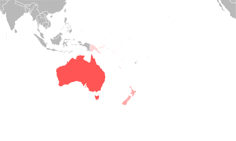
Map of World Heritage Sites
Future World Heritage Sites: Tentative List
The Tentative List is a list of important places. Countries think these places might become World Heritage Sites one day. Countries can update this list anytime. A site must be on this list before it can be considered for the main World Heritage List.
| Site | Image | Location | Criteria | Area ha (acre) |
Year of submission | Description |
|---|---|---|---|---|---|---|
| Marine Protected Areas of American Samoa |  |
14°21′54″S 170°45′54″W / 14.365°S 170.765°W |
Natural (vii)(ix)(x) | 2017 | This area protects important marine life and ecosystems in American Samoa. | |
| Great Sandy World Heritage Area | Queensland, 25°39′00″S 153°00′00″E / 25.65000°S 153.00000°E |
Natural: (vii)(viii)(ix) |
184,000 (450,000) | 2010 |
This proposed extension to Fraser Island includes several new areas. It will help tell a bigger story about the world's oldest coastal dune formation. | |
| The Gondwana Rainforests of Australia World Heritage Area (extension to existing property) | New South Wales/Queensland, 30°04′15″S 152°18′08″E / 30.07083°S 152.30222°E |
Natural: (viii)(ix)(x) |
268,678 (663,920) | 2010 |
This is another proposed extension to the existing Gondwana Rainforests site. | |
| Murujuga Cultural Landscape |  |
Western Australia, 20°33′06″S 116°50′09″E / 20.551718°S 116.835825°E |
Cultural (i)(iii) | 30,000 (74,000) | 2020 | This landscape is important for its cultural heritage, including ancient rock art. |
| Flinders Ranges | South Australia, 20°33′06″S 116°50′09″E / 20.551718°S 116.835825°E |
Natural (viii) | 2021 | The Flinders Ranges are known for their unique geological features and natural beauty. | ||
| Yapese Disk Money Regional Sites |  |
Yap State, 9°32′00″N 138°07′00″E / 9.533333°N 138.116667°E |
Cultural (i)(ii)(iii)(iv) | 2004 | These sites show the unique Yapese tradition of using large stone disks as money. | |
| Sovi Basin | Eastern Division, 17°59′01″S 178°10′56″E / 17.983611°S 178.182222°E |
Cultural (iii)(iv)(v) | 1999 | The Sovi Basin is a significant cultural and natural area in Fiji. | ||
| Sigatoka Sand Dunes |  |
Western Division, 20°33′06″S 116°50′09″E / 20.551718°S 116.835825°E |
Cultural (iii)(iv)(v) | 1999 | These sand dunes hold important archaeological evidence of early human settlements in Fiji. | |
| Yaduataba Crested Iguana Sanctuary | Northern Division, 16°50′00″S 178°16′45″E / 16.833333°S 178.279167°E |
Natural (x) | 1999 | This sanctuary is a protected home for the endangered Fijian crested iguana. | ||
| Marquesas Islands | .jpg) |
Marquesas Islands, 9°27′00″S 139°23′00″W / 9.45°S 139.383333°W |
Mixed | 2010 | The Marquesas Islands offer a mix of cultural and natural beauty. | |
| Northern Marshall Islands Atolls |  |
Ralik Chain, 8°N 167°E / 8°N 167°E |
Mixed | 2005 | These atolls are important for both their natural environment and cultural history. | |
| Likiep Village Historic District | .jpg) |
Ratak Chain, 9°54′00″N 169°08′00″E / 9.9°N 169.133333°E |
Cultural (ii)(iv) | 2005 | This historic district shows a unique blend of traditional Marshallese and European architecture. | |
| Mili Atoll Nature Conservancy (and Nadrikdrik) |  |
Ratak Chain, 6°08′00″N 171°55′00″E / 6.133333°N 171.916667°E |
Natural | 2005 | This nature conservancy protects the rich biodiversity of Mili Atoll. | |
| Auckland volcanic fields |  |
North Island, 36°52′37″S 174°45′50″E / 36.877°S 174.764°E |
Mixed (ii)(iii)(iv)(v)(viii) | 2007 | This area shows a unique volcanic landscape with cultural significance. | |
| Kahurangi National Park, Farewell Spit and Canaan karst system |  |
South Island, 41°15′00″S 172°07′00″E / 41.25°S 172.116667°E |
Natural (vii)(viii)(ix)(x) | 2007 | This park is known for its diverse landscapes, including a long sand spit and unique cave systems. | |
| Kerikeri Basin historic precinct |  |
North Island, 35°13′00″S 173°58′00″E / 35.216667°S 173.966667°E |
Cultural (ii)(iii)(iv)(v)(vi) | 2007 | This historic area shows early European and Māori interactions and settlements. | |
| Kermadec Islands and Marine reserve |  |
North Island, 29°16′37″S 177°55′24″W / 29.276944°S 177.923333°W |
Natural (vii)(viii)(ix)(x) | 2007 | These remote islands and their surrounding waters are a haven for marine life. | |
| Napier Art Deco historic precinct |  |
North Island, 39°29′25″S 176°55′04″E / 39.490278°S 176.917778°E |
Cultural (ii)(iv)(vi) | 2007 | Napier's city center is famous for its unique Art Deco architecture. | |
| Waitangi Treaty Grounds historic precinct |  |
North Island, 35°15′58″S 174°04′48″E / 35.266111°S 174.08°E |
Cultural (i)(ii)(iii)(iv)(vi) | 2007 | This site is where the Treaty of Waitangi was signed, a key event in New Zealand's history. | |
| Waters and seabed of Fiordland (Te Moana O Atawhenua) |  |
South Island, 44°44′S 167°34′E / 44.73°S 167.57°E |
Natural (vii)(viii)(ix)(x) | 2007 | This area protects the stunning fjords and marine ecosystems of Fiordland. | |
| Whakarua Moutere (North East Islands) |  |
North Island, 34°09′14″S 172°08′24″E / 34.153889°S 172.14°E |
Natural (vii)(viii)(ix)(x) | 2007 | These islands are important for their unique plant and animal life. | |
| Marianas Trench Marine National Monument |  |
18°N 148°E / 18°N 148°E |
Natural (viii)(ix)(x) | 2017 | This monument protects the deepest part of the world's oceans and its unique marine life. | |
| Imeong Conservation Area | Babeldaob, 7°31′39″N 134°31′32″E / 7.5275°N 134.525556°E |
Mixed | 2004 | This area is important for both its natural environment and cultural significance. | ||
| Ouballang ra Ngebedech (Ngebedech Terraces) | _-_panoramio.jpg) |
Babeldaob, 7°26′13″N 134°29′34″E / 7.437056°N 134.492667°E |
Cultural (ii)(iii)(v) | 2004 | These ancient terraces show the agricultural skills of the people of Palau. | |
| Tet el Bad Stone Coffin |  |
Ngarchelong, 7°43′10″N 134°36′48″E / 7.719389°N 134.613444°E |
Cultural (i) | 2004 | This site features a unique stone coffin, showing ancient Palauan craftsmanship. | |
| Yapease Quarry Sites | ,_Yap,_quarried_1904_on_Palau_-_National_Museum_of_Natural_History,_United_States_-_DSC00363.jpg) |
Airai, 7°21′01″N 134°33′54″E / 7.350306°N 134.564944°E |
Cultural (i)(ii)(iii) | 2004 | These quarries are where the famous large stone "Rai" money disks were carved. | |
| Huon Terraces - Stairway to the Past | Morone, 6°24′S 147°30′E / 6.4°S 147.5°E |
Mixed (iii)(v)(vii)(viii)(ix)(x) | 2006 | These terraces show ancient human activity and unique geological formations. | ||
| Kikori River Basin / Great Papuan Plateau | Gulf, Southern Highlands, Western Highlands, 7°39′00″S 144°17′00″E / 7.65°S 144.283333°E |
Mixed (iii)(iv)(v)(vii)(viii)(ix)(x) | 2006 | This vast area is rich in biodiversity and has significant cultural landscapes. | ||
| Kokoda Track and Owen Stanley Ranges |  |
Central, Southern Highlands, 9°23′S 148°24′E / 9.38°S 148.4°E |
Mixed (iii)(v)(vi)(vii)(x) | 2006 | This track is famous for its historical importance during World War II and its natural beauty. | |
| Milne Bay Seascape (Pacific Jewels of Marine Biodiversity) |  |
Milne Bay, 10°22′00″S 150°30′00″E / 10.366667°S 150.5°E |
Mixed (iii)(v)(vii)(viii)(ix)(x) | 2006 | This seascape is a hotspot for marine biodiversity with beautiful coral reefs. | |
| The Sublime Karsts of Papua New Guinea | East New Britain, Southern Highlands, Western, 6°36′13″S 142°35′16″E / 6.603611°S 142.5879°E |
Mixed (v)(vii)(viii)(ix)(x) | 2006 | These stunning limestone landscapes are home to unique ecosystems and cultural sites. | ||
| Trans-Fly Complex |  |
Western, 8°54′S 141°00′E / 8.9°S 141°E |
Mixed (v)(vi)(x) | 2006 | This area features vast savannas and grasslands, important for wildlife and local cultures. | |
| Upper Sepik River Basin |  |
East Sepik, West Sepik, 5°13′00″S 141°49′00″E / 5.216667°S 141.816667°E |
Mixed (i)(iii)(iv)(v)(vii)(viii)(ix)(x) | 2006 | The Upper Sepik River Basin is rich in cultural traditions and natural beauty. | |
| Fagaloa Bay – Uafato Tiavea Conservation Zone |  |
Va'a-o-Fonoti, 13°55′37″S 171°32′26″W / 13.926864°S 171.540444°W |
Mixed (v)(vii)(x) | 2006 | This conservation zone protects a beautiful bay and its unique cultural practices. | |
| Manono, Apolima and Nuulopa Cultural Landscape |  |
Aiga-i-le-Tai, 13°45′00″S 172°05′00″W / 13.75°S 172.083333°W |
Cultural (iii)(v) | 2006 | These islands show traditional Samoan village life and cultural practices. | |
| Marovo - Tetepare Complex | .jpg) |
Western, 8°29′S 158°04′E / 8.48°S 158.07°E |
Mixed (iii)(v)(vi)(vii)(viii)(ix)(x) | 2008 | This complex includes a large lagoon and an untouched island, important for culture and nature. | |
| Tropical Rainforest Heritage of Solomon Islands |  |
Choiseul, Guadalcanal, Makira-Ulawa, Western, 7°08′00″S 156°57′00″E / 7.133333°S 156.95°E |
Natural (vii)(ix)(x) | 2008 | These rainforests are home to many unique and endangered species. | |
| Lapita Pottery Archaeological Sites | Haʻapai, Niuatoputapu, Tongatapu, Vavaʻu, 20°S 175°W / 20°S 175°W |
Cultural (iii)(iv) | 2007 | These sites contain pottery from the ancient Lapita culture, showing early Pacific settlement. | ||
| The Ancient Capitals of the Kingdom of Tonga |  |
Tongatapu, 21°12′41″S 175°09′11″W / 21.21138°S 175.153056°W |
Cultural (iii)(iv) | 2007 | These sites show the history and power of the ancient Tongan kingdom. | |
| Pacific Remote Islands Marine National Monument |  |
Baker Island, Howland Island, Jarvis Island, Johnston Atoll, Kingman Reef, Palmyra Atoll, Wake Island, 5°53′00″N 162°05′00″W / 5.883333°N 162.083333°W |
Natural (vii)(viii)(x) | 2017 | This monument protects a vast area of remote Pacific islands and their marine ecosystems. | |
| Lake Letas |  |
Torba, 14°17′00″S 167°32′00″E / 14.283333°S 167.533333°E |
Natural (vii)(ix)(x) | 2004 | Lake Letas is a large freshwater lake with unique natural features. | |
| The Nowon and Votwos of Ureparapara | Torba, 13°32′00″S 167°20′00″E / 13.533333°S 167.333333°E |
Cultural (iii)(iv)(v) | 2005 | These sites represent important cultural practices and traditions of Ureparapara. | ||
| The President Coolidge | Sanma, 15°25′00″S 166°54′00″E / 15.416667°S 166.9°E |
Cultural (i)(iii)(iv)(v) | 2004 | This sunken ship is a famous dive site and a reminder of World War II history. | ||
| Vatthe Conservation Area |  |
Sanma, 15°25′00″S 166°54′00″E / 15.416667°S 166.9°E |
Natural (vii)(ix)(x) | 2004 | This area protects a diverse rainforest and coastal ecosystems. | |
| Yalo, Apialo and the sacred geography of Northwest Malakula | Malampa, 16°15′S 167°30′E / 16.25°S 167.5°E |
Cultural (iii) | 2004 | These sites are important for the sacred beliefs and traditions of the people of Malakula. |
