Napier, New Zealand facts for kids
Quick facts for kids
Napier
Ahuriri (Māori)
|
|||
|---|---|---|---|
|
Various sites around Napier
|
|||
|
|||
| Motto(s):
Faith and Courage
|
|||
| Country | New Zealand | ||
| Region | Hawke's Bay | ||
| Established | 1851 | ||
| Area | |||
| • Territorial | 105.05 km2 (40.56 sq mi) | ||
| • Urban | 105.05 km2 (40.56 sq mi) | ||
| Population
(June 2023)
|
|||
| • Territorial | 67,500 | ||
| • Density | 642.6/km2 (1,664.2/sq mi) | ||
| • Urban | 67,500 | ||
| • Urban density | 642.6/km2 (1,664.2/sq mi) | ||
| Time zone | UTC+12 (NZST) | ||
| • Summer (DST) | UTC+13 (NZDT) | ||
| Area code(s) | 06 | ||
| Website | Napier.govt.nz | ||
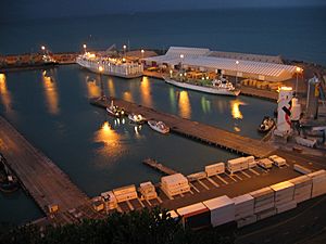
Napier (pronounced NAY-pee-ər) is a city on the eastern coast of New Zealand's North Island. It is the main city of the Hawke's Bay area. Napier is a city by the sea with a seaport. It is famous for its sunny weather, streets lined with Norfolk pine trees, and amazing Art Deco buildings. Because of its beauty, some people call Napier the "Nice of the Pacific".
Napier is located on the land of Ngāti Kahungunu, one of New Zealand's largest iwi (Māori tribes). The city has grown and changed over nearly 200 years as people have moved there. About 18 kilometers south of Napier is the city of Hastings. These two cities are often called "The Bay Cities" or "The Twin Cities". Together with nearby towns like Havelock North and Clive, they form a large community. Napier City covers about 106 square kilometers.
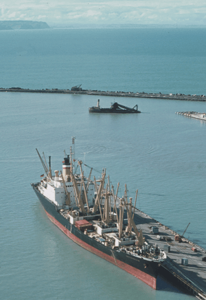
Napier is a very important place for wool in the Southern Hemisphere. It is also the main seaport for exports from northeastern New Zealand. This area grows the most apples, pears, and stone fruit in New Zealand. The Hawke's Bay wine region is the second largest in New Zealand. Grapes from around Hastings and Napier are sent through the Port of Napier to be exported. Large amounts of wool, frozen meat, wood pulp, and timber are also shipped from Napier every year. Some goods are also sent by road and train to other big New Zealand cities like Auckland, Wellington, and Hamilton.
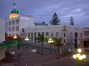
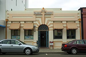
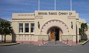
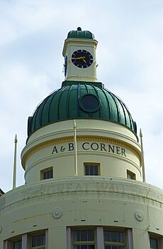
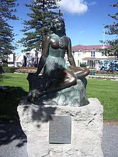
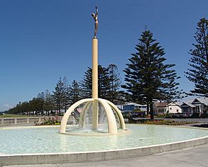
Napier is a popular place for tourists to visit. It has many unique Art Deco buildings from the 1930s, and some Spanish Mission style buildings too. These were built after a huge earthquake destroyed much of the city in 1931. One of the most photographed tourist spots is a statue called Pania of the Reef. This statue on Marine Parade shows a figure from local Ngāti Kahungunu stories. Every February, thousands of people come to Napier for the Tremains Art Deco Weekend. This event celebrates the city's Art Deco history. Other popular events include food and wine festivals and concerts at the Mission Estate Winery.
Contents
- Exploring Napier's Past
- Napier's Location and Weather
- People and Population in Napier
- Things to See and Do in Napier
- Culture and Fun in Napier
- Napier's Economy
- Sports in Napier
- Getting Around Napier
- Schools and Learning in Napier
- Media in Napier
- Famous People from Napier
- Napier's Sister Cities
- See also
Exploring Napier's Past
Māori History of Napier
Napier has a rich Māori history. Many centuries ago, the Ngāti Kahungunu tribe arrived in the area. Other tribes like the Whatumamoa, Rangitane, and Ngāti Awa lived in nearby places. Later, the Ngāti Kahungunu became the main tribe from Poverty Bay to Wellington. They were among the first Māori tribes to meet European settlers.
A chief named Te Ahuriri dug a channel into the lagoon at Ahuriri. This was because the old entrance had become blocked. This blockage threatened the farms around the lagoon and the fishing villages on its islands. Rivers were constantly bringing fresh water into the area.
European Settlement in Napier
Captain James Cook was one of the first Europeans to see the area where Napier is now. He sailed along the east coast in October 1769. He described a large saltwater lake between the beaches and the mainland. He noted the harbor entrance was at the Westshore end of the beach. Later, European traders, whalers, and missionaries visited and settled there. By the 1850s, farmers and hotel owners also arrived.
The British Crown bought the Ahuriri land, which included the future site of Napier, in 1851. In 1854, Alfred Domett was put in charge of the land and became the local judge in Ahuriri village. They decided to build a planned town there. Its streets were laid out, and the new town was named after Charles James Napier, a military leader. Domett named many streets in Napier after places in the British Indian Empire.
Napier officially became a borough (a type of town) in 1874. However, developing the swampy land around it was slow. For a while, Napier was the main administrative center for the Hawke's Bay Province. But in 1876, all provincial governments in New Zealand were ended.
In its early years, Napier was mostly built on a group of hills called Scinde Island. This island was almost completely surrounded by the ocean. There was also a swamp where some streets are now, and the sea reached "Clive Square".
The 1931 Hawke's Bay Earthquake
On February 3, 1931, a huge earthquake hit Napier and nearby Hastings. Most of the buildings in both cities were destroyed. The buildings collapsing and the fires that followed killed 256 people. The center of Napier was ruined. It was then rebuilt in the Art Deco style, which was popular at the time.
The earthquake also changed the land. About 4,000 hectares (or 40 square kilometers) of what is now Napier used to be under the sea! The earthquake lifted this land above sea level. In some places, the ground rose by up to 2.7 meters. In Hastings, the ground sank by about 1 meter.
Even though some Art Deco buildings were replaced later, most of Napier's city center stayed the same. It became known for its important architecture. Starting in the 1990s, these buildings have been protected and restored. Napier and South Beach, Miami, Florida, are considered the two best-preserved Art Deco towns in the world.
Napier was even suggested as a World Heritage Site by UNESCO in 2007. This would have been the first cultural site in New Zealand to get this honor. It didn't get the status in 2011, but the report said its Art Deco heritage was "first and foremost of outstanding value to all New Zealanders".
Napier's Location and Weather
Geography of Napier
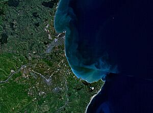
Napier is built on Napier Hill and the flat Heretaunga Plains. It sits on the southeastern edge of Hawke Bay, a large bay on New Zealand's east coast. The city's coastline changed a lot after the big earthquake in 1931. Because much of the city center is close to sea level, Napier is at risk from a tsunami. If the sea ever came over Marine Parade, it could flood the city all the way to Ahuriri. Also, much of Napier's older areas are at risk of soil liquefaction during an earthquake.
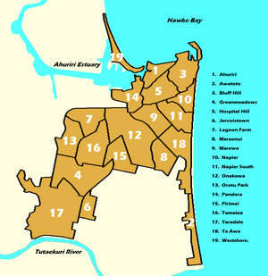
Napier has several suburbs, including Ahuriri, Awatoto, Bluff Hill, Greenmeadows, Hospital Hill, Jervoistown, Lagoon Farm, Maraenui, Marewa, Napier CBD (city center), Napier South, Onekawa, Orutu Park, Pandora, Pirimai, Tamatea, Taradale, Te Awa, and Westshore.
Napier's Climate
Napier has an oceanic climate, which means it has mild temperatures all year round. The weather is warm and quite dry. This is because Napier is on the east coast of the North Island. Most of New Zealand's weather comes from the west. Napier is in the "rain shadow" of the North Island Volcanic Plateau and nearby mountain ranges. This means these mountains block a lot of the rain from reaching the city.
| Climate data for Napier (1981–2010) | |||||||||||||
|---|---|---|---|---|---|---|---|---|---|---|---|---|---|
| Month | Jan | Feb | Mar | Apr | May | Jun | Jul | Aug | Sep | Oct | Nov | Dec | Year |
| Mean daily maximum °C (°F) | 24.5 (76.1) |
24.2 (75.6) |
22.7 (72.9) |
19.9 (67.8) |
17.4 (63.3) |
15.0 (59.0) |
14.1 (57.4) |
15.1 (59.2) |
17.3 (63.1) |
19.2 (66.6) |
20.9 (69.6) |
23.2 (73.8) |
19.5 (67.1) |
| Daily mean °C (°F) | 19.5 (67.1) |
19.4 (66.9) |
17.7 (63.9) |
15.0 (59.0) |
12.4 (54.3) |
10.0 (50.0) |
9.4 (48.9) |
10.3 (50.5) |
12.3 (54.1) |
14.3 (57.7) |
16.1 (61.0) |
18.4 (65.1) |
14.6 (58.3) |
| Mean daily minimum °C (°F) | 14.6 (58.3) |
14.6 (58.3) |
12.7 (54.9) |
10.3 (50.5) |
8.5 (47.3) |
6.8 (44.2) |
5.6 (42.1) |
6.4 (43.5) |
8.1 (46.6) |
9.6 (49.3) |
10.9 (51.6) |
13.0 (55.4) |
10.0 (50.0) |
| Average precipitation mm (inches) | 46.8 (1.84) |
54.3 (2.14) |
66.8 (2.63) |
67.9 (2.67) |
74.8 (2.94) |
82.1 (3.23) |
108.3 (4.26) |
60.1 (2.37) |
57.9 (2.28) |
59.9 (2.36) |
52.4 (2.06) |
53.5 (2.11) |
784.8 (30.90) |
| Average precipitation days (≥ 1.0 mm) | 6.0 | 5.9 | 7.2 | 7.1 | 7.9 | 8.8 | 9.4 | 8.2 | 7.4 | 7.5 | 6.0 | 6.5 | 88.1 |
| Average relative humidity (%) | 69.9 | 73.9 | 74.6 | 77.1 | 78.7 | 79.9 | 79.6 | 76.0 | 69.2 | 67.3 | 67.8 | 67.0 | 73.4 |
| Mean monthly sunshine hours | 249.3 | 202.6 | 201.7 | 172.4 | 155.6 | 130.7 | 134.7 | 166.8 | 181.2 | 213.9 | 216.2 | 233.7 | 2,258.7 |
| Source: NIWA Climate Data | |||||||||||||
People and Population in Napier
Napier's Population Growth
The Napier urban area is the same as the Napier City area. It covers about 105 square kilometers. In 2023, Napier City had a population of 64,695 people. This was an increase of 2,454 people since 2018. The population has grown by 7,455 people since 2013.
| Historical population | ||
|---|---|---|
| Year | Pop. | ±% p.a. |
| 1986 | 52,512 | — |
| 1991 | 51,645 | −0.33% |
| 1996 | 54,900 | +1.23% |
| 2001 | 55,200 | +0.11% |
| 2006 | 56,359 | +0.42% |
| 2013 | 57,240 | +0.22% |
| 2018 | 62,241 | +1.69% |
| 2023 | 64,695 | +0.78% |
| Largest groups of overseas-born residents | |
|---|---|
| Nationality | Population (2018) |
| England | 2,994 |
| Australia | 1,008 |
| South Africa | 618 |
| India | 543 |
| China | 456 |
| Samoa | 453 |
| Scotland | 420 |
| Philippines | 288 |
| United States | 270 |
| Netherlands | 255 |
In 2023, there were slightly more females than males in Napier. The average age was 42.0 years old. About 18.4% of people were under 15 years old, and 21.1% were 65 or older.
Ethnicities and Languages
People in Napier come from many different backgrounds. About 79.0% of people identified as European (Pākehā). About 24.2% identified as Māori. Other groups included Pasifika (4.2%) and Asian (6.5%). Many people identified with more than one ethnicity.
English is spoken by most people (96.9%). The Māori language is spoken by 5.7% of people. Other languages like Samoan are also spoken. About 17.9% of people in Napier were born overseas.
Religion and Education
When asked about religion, 30.6% of people identified as Christian. About 55.8% said they had no religion.
For education, 15.0% of people aged 15 or older had a university degree. More than half (55.1%) had a certificate or diploma after high school. The average income in Napier was $39,200.
Napier's Wards
Napier City is divided into different areas called wards. Each ward has its own population and characteristics:
| Name | Area (km2) |
Population | Density (per km2) |
Dwellings | Median age | Median income |
|---|---|---|---|---|---|---|
| Ahuriri Ward | 36.20 | 10,245 | 283 | 4,371 | 50.3 years | $43,700 |
| Onekawa-Tamatea Ward | 5.65 | 10,620 | 1,880 | 4,032 | 37.3 years | $40,800 |
| Nelson Park Ward | 7.58 | 19,320 | 2,549 | 6,744 | 33.4 years | $36,000 |
| Taradale Ward | 55.62 | 24,510 | 441 | 9,714 | 47.8 years | $39,600 |
| New Zealand | 38.1 years | $41,500 |
Things to See and Do in Napier
Napier's Famous Architecture
Napier's main tourist attraction is its amazing architecture. People who love Art Deco buildings come from all over the world to see them. The city was rebuilt after the 1931 earthquake during the Art Deco period. This means Napier's buildings look very different from those in other cities. The whole center of Napier was rebuilt at the same time, creating a unique look.
Top Tourist Spots
Other popular places to visit in Napier include:
- MTG Hawke's Bay: This is a museum, art gallery, and theater. It has information about the 1931 earthquake and how Napier was rebuilt in the Art Deco style.
- National Aquarium: A great place to see marine life.
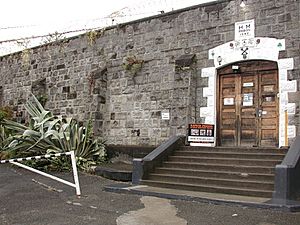
- Napier Prison: The oldest prison in New Zealand. Visitors can learn about prison history and see some of the earthquake damage that was left untouched.
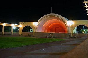
- The Soundshell and the Pania of the Reef statue. The Pania statue on Marine Parade is as important to Napier as the Little Mermaid statue is to Copenhagen. In 2005, the statue was stolen but found a week later.
Thousands of tourists visit Napier in February for the Art Deco Weekend. In 2018, this festival celebrated its 30th year and attracted about 45,000 people. The Mission Estate Winery Concert in the suburb of Greenmeadows has hosted many famous singers like Eric Clapton, Rod Stewart, and Sting.
Nearby attractions include the Cape Kidnappers Gannet Colony, where you can see many gannet birds. There are also many vineyards around Taradale, Hastings City, and north of Napier.
Many people start their Hawke's Bay trip by flying into Hawke's Bay Airport at Westshore. Flights come from Wellington, Auckland, and Christchurch. Tourists also drive to Napier using State Highway 2 along the coast or State Highway 5 from Taupō.
Culture and Fun in Napier
Napier is known as the Art Deco Capital. The Hawke's Bay wine region is very important to Napier's economy. There are over 70 wineries in the area. Wine Enthusiast Magazine even named the region one of the 10 Best Wine Travel Destinations in 2015. The region also produces the most apples, pears, and stone fruit in New Zealand. The Port of Napier and the rail network help export these goods quickly.
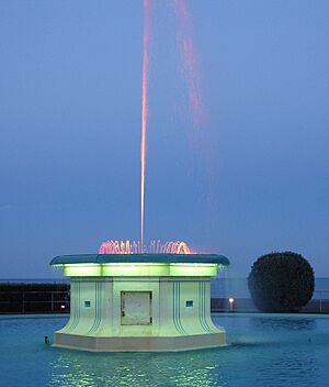
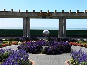
Marine Parade is one of Napier's most famous places. It's a tree-lined street along the ocean with fountains, gardens, mini golf, statues, and spas. The National Aquarium is at one end, and the historic Napier Prison is at the other. Recent improvements to Marine Parade include shaded picnic areas and playgrounds.
Napier has a lively theater scene, with musicals put on by the Napier Operatic Society at the Napier Municipal Theatre, another beautiful Art Deco building. You can find many shops, antique stores, art galleries, and studios of local artists.
The marina and waterfront in Ahuriri are great for sea tourism. Swimming and family activities are popular at Pandora Pond, a saltwater inlet. You can also enjoy the beaches and playgrounds at Marine Parade, Westshore, and Ahuriri. The rivers in the region are used for activities like jet boating, kayaking, fishing, and swimming.
The region has many cycleways and walkways. There are special bike lanes on city streets and off-road paths for cyclists and walkers. The Hawke's Bay Trails have nearly 200 kilometers of paths that wind through the cities and link them to nearby suburbs.
Napier's Economy
The biggest industry in Napier is processing and manufacturing. This includes making food, textiles, wood, metal products, and machinery. Other important industries are property and business services, farming, and retail.
Napier used to have one of New Zealand's largest smoking tobacco factories. However, in 2005, the Rothmans factory closed because fewer people were smoking. Production moved to Australia. The Art Deco-style factory used to make billions of cigarettes each year.
Sports in Napier
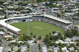
McLean Park is the main sports stadium in Hawke's Bay. It is used for cricket and rugby union games. It has hosted matches for the Rugby World Cup and the Cricket World Cup.
Napier is home to the Hawke's Bay Hawks, a professional basketball team. They play in the National Basketball League at the Pettigrew Green Arena.
Meeanee Speedway is a place where car and motorcycle races are held. It opened in 1961 and hosts various speedway events.
Getting Around Napier
Air Travel
Hawke's Bay Airport is the main airport for the Hawke's Bay region. It has flights within New Zealand. The airport is partly owned by the government and the Napier and Hastings councils. It is located in the Napier suburb of Westshore. Air New Zealand has regular flights to Auckland, Wellington, and Christchurch. Other smaller airlines also operate. The airport was built on land that was lifted above sea level by the 1931 Napier earthquake.
Walking and Cycling Paths
The Hawke's Bay region has many paths for walking and cycling, known as the 'Hawke's Bay Trails'. These paths connect Napier and Hastings, as well as many other suburbs. Some paths are special lanes on roads, while others are separate paths through parks. Many are used by both cyclists and walkers. The Hawke's Bay Trails have over 200 kilometers of paths. The Napier Rotary Pathway forms a loop around the city and connects to the Hastings Rotary Pathway.
Roads and Highways
State Highway 2 is the main highway for Napier. It connects the city to Wairoa and Gisborne to the north. To the south, it connects to Wellington and Palmerston North. Between Napier and Hastings, SH 2 follows the Hawke's Bay Expressway, which is a fast link between the two cities. This expressway also connects to Napier's main roads and the airport.
State Highway 5, also called the Napier-Taupo Road, starts just north of Napier. It connects Napier to Taupō and the central North Island. This is the main route for travel from Napier to Auckland, Hamilton, and Rotorua.
State Highway 50 connects Napier to the southwestern Hawke's Bay. It goes through many small towns and past many of the region's famous wineries.
State Highway 51 is another way to get between Napier and Hastings. It follows an older route through the city.
Buses in Napier
Go Bus operates nine local bus routes in Napier, called 'Go Bay' routes. You can use a Bee Card to pay for your bus fare.
Train Travel
The Palmerston North–Gisborne Line train track runs through Napier. The southern part of the line to Palmerston North was built between 1872 and 1891. The northern part to Gisborne was built from 1912 to 1942. The line goes through Napier and then inland towards Hastings.
The Napier Port Branch is a short railway line that goes to the Port of Napier. Napier Railway Station was the main train station. It opened in 1874. Passenger train services on the line stopped in 2001.
Schools and Learning in Napier
Napier has five state secondary schools: Napier Boys' High School, Napier Girls' High School, William Colenso College, Tamatea High School, and Taradale High School. There are also two state-integrated Catholic girls' schools: Sacred Heart College and St Joseph's Māori Girls' College. Te Kura Kaupapa Māori o Te Ara Hou is a Māori language immersion school.
The Eastern Institute of Technology in Taradale is the main place for higher education in Napier and Hawke's Bay.
Media in Napier
The main daily newspaper for Napier is Hawke's Bay Today, which is based in Hastings. This newspaper was created in 1999 when two older newspapers merged.
The main television and radio transmitter for the city is on Mount Erin, south of Napier. Television first came to Napier in 1962.
Famous People from Napier
- Sir Ian Axford – a space scientist
- Mike Boon – a comedian
- Adele Broadbent (born 1968) – a children's author
- Sir Ashley Bloomfield – former Director-General of Health for New Zealand, born in Napier
- Jamie Curry – a YouTube personality
- Debbie Harwood – a singer
- Paul Henare – a basketball player
- Chris Jackson – a former New Zealand football player
- Phil Lamason – a WWII pilot
- Simon Mannering – a rugby league player
- Paratene Matchitt – an artist
- Stuart Nash – a politician
- Nyree Dawn Porter – an actress
- John Psathas – a composer
- Renée – a feminist writer and playwright
- Darren Smith – a field hockey player
- Percy Storkey – a soldier and Victoria Cross winner
- Chris Tremain – a politician
- Kel Tremain – a rugby player
- Shane Young – a Mixed Martial Arts fighter
Napier's Sister Cities
Napier City Council has special relationships with three other cities around the world:
- Lianyungang, Jiangsu, China
- Tomakomai, Japan
- Victoria, British Columbia, Canada
See also
 In Spanish: Napier (Nueva Zelanda) para niños
 | Precious Adams |
 | Lauren Anderson |
 | Janet Collins |


