
Hastings, New Zealand facts for kids
Quick facts for kids
Hastings
Heretaunga (Māori)
|
|
|---|---|
|
From top, left to right: Saint Matthew's Church, Hastings CBD, Toitoi Events Centre, Nga Pou o Heretaunga, Splash Planet castle, Lion sculpture at Cornwall Park
|
|
| Motto(s):
Urbis Et Ruris Concordia (Town and Country in Harmony)
|
|

Hastings
Location in New Zealand

Hastings
Location in Oceania

Hastings
Location in Pacific Ocean
|
|
| Country | New Zealand |
| Island | North Island |
| Region | Hawke's Bay |
| Territorial authority | Hastings District |
| Settled by Māori | c. 14th Century |
| Settled by Europeans | c. 19th Century |
| Area | |
| • District | 5,226.62 km2 (2,018.01 sq mi) |
| • Urban | 26.29 km2 (10.15 sq mi) |
| Elevation | 11 m (36 ft) |
| Population
(June 2023)
|
|
| • District | 91,900 |
| • Density | 17.583/km2 (45.540/sq mi) |
| • Urban | 51,500 |
| • Urban density | 1,958.9/km2 (5,074/sq mi) |
| Postcode(s) |
4120, 4122
|
| Website | HastingsDC.govt.nz |


.jpg)
.jpg)

.jpg)
Hastings (pronounced HAY-stings), also known as Heretaunga in Māori, is a city in New Zealand. It is one of the two main urban areas in the Hawke's Bay Region, located on the east coast of the North Island.
Hastings is about 18 kilometres (11 miles) inland from the coastal city of Napier. These two cities are often called "The Bay Cities" or "The Twin Cities" because they are so close.
Hastings is the main administrative centre for the wider Hastings District. Over time, smaller towns nearby have joined with Hastings, making it one of the largest urban areas in Hawke's Bay.
The Hastings District is famous for producing food. The rich Heretaunga Plains around the city grow lots of fruits like peaches and apples, as well as kiwifruit and vegetables. This area is also one of New Zealand's top places for making red wine. Many businesses here are linked to food, like processing plants, farm services, and transport. Hastings is a key hub for the farms and tourist spots in the surrounding area.
Contents
History of Hastings
Māori History
Around the 14th century, Māori people arrived in the Heretaunga area, which is now Hawke's Bay. They settled in river valleys and along the coast where there was plenty of food. It is believed they came by canoe, travelling down the coast from the north.
Their culture grew strong, and they slowly cleared some of the land. This made it one of the few places in New Zealand where sheep could be brought in without first cutting down thick forests. In the 16th century, a powerful chief named Taraia founded the large Ngāti Kahungunu tribe. This tribe eventually settled across the eastern side of the North Island. They were among the first Māori tribes to meet European settlers.
European Settlers Arrive

In 1867, Māori owners leased about 70 square kilometres (27 square miles) of land on the Heretaunga Plains to Thomas Tanner. He had been trying to buy this land since 1864. In 1870, a group of twelve people bought the land for about £1 10s per acre.
Many local people think Hastings was first called Hicksville, after Francis Hicks. He bought a 100-acre (0.4 km²) block of land where the city centre is now. However, this story is not true. The original name for the area that became the town centre was Karamu.
In 1871, the New Zealand Government decided to build a new railway line south of Napier. It would pass through a planned Karamu junction in the middle of the Heretaunga Plains. This spot was on Francis Hicks's land.
Karamu junction was renamed Hastings in 1873. The name was chosen, possibly by Thomas Tanner, after he read about Warren Hastings, a famous British figure in India. The name fit well with other nearby towns like Napier and Clive, which were also named after important people from British India.
In 1874, the first train travelled from Napier to Hastings. This helped Hastings become a centre for exporting goods through Port Ahuriri. The local economy grew even more when Edward Newbigin opened a brewery in 1881. By 1882, the town had about 600 people and became a borough (a type of town council) on October 20, 1886.
Hastings got electricity in 1912, and Napier followed in 1915. In 1918, nearly 300 people in Hawke's Bay died from a flu epidemic.
The 1931 Earthquake
On February 3, 1931, at 10:47 am, a huge earthquake hit Hastings and nearby Napier. It measured 7.8 on the Richter scale. In Hastings, the ground sank by about 1 metre (3 feet). Buildings collapsed, and fires started, killing 258 people in the region, with 93 deaths in Hastings.
The city centre of Hastings was destroyed. It was later rebuilt in the popular Art Deco and Spanish Mission styles of that time. Thanks to quick actions by residents and the fire department, Hastings did not suffer as much fire damage as Napier. Most deaths were from collapsing buildings, like Roaches' Department Store, where 17 people died.
From 1932 to 1999

During World War II, Allied soldiers stayed in Hastings. Local clubs packed supplies to send to the soldiers. In 1954, Hastings was the first city in New Zealand to add fluoride to its water supply. This was done to study its effect on tooth decay.
Hastings grew quickly in the 1960s and 1970s, becoming one of New Zealand's fastest-growing cities. A new suburb called Flaxmere was built to handle this growth. It was built on dry, stony land that was once a riverbed. This land was later found to be excellent for growing grapes, and it is now part of the famous Gimblett Gravels wine area.
In the late 1970s and early 1980s, Hastings faced economic challenges. However, by the mid-1990s, the economy started to improve.
In 1989, Hastings City joined with Havelock North and Hawke's Bay County to form the modern Hastings District. The new Hastings District Council offices were built in Hastings. Because Hastings and Napier are so close, people often suggest they should combine. In 1999, a vote was held, but Napier residents mostly said no, while Hastings residents were in favour.
From 2000 to Today
On August 25, 2008, at 11:25 pm, a 5.9 magnitude earthquake hit Hastings. Its centre was just 10 km (6 miles) south of the city. It caused minor damage, like items falling off shelves, and some power outages.
In 2010, Hastings became one of two "model communities" for walking and cycling in New Zealand. This meant it received government funding to improve its paths and encourage people to walk and cycle more.
In August and September 2016, about 5,200 people became sick with campylobacteriosis (a type of food poisoning) after the water supply in Havelock North was found to have bacteria. Two people died. It is thought that heavy rain caused water contamination. This was the largest outbreak of waterborne illness ever in New Zealand. Schools in Havelock North closed, and people were told to boil their water. Later, the water supplies in Hastings and Flaxmere were also chlorinated as a safety measure.
Key Moments in Hastings History
- 1867: Māori owners leased land on the Heretaunga Plains to Thomas Tanner. This area was known as Karamu Junction.
- 1873: The town of Karamu Junction was officially renamed Hastings.
- 1874: Hastings was connected to the railway line.
- 1886: On October 20, Hastings became a Borough (a self-governing town).
- 1912: Hastings received electricity.
- 1918: A flu epidemic caused nearly 300 deaths in Hawke's Bay.
- 1931: On February 3, a powerful 7.8 magnitude earthquake hit Hastings, killing 93 people in the city.
- 1950: The first Blossom Parade was held in Hastings, which is now a popular yearly event.
- 1954: Hastings was the first city in New Zealand to add fluoride to its water supply.
- 1960: On September 10, the Hastings Blossom Parade was cancelled for the first time due to rain.
- 1989: Hastings City joined with Havelock North to form the modern Hastings District.
- 2008: On August 25, a 5.9 magnitude earthquake caused about $5 million in damage.
- 2010: Hastings became a "model community" for walking and cycling.
- 2016: In August and September, 5,200 residents got sick from contaminated water, leading to a major health crisis.
Geography and Climate
Hastings is on New Zealand's east coast, east of the North Island Volcanic Plateau. It sits on the fertile alluvial Heretaunga Plains. These plains were once swamps but have been drained for farming. The area is very productive, with orchards, farms, and vineyards. It also sits on New Zealand's most valuable underground water source.
Hastings is about 250 km (155 miles) northeast of Wellington, the nation's capital, and 350 km (217 miles) southeast of Auckland, the largest city.
 |
Napier | |
||
| Taihape and Tongariro National Park | Cape Kidnappers | |||
| Waipukurau | Ocean Beach and Waimarama |
Hastings has an oceanic climate, which means it has mild temperatures all year. It gets over 2200 hours of sunshine each year, and rainfall is usually less than 800 mm (31.5 inches). It is one of the warmest urban areas in the country.
Because Hastings is 15 km (9 miles) inland, the sea breeze does not affect its climate as much as it does Napier's. In summer, temperatures often reach the low 30s °C (90s °F). In winter, days are often above 15 °C (60 °F), sometimes even over 20 °C (68 °F) with warm north-west winds. Winters are usually calm and crisp, with frequent frosts followed by bright, cold, sunny days.
| Climate data for Hastings | |||||||||||||
|---|---|---|---|---|---|---|---|---|---|---|---|---|---|
| Month | Jan | Feb | Mar | Apr | May | Jun | Jul | Aug | Sep | Oct | Nov | Dec | Year |
| Record high °C (°F) | 35.8 (96.4) |
37.1 (98.8) |
33.4 (92.1) |
28.9 (84.0) |
27.1 (80.8) |
23.4 (74.1) |
22.5 (72.5) |
22.7 (72.9) |
26.4 (79.5) |
29.0 (84.2) |
31.8 (89.2) |
36.5 (97.7) |
37.1 (98.8) |
| Mean daily maximum °C (°F) | 25.5 (77.9) |
25.4 (77.7) |
23.6 (74.5) |
20.7 (69.3) |
17.1 (62.8) |
14.4 (57.9) |
13.9 (57.0) |
14.9 (58.8) |
17.5 (63.5) |
20.0 (68.0) |
22.3 (72.1) |
24.1 (75.4) |
20.0 (68.0) |
| Mean daily minimum °C (°F) | 13.7 (56.7) |
14.0 (57.2) |
12.2 (54.0) |
9.1 (48.4) |
6.7 (44.1) |
3.9 (39.0) |
3.6 (38.5) |
4.8 (40.6) |
6.1 (43.0) |
8.0 (46.4) |
10.4 (50.7) |
12.6 (54.7) |
8.8 (47.8) |
| Record low °C (°F) | 5.4 (41.7) |
5.0 (41.0) |
2.7 (36.9) |
0.6 (33.1) |
−3.0 (26.6) |
−4.2 (24.4) |
−5.0 (23.0) |
−3.3 (26.1) |
−2.8 (27.0) |
−2.0 (28.4) |
1.7 (35.1) |
3.2 (37.8) |
−5.0 (23.0) |
| Average precipitation mm (inches) | 66 (2.6) |
53 (2.1) |
61 (2.4) |
48 (1.9) |
81 (3.2) |
79 (3.1) |
64 (2.5) |
86 (3.4) |
46 (1.8) |
46 (1.8) |
41 (1.6) |
53 (2.1) |
724 (28.5) |
| Source: NIWA Climate Data | |||||||||||||
People and City Life
Population and Layout
Hastings has grown quite fast since it was settled in 1864. To manage this growth, new suburbs were built around the city. Hastings is known for its grid-like street layout. The railway line runs through the middle, dividing many main streets into "east" or "west" sections.
Many people in Hastings work in the city. Families with middle to higher incomes often live in Havelock North. Other areas, like Camberley and parts of Flaxmere, have families with middle to lower incomes.
In 2018, the Hastings urban area had a population of 44,940 people. This was an increase of over 5,000 people since 2013. About 23.6% of the population was aged 15 or younger.
The city is very diverse. About 60.2% of people identified as European (Pākehā), 35.4% as Māori, 12.2% as Pacific peoples, and 8.1% as Asian. People could choose more than one ethnicity.
City Changes and Growth
Like Napier, Hastings was badly damaged by the 1931 earthquake. However, because there was less fire damage, Hastings kept more of its older buildings. Both cities rebuilt in the popular Art Deco and Spanish Mission styles of the 1930s. But in the 1960s and 70s, many of Hastings' 1930s buildings were replaced.
By the end of the 20th century, Hastings faced economic challenges. However, after big projects to improve the city and bring in artists, Hastings has become more attractive. The city council worked to make the central shopping area better and to promote Havelock North as a fancy shopping spot. This plan worked well, and by 2005, there were very few empty shops in Hastings. The council continues to develop the city centre to attract more businesses and entertainment.
The Hastings Sports Park was moved to a new location on the edge of the city. This made space for a large shopping centre with big stores. The new sports park is a regional facility. It has a velodrome (for cycling), an athletics track, and sports fields for many different sports. It now also has tennis courts, netball courts, and an internationally recognized hockey turf.
Horse of the Year Show
The Hawke's Bay A&P Showgrounds in Hastings hosts the annual NZ Horse of the Year show every March. This is one of the biggest sporting events in the Southern Hemisphere. It brings together 2,500 horses and riders who compete in 19 different areas, including Dressage, Showhunter, and Showjumping. The event costs about NZ$3 million and attracts over 70,000 visitors from New Zealand and other countries over five days.
Suburbs of Hastings

City suburbs:
- Hastings Ward: Akina, Camberley, Frimley, Hastings Central, Mahora, Mayfair, Parkvale, Raureka, St Leonards, Stortford Lodge, Tomoana, Waipatu, Whakatu
- Havelock North Ward: Havelock North Central, Anderson Park, Iona, Te Mata, Te Mata Hills
- Flaxmere Ward: Flaxmere East, Kingsley-Chatham, Lochain, Woolwich
Outlying communities: Bridge Pa, Karamu, Longlands, Mangateretere, Maraekakaho, Omahu/Fernhill, Pakipaki, Pukahu, Twyford.
Transport in Hastings
Roads
Hastings is connected by State Highway 2. This highway links Hastings to Napier, Wairoa, and Gisborne to the north. To the south, it connects to Wellington, Masterton, and Palmerston North.
State Highway 2 used to go right through Hastings. Now, it connects Hastings to Napier through the Hawke's Bay Expressway. This provides a more direct route for trucks and other heavy vehicles going to Hawke's Bay Airport and the Port of Napier. The old part of State Highway 2 is now called State Highway 51.
State Highway 50 starts north of Takapau and connects Hastings to the Ruataniwha Valley and western Hawke's Bay. It's a quieter and shorter way to get into Hawke's Bay. This highway also passes many of Hawke's Bay's famous wineries and is part of the Hawke's Bay Wine Trail.
Buses
Go Bus runs 9 "Go Bay" bus routes in Hastings. These routes are supported by the Regional Council. Since August 24, 2020, people use Bee Cards to pay for their bus fares.
Rail
The Palmerston North–Gisborne Line (PNGL) is a railway line that runs through the centre of Hastings. This is a unique feature of the city's design. The railway divides Hastings from southwest to northeast. Many main streets in the city centre are named "east" or "west" depending on which side of the railway they start from.
Passenger trains used to run to Hastings, but these services stopped in 2001. The Hastings railway station is now a major hub for freight services along the PNGL. It helps transport many goods for export from the Port of Napier.
City Services
Utilities
The Hastings Borough Council started the city's first public electricity supply in 1912. Electricity was made by two diesel engines. Later, Hastings was connected to larger power schemes like the Mangahao hydroelectric scheme in 1927 and the Waikaremoana hydroelectric scheme in 1929.
Today, a company called Unison Networks owns and runs the local electricity network. Electricity comes mainly from large power stations at Fernhill and Whakatu.
Natural gas arrived in Napier and Hastings in 1983. The pipelines that bring gas to the city are now owned by First Gas. Powerco owns and runs the local gas network. In 2004, Hastings and the wider Hawke's Bay region lost natural gas for six days. This happened when a flood washed away a bridge that supported the main gas pipeline.
Parks and Green Spaces
Hastings has many parks and reserves for everyone to enjoy.
| Park | Suburb | Photo | Area (hectares) | Opened |
|---|---|---|---|---|
| Akina Park | Akina | 9.44 | ||
| Bill Mathewson Park | Mayfair | 3.60 | ||
| Civic Square | Hastings Central |  |
2.01 | |
| Cornwall Park | Mahora |  |
8.34 | November 1905 |
| Duke Street Reserve | Mahora | 1.23 | ||
| Ebbett Park | Raureka | 3.36 | ||
| Frimley Park | Frimley |  |
19.78 | October 1953 |
| Hastings Cemetery | Camberley | 6.67 | ||
| Hawke's Bay Regional Sports Park | Frimley |  |
30.18 | After 2007 |
| Kirkpatrick Park | Camberley | 3.63 | ||
| Landmarks Square | Hastings Central |  |
0.09 | |
| St Aubyn Street Reserve | St Leonards | 1.30 | ||
| St Leonards Park | St Leonards |  |
4.87 | |
| Queens Square | Parkvale | 1.01 | ||
| Tamatea Street Reserve | Mahora | 0.79 | ||
| William Nelson Park | Hastings Central | 0.60 | ||
| Windsor Park | Mayfair/Parkvale | 26.80 | 1885 |
Famous People from Hastings

Many well-known people have lived in or come from the Hastings area. Here are a few:
- Rita Angus – a famous artist
- Geordie Beamish – a champion runner in the 1500 metres
- Martin Campbell – a director of TV shows and movies
- Alan Duff – an author, known for Once Were Warriors
- Georgina Evers-Swindell and Caroline Evers-Swindell – Olympic gold medalists in rowing
- Paul Holmes – a well-known radio and television host
- Phil Judd – a musician and founding member of the band Split Enz
- Josh Kronfeld – an All Black rugby player
- Liam Lawson – a Formula One racing driver
- Greg Murphy – a V8 Supercar racer
- George Nēpia – a legendary All Black rugby player
- Mark Paston – a New Zealand national football goalkeeper
- Bruce Robertson – an All Black rugby player
- Taine Randell – a rugby player who captained the All Blacks
- Ian Smith – a New Zealand national cricketer
- John Timu – a rugby player who played for New Zealand in both rugby union and rugby league
- James Wattie – a business leader who founded the famous Wattie's food company
- Joan Wiffen – an amateur scientist who found the first dinosaur fossils in New Zealand
Images for kids
-
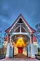
Saint Matthew's Church
-
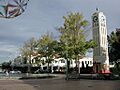
Hastings CBD
-
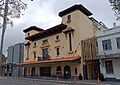
Toitoi Events Centre
-
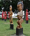
Nga Pou o Heretaunga
-
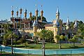
Splash Planet castle
-

Lion sculpture at Cornwall Park
See also
 In Spanish: Hastings (Nueva Zelanda) para niños
