Niuatoputapu facts for kids

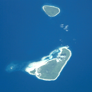
Niuatoputapu is a beautiful high island in the island nation of Tonga. Tonga is located in the Pacific Ocean. The highest point on Niuatoputapu is 157 meters (about 515 feet) tall. Its name means sacred island. In the past, European explorers called it Traitors island or Keppel island.
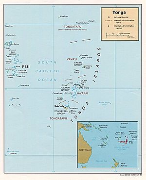
Niuatoputapu is in the northern part of Tonga. It is about 300 kilometres (190 miles) away from Vavaʻu. It is also close to the border with Samoa. Its closest neighbors are the small island of Tafahi, which is only 9 km (5.6 mi) to the north-northeast, and the island of Niuafo'ou. These three islands together make up an area called the Niuas. Niuatoputapu has an airport called Mataʻaho airport. This airport can even accept international flights. In 2006, about 934 people lived on Niuatoputapu. People on the island used to speak the Niuatoputapu language. However, this language is no longer spoken. Today, everyone speaks Tongan. Still, you might notice some words from Samoan, ʻUvean, and Futunan languages.
Contents
Exploring Niuatoputapu's Geography
The highest point in the center of Niuatoputapu is a hill. It is only 157 m (515 ft) tall. This hill is what is left of a very old volcano. This volcano erupted about 3 million years ago. A large reef almost completely surrounds the island. The island's soil is very fertile. This is because it is covered with volcanic ash.
Niuatoputapu has three main villages. These are Hihifo, Vaipoa, and Falehau. Hihifo means "west" in Tongan. It is the biggest village and is located on the west side of the island. Hihifo has most of the local governmental facilities. This includes the post office, police station, and a high school. All three villages have primary schools. Vaipoa is in the middle of the island. Falehau is east of Vaipoa. It is located near the island's only harbor, which is on the northwest coast.
A Look at Niuatoputapu's History
The traditional leaders of Niuatoputapu belong to the Māʻatu family. Old legends say that an early member of this family became the fish god Seketoʻa.
European explorers first put Niuatoputapu on their maps in 1616. This happened during a famous trip around the world. The explorers were Willem Schouten and Jacob Le Maire. They were sailing on their ship called the Eendracht (which means Unity). They first traded successfully with people on Tafahi. But they could not find a good place to anchor their ship there. So, they sailed to Niuatoputapu, the bigger island to the south.
Their welcome on Niuatoputapu was not as peaceful. Native islanders boarded their ship. They attacked the Dutch sailors with clubs. But then they learned what muskets were and what they could do. After that, an uneasy peace began. This allowed them to trade for coconuts, ubes roots (which were probably yams), hogs, and water. A 'king' of the island came to meet them. He was dressed like everyone else. You could only tell he was the king by the respect the islanders showed him.
The next day, the Dutch sailors felt that something was wrong. And indeed, when the king came again, he suddenly told his people to attack. There were about 700 to 800 islanders. They came in 23 double canoes and 45 single canoes. But the Dutch fired their muskets and 3 cannons. The islanders quickly left. Schouten and LeMaire continued their journey west. They left behind the island they called Verraders (Traitors) island.
Niuatoputapu in Movies
The 2001 film The Other Side of Heaven tells the story of LDS missionary efforts by John Groberg on Niuatoputapu. However, the movie was not actually filmed on Niuatoputapu. It was filmed on Rarotonga in the Cook Islands and in Auckland, New Zealand.
See also
 In Spanish: Niuatoputapu para niños
 | Aurelia Browder |
 | Nannie Helen Burroughs |
 | Michelle Alexander |


