Rarotonga facts for kids
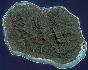
NASA satellite image of Rarotonga
|
|
| Geography | |
|---|---|
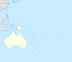
| Location | Central-Southern Pacific Ocean |
| Coordinates | 21°14′6″S 159°46′41″W / 21.23500°S 159.77806°W |
| Archipelago | Cook Islands |
| Major islands |
|
| Area | 67.39 km2 (26.02 sq mi) |
| Highest elevation | 2,139 ft (652 m) |
| Highest point | Te Manga |
| Administration | |
| Largest settlement | Avarua (pop. 4,906) |
| Demographics | |
| Demonym | Rarotongan |
| Population | 13,007 |
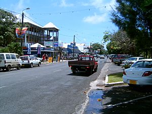
Rarotonga is the biggest and most populated island in the Cook Islands. It is a volcanic island, covering about 67 square kilometers. Almost 75% of the country's people live here, with a population of 13,007.
The Cook Islands' Parliament buildings are on Rarotonga. The main international airport is also located here. Rarotonga is a very popular place for tourists to visit. Many resorts, hotels, and motels can be found across the island. Avarua, on the north coast, is the capital city of the Cook Islands.
Contents
Exploring Rarotonga's Geography
Rarotonga is shaped like a kidney and is a volcanic island. It is about 32 kilometers around. The island is the top of an old, inactive volcano. This volcano rises 5000 meters from the ocean floor.
The island was formed between 2.3 and 1.6 million years ago. There was another period of volcanic activity about 1.4 to 1.1 million years ago. Scientists believe it was formed by a special "hotspot" or by old volcanoes becoming active again.
Mountains and Valleys
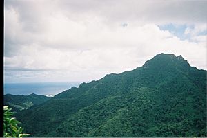
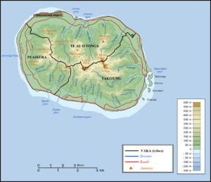
The middle of the island has thick forests and deep valleys. These are what is left of the original volcano. Many streams flow from these hills, like the Avatiu Stream. Te Manga is the highest point on the island, reaching 658 meters above sea level. Another smaller peak, Ikurangi, looks over the capital city.
Coastal Areas and Reefs
Around the hills is a flat coastal area. This area has beaches, swamps, and river deposits. A fringing reef surrounds the island. This reef is between 30 and 900 meters wide. It is shallow, only about 1.5 meters deep at most.
The reef has several openings, especially near Avarua and Ngatangiia. Beyond the reef, the ocean floor drops quickly into deep water.
Beautiful Lagoons and Islets
The lagoon is widest off the southeast coast, in the area of the Muri Lagoon. This part has four small islands called motu. They are:
- Motutapu
- Oneroa
- Koromiri
- Taakoka
Another tiny island, Motutoa, is on the reef flat on the northwest coast.
Rarotonga's Natural Environment
The island's center has eroded volcanic peaks covered in thick plants. Roads allow access to some valleys. However, most of the island's interior is not lived in because the land is difficult to cross.
Protecting Native Wildlife
A special area of 155 hectares has been set aside. It is called the Takitumu Conservation Area. This area helps protect native birds and plants. It is especially important for the vulnerable Rarotonga monarch, also known as kakerori.
Other rare birds living here include the Rarotonga fruit dove and Rarotonga starling. This place is recognized as an Important Bird Area (IBA) by BirdLife International.
A Glimpse into Rarotonga's History
The first signs of people living in the Southern Cook Islands date back to around 1000 AD. Stories say that different groups settled Rarotonga. These included Ata-i-te-kura in the ninth century. Tangi'ia Nui from Tahiti and Karika from Samoa arrived in 1250.
An early leader, Toi, is said to have built Te Ara Nui o Toi. This was a paved road that goes around the island. People traded with other islands like Samoa. They brought in basalt rock for tools. They also brought animals like chickens and pigs, and many crops.
European Arrival and Changes
Captain John Dibbs was the first European to officially discover Rarotonga. This happened on July 25, 1823. He was transporting a missionary named Reverend John Williams. A missionary from Bora Bora, Papeiha, went ashore to teach Christianity. By 1830, the island had become Christian.
From 1830 to 1850, Rarotonga was a popular stop for whaling ships. Trade with other countries began. The local leaders, called ariki, tried to stop Europeans from settling. They did not want them to buy land.
In 1888, the island became a British protectorate. This meant Britain would protect it. In 1901, New Zealand took control of the island.
Modern Times and Challenges
Oranges were brought to the island by the Bounty mutineers. After New Zealand took control, oranges became a major export. A canning factory opened in 1961 to export orange juice. This industry lasted until the 1980s.
An airstrip was built in 1944. This led to regular flights to other islands. The airport's upgrade in the 1970s led to more people moving to New Zealand. However, people from other Cook Islands also moved to Rarotonga.
The island has faced natural disasters. In 1967, floods damaged bridges and crops. A cyclone in December 1967 left many people without homes. In 1976, Tropical Cyclone Kim destroyed most of the island's banana crop. In 1987, Tropical Cyclone Sally damaged many buildings in Avarua.
People and Communities
In 2016, Rarotonga had a population of 13,007 people.
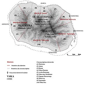
The island is traditionally split into three main areas called vaka. These are Te Au O Tonga, Takitumu, and Puaikura. For official purposes, it is divided into five Land Districts. The capital, Avarua, is in Te Au O Tonga.
Fun Things to Do in Rarotonga
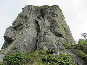
White sandy beaches with palm trees are all around the island. There is a popular walk that crosses the island. It goes through the Avatiu valley to the south side. This walk passes Te Rua Manga, a famous needle-shaped rock. You can see it from the air and some parts of the coast.
You can also hike to Raemaru, which is a flat-top mountain. Other interesting places include Wigmore Falls (Papua Falls) and the ancient Arai te Tonga.
Popular activities on the island include snorkeling and scuba diving. You can also ride bikes, go kite surfing, or try deep-sea fishing. Boat tours and scenic flights are also available. Many restaurants offer delicious food. You can enjoy dancing and island shows. People also play squash and tennis. Zipping around on mopeds is a fun way to explore. Of course, sleeping on the beach is always an option!
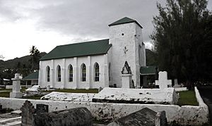
Many churches are open for Sunday service, where you can hear beautiful a cappella singing. People also gather at the sea wall near the airport runway. They like to feel the "jetblast" from planes taking off.
Getting Around Rarotonga
Rarotonga has three harbors: Avatiu, Avarua, and Avana. Avatiu harbor is the most important for trade. It serves small inter-island and fishing boats. Cargo ships from New Zealand visit regularly. Large cruise ships often visit Rarotonga. However, the harbor is too small for them, so they anchor offshore.
A main road, Ara Tapu, goes around the coast of the island. Most of Rarotonga also has an older inner road called Ara Metua. This road is about 29 kilometers long. It was built in the 11th century and was paved with large stone slabs. Important ancient sites, called marae, are along this road. Arai Te Tonga is the most sacred shrine on Rarotonga.
Because the middle of the island is mountainous, there is no road that crosses it. Rarotonga has only two bus routes: clockwise and anticlockwise. The clockwise bus runs hourly until 11 pm. The anti-clockwise bus leaves Avarua every half hour until 4:30 pm. Buses will pick you up and drop you off anywhere along the route, even without a bus stop.
Rarotonga International Airport is the main airport for the Cook Islands. Air Rarotonga flies between the islands. They have daily flights to Aitutaki. They also have regular flights to Atiu, Mangaia, Mauke, and Mitiaro. Sometimes, they fly to the far northern islands like Manihiki and Pukapuka.
As of 2017, Air New Zealand flies directly to and from Los Angeles and Sydney weekly. They also have five flights a week from Auckland. Jetstar and Virgin Australia also offer flights from Auckland. Air Tahiti flies to and from Papeete once or twice a week.
Rarotonga in Movies and Books
- The 1995 album Finn by the Finn Brothers has a song called "Kiss the Road of Rarotonga." It was inspired by a motorcycle accident Tim Finn had there.
- The U.S. TV show Survivor: Cook Islands was filmed on Aitutaki. One of the teams was named Rarotonga (or Raro).
- Several movies have connections to Rarotonga. Merry Christmas, Mr. Lawrence was filmed here. The Other Side of Heaven was partly filmed on Rarotonga. The movie Johnny Lingo was set here.
- In the 2008 movie Nim's Island, Rarotonga is a stop for the character Alexandra Rover.
- In 1951, Mexican writers created a comic book called Rarotonga. The story takes place on the island. The main character, Zonga, has amazing powers. This comic inspired a Mexican movie in 1978 and a song by the band Café Tacuba.
- The 1948 film Another Shore is about an Irish man who dreams of living on Rarotonga.
- The 1990 autobiography of former New Zealand cricket captain John Wright is titled Christmas in Rarotonga.
See also
 In Spanish: Rarotonga para niños
- Auparu – In Cook Islands stories, Auparu is a stream in Rarotonga. It was a bathing place for nymphs or fairies.
- Nukutere College – The only Roman Catholic high school in the country.
- Roman Catholic Diocese of Rarotonga
- Treaty of Rarotonga – A 1985 treaty that made the South Pacific a nuclear-free zone.
 | Audre Lorde |
 | John Berry Meachum |
 | Ferdinand Lee Barnett |


