South West Wilderness facts for kids
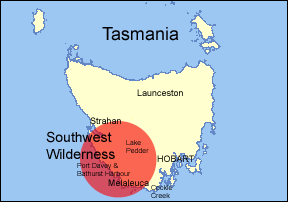
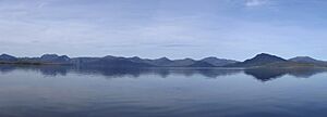
The South West Wilderness in Tasmania, Australia, is a wild and remote place. It has amazing scenery, tall mountains, wild rivers, and a long coastline. You can find unique plants and animals here. Some parts of this area are more than 50 kilometers from the nearest road. This means you can only get there by walking, flying, or sailing.
People have called this area by different names over the years. Sometimes it's just called The Southwest. Other times, maps and travel guides call it the Southwest Wilderness or South-West Wilderness.
Contents
Exploring the History of the South West Wilderness
Scientists have found signs that people lived in the South West Wilderness a very long time ago. Evidence shows humans were here at least 25,000 years ago. For at least 3,000 years, four Tasmanian Aboriginal tribes shared the coastal areas.
European explorers also visited this coast. Captain James Cook mapped parts of it in 1777. This was during his third big sea journey. Other European sailors probably saw it before him. But they didn't try to land much because it was so wild.
In the 1800s, Europeans settled other parts of Australia and Tasmania. But they found this area very tough to live in. Only a few seal hunters, whale hunters, miners, and timber cutters stayed here.
In 1955, Lake Pedder National Park was created. Over the next 35 years, this park grew bigger. It was renamed the Southwest National Park. By 1990, it reached its current large size. This park makes up most of the South West Wilderness.

A Special World Heritage Area

The South West Wilderness is a very important part of the Tasmanian Wilderness World Heritage Site. This means it has "super amazing natural features" and "exceptionally beautiful places." These areas are important for everyone on Earth.
Most of the South West Wilderness is covered by the Southwest National Park. This is Tasmania's biggest National Park. It is 6,052.13 square kilometers in size. That's bigger than many small countries!
The Southwest National Park is part of a long chain of five National Parks. These include the Hartz Mountains National Park, the Franklin-Gordon Wild Rivers National Park, the Cradle Mountain-Lake St Clair National Park, and the Walls of Jerusalem National Park. Together, these five parks cover almost a quarter of Tasmania. Along with other smaller areas, they form the World Heritage Area. Some parts of these other National Parks are also considered part of the South West Wilderness.
Understanding the Geology and Geography
The South West Wilderness has a lot of dolerite and quartzite rocks. There isn't much soil covering the ground. This is why the landscape looks the way it does. It also means the land isn't good for farming or growing trees for wood. Because it's so remote, rugged, and has poor soil, it was hard for people to settle here.
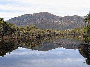
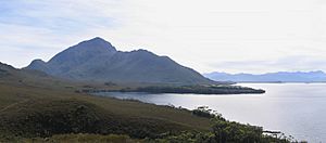
You'll see many mountain ridges and deep valleys. There are also deep mountain lakes and large, wild moor-lands. Much of the land was shaped by ice ages long ago. The wilderness also has huge water areas called Port Davey and Bathurst Harbour. Together, they cover 170 square kilometers. That's more than three times the size of Sydney Harbour!
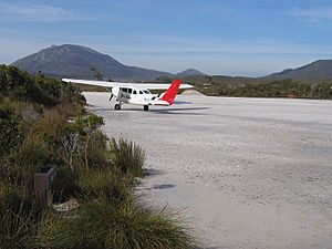
Melaleuca is a tiny place on Bathurst Harbour. It has one house where someone lives now. There's also an old house where a famous Tasmanian naturalist, Deny King, used to live. You'll find a small airstrip made of crushed rock. There are also some basic park facilities like a bird hide, information center, and toilets. Only two people live there permanently.
Some important places include the Arthur Range, South Picton Range, Frankland Range, and Ray Range. Famous mountains are Mount Rugby, Mount Melaleuca, Mount Anne, Precipitous Bluff, and Federation Peak. Rivers that start in or flow through the South West Wilderness include the Davey River, the Franklin and Gordon Rivers, and the Huon River.
Discovering Flora and Fauna
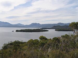
In the areas with better soil, you'll find thick forests. These include eucalyptus trees, southern sassafras, and myrtle beech. There are also acacia (wattle) and leatherwood (Eucryphia lucida) trees. Closer to the ground, you'll see low-growing ferns, climbing heath, bauera, mosses, and lichen. In wet, protected spots, you can still find stands of temperate rainforest.
This region is also home to special and very old Huon pines. These trees grow very slowly but can live for thousands of years. Their wood is one of the strongest on Earth. You can also see the interesting celery-top pines (Phyllocladus aspleniifolius).
The exposed areas with poorer soil, especially in the far south-west, have mostly low-growing native grasses. These include the unusual buttongrass, heaths, and tough melaleucas. These plants grow right up to the water's edge. They make the pure, clean water look like tea.
The animals here are typical Tasmanian species. However, there aren't huge numbers of them, especially in the less fertile areas. Because it's so remote, some people think the wilderness might be a place where thylacines (Tasmanian tigers) could have survived. They were officially declared extinct in 1936. However, most experts think areas in north-west Tasmania, like the Tarkine wilderness, are more likely. This is because those areas have better homes and more food for thylacine.
The rivers can be full of fish, like giant trout. This is because humans don't fish here too much. You can see many different birds. These include rosellas, honeyeaters, native wrens and robins, thornbills, and currawongs. The area around Melaleuca is a summer breeding spot for the very rare orange-bellied parrot.
How to Access the South West Wilderness
The South West Wilderness is one of the hardest places to reach in Australia. No roads go deep into the wilderness. So, to get to the south-west part, you must walk, fly, or go by boat.
There are two places to stay overnight near Lake Pedder. The Ted's Beach campground is 10 kilometers from Strathgordon. It's on the east side of the lake. It has electric barbecues, showers, and toilets. The Lake Pedder Chalet is on the west side of the lake in Strathgordon. It's like a hotel with a restaurant and bar. Both places have free boat ramps. They are also close to the start of the Port Davey Track.
Two walking tracks cross the wilderness. These are for very experienced walkers only. The 54-kilometer Port Davey Track goes from Lake Pedder to Melaleuca. It usually takes four to five days to walk. Lake Pedder is 75 kilometers from Hobart by road.
From Melaleuca, the 66-kilometer South Coast Track follows Tasmania's southern coast. It goes back to Cockle Creek. This part of the walk usually takes five to nine days. Cockle Creek is at the end of the Huon Highway. This is Australia's southernmost road. From there, it's about a two-hour drive back to Hobart. There are also some shorter walks that start from the edges of the wilderness where roads end.
You can also arrange for a plane to drop you off or pick you up at Melaleuca. However, flying into the area depends a lot on the weather. The weather can change very quickly. Light aircraft fly regular tourist flights from Cambridge Aerodrome near Hobart. These flights offer a great way to see the South West Wilderness from above. Flights take about 45 minutes each way.
The only other way to get to the wilderness is by boat. There aren't regular boat tours to the area. But you can arrange a boat trip through the tourist flight operator. They also offer overnight stays at a camp. At least one sea kayak company leads long tours of Bathurst Harbour. They use folding kayaks and start from Melaleuca.
The weather in this area can be very challenging. It can snow, get icy, have strong winds, heavy fog, and thick clouds at any time of year. This is especially true in the middle months of the year. So, any trip into the wilderness needs careful planning. It can rain up to 3,000 millimeters (about 118 inches) per year. The amazing views are often hidden by low clouds. This changeable and potentially dangerous weather happens because the wilderness faces the wild Southern Ocean. The next land you would reach to the south is Antarctica, and to the west is South America.
 | Jackie Robinson |
 | Jack Johnson |
 | Althea Gibson |
 | Arthur Ashe |
 | Muhammad Ali |


