
Franklin River facts for kids
Quick facts for kids Franklin |
|
|---|---|

Franklin River near the Lyell Highway
|
|

|
|
| Country | Australia |
| State | Tasmania |
| Region | Central Highlands, Western |
| Physical characteristics | |
| Main source | Mount Hugel Franklin-Gordon Wild Rivers National Park 951 m (3,120 ft) 42°18′48″S 146°12′56″E / 42.31333°S 146.21556°E |
| River mouth | Gordon River 11 m (36 ft) 42°35′27″S 145°44′24″E / 42.59083°S 145.74000°E |
| Length | 129 km (80 mi) |
| Basin features | |
| River system | Gordon River |
| Tributaries |
|
| Reservoirs | Lake Undine; Lake Dixon |
The Franklin River is a big river in Tasmania, Australia. It flows all year round. You can find it in the Central Highlands and western parts of the state.
This river is part of the Franklin-Gordon Wild Rivers National Park. This park is also a World Heritage Area, which means it's a very special place protected for everyone. The river starts in the Central Highlands and flows west.
The river got its name from Sir John Franklin. He was once the Governor of Tasmania. Later, he went on a famous journey to find the Northwest Passage and sadly did not return.
River's Path and Features
The Franklin River begins near Mount Hugel. This is west of Derwent Bridge in the Central Highlands. It then flows through wild, mountainous areas. Finally, it joins the Gordon River.
Many smaller rivers flow into the Franklin. These are called tributaries. Some of them include the Surprise, Collingwood, Lucan, Loddon, Andrew, and Jane rivers.
Along its path, the Franklin River has two man-made lakes. These are Lake Undine and Lake Dixon. The Lyell Highway crosses the river in its upper parts.
Long ago, people lived near the Franklin River. Scientists have found old sites that show human activity from before Europeans arrived. Explorers also traveled the upper parts of the river in the 1800s. They were trying to reach Frenchmans Cap, a famous mountain.
In the early 1900s, people used the lower parts of the river for logging pine trees. Later, in the mid-1900s, brave canoers started exploring the river's challenging rapids. Many of the river's bends and rapids have special names given by rafters and canoers over the years.
Saving the Franklin River
In the 1980s, the Franklin River became famous across Australia. This was because of a huge effort to protect it. A company called Hydro Tasmania wanted to build a large dam on the river. This dam would have created electricity but would also have flooded much of the wild river.
Many people joined together to stop the dam. This became one of Australia's biggest environmental movements ever. People protested, and there were many discussions about protecting wilderness areas.
The fight to save the Franklin River brought a lot of attention to the area. It also led to new rules for people visiting the river. These rules help keep visitors safe and protect the river's natural beauty.
Images for kids
-
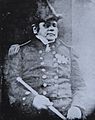
Sir John Franklin, who the river is named after.

