Federation Peak facts for kids
Quick facts for kids Federation Peak |
|
|---|---|

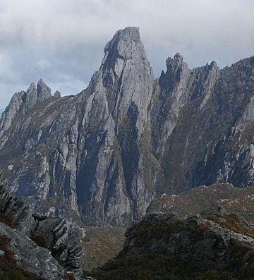
Federation Peak from the Eastern Arthur Range
|
|
| Highest point | |
| Elevation | 1,224 m (4,016 ft) |
| Prominence | 600 m (2,000 ft) |
| Geography | |
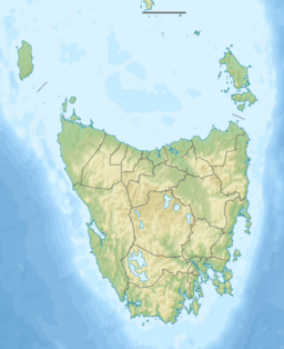
| Location | Tasmania, Australia |
| Parent range | Arthur Range |
| Climbing | |
| First ascent | John Béchervaise, Bill Elliot, Fred Elliot and Allan Rogers - 27 January 1949 |
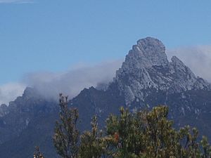
Federation Peak is a famous mountain in Tasmania, Australia. It has a very sharp, spire-like shape. This peak marks the end of the Eastern Arthur Range and is located in the beautiful Southwest National Park.
The mountain is about 90 kilometers (56 miles) southwest of Hobart, Tasmania's capital city. It was named after the Federation of Australia, which is when the different Australian colonies joined together to form one country.
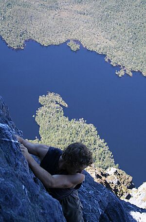
Federation Peak stands 1,224 meters (4,016 feet) above sea level. The very last part of the climb to the top is extremely steep and exposed. It involves moves similar to rock climbing, high above Lake Geeves. Because of its challenging nature, the famous climber Sir Edmund Hillary once called it "Australia's only real mountain."
Contents
History of Federation Peak
First Sightings and Naming
The first European person to see Federation Peak was a surveyor named James Sprent. He was mapping Tasmania and called the peak "the Obelisk" because of its shape. For a while, it was known as Sprent's Obelisk.
However, in 1901, the peak was officially named Federation Peak. This was done by Thomas Bather Moore to honor the Federation of Australia. He was working on creating a track from Hastings to Port Davey at the time.
Reaching the Summit
It took almost 50 years after the first sighting for anyone to successfully climb to the top. This shows how tough and wild southwest Tasmania is. Climbers faced many challenges, like thick, tangled bushes, ancient rainforests, rough ground, and unpredictable weather. The strong winds known as the "roaring forties" often bring sudden storms.
After several groups tried and failed in the late 1940s, a team from The Geelong College Exploration Society finally made it. Led by John Béchervaise, they reached the summit on January 27, 1949.
The usual climbing path is very exposed and technical. Sadly, there have been some accidents on this route.
Mountain Climate
The highest parts of Federation Peak experience alpine weather conditions. This means it's often cold and windy, similar to conditions found in high mountain ranges. Most of the weather patterns are controlled by the strong winds.
The mountain gets a lot of snow in autumn, winter, and early spring. Sometimes, it can even snow in summer, though this snow usually melts quickly.
Climbing Routes on Federation Peak
There are several different ways to climb to the summit, ranging in difficulty. These are called "rock climbing routes."
Blade Ridge Route
One of the most famous routes is called Blade Ridge. This is a very steep, narrow ridge that looks like a knife edge. It rises out of the cool forest at the bottom of the mountain. The ridge connects to the main face of the peak a few hundred meters below the summit.
After climbing the ridge, the path continues up an exposed but safe face to the very top. This part is about 600 meters (2,000 feet) above the valley floor. Blade Ridge was first successfully climbed in February 1968 by Peter Heddles, Rod Harris, David Neilson, and Jack Woods.
Direct Ascent for Bushwalkers
Most bushwalkers (people who hike in the wilderness) who don't use much climbing gear take a route called the 'Direct Ascent'. This involves scrambling up an exposed path from the Southern Traverse of the peak. It's about 600 meters (2,000 feet) above Lake Geeves.
Accessing the Peak
To get to the base of Federation Peak, hikers usually start from Geeveston. One common route is via Farmhouse Creek and Moss Ridge. This is generally the shorter option, taking about three days to reach the peak.
Another way is from Scotts Peak via the Eastern Arthurs. This route is much longer, taking at least 7 days, and sometimes up to 10 days if the weather is bad. It finishes at Farmhouse Creek.
Winter Ascents
Climbing Federation Peak in winter is even more challenging due to the cold and snow. The first successful climb in true winter conditions was made by Faye Kerr and Max Cutcliffe in September 1954.
In August 1978, a Tasmanian group led by Kevin Doran climbed the mountain during very severe weather. This difficult trip lasted two weeks.
The first and only winter climb of Blade Ridge was completed in 2016 by Mick Wright and Mark Savage. Their expedition was led by Andy Szollosi, and their journey is shown in a documentary called Winter on the Blade.
 | George Robert Carruthers |
 | Patricia Bath |
 | Jan Ernst Matzeliger |
 | Alexander Miles |


