Bathurst Harbour, Tasmania facts for kids
Quick facts for kids Bathurst Harbour |
|
|---|---|

Forest Lagoon, an offshoot of Bathurst Harbour, looking south with "Claytons Corner" in lower right
|
|
| Location | South West Tasmania |
| Coordinates | 43°20′33.68″S 146°10′32.38″E / 43.3426889°S 146.1756611°E |
| River sources | North River, Old River, Ray River and Melaleuca Creek |
| Primary outflows | Bathurst Channel to Port Davey and then the Southern Ocean |
| Basin countries | Australia |
| Average depth | 3 to 7 metres (9.8 to 23.0 ft) |
| Max. depth | 29 metres (95 ft) |
| Settlements | Melaleuca |
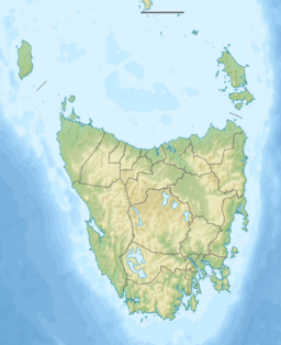
Bathurst Harbour is a large, shallow bay located in the southwest part of Tasmania, Australia. It's a very special place because it's protected within the Port Davey/Bathurst Harbour Marine Nature Reserve. It's also part of the Southwest National Park. This park is even part of the Tasmanian Wilderness, which is a World Heritage Area. This means it's recognized globally for its unique natural beauty.
The harbour is almost completely surrounded by land. It's a calm, shallow bay, usually about 3 to 7 meters deep. This makes it a safe place for boats to anchor. It protects them from the very strong winds called the Roaring Forties. These winds often hit the western and southern coasts of Tasmania.
Bathurst Harbour connects to Port Davey through a narrow, 12-kilometer-long passage called Bathurst Channel. From Port Davey, the water flows out into the Southern Ocean. The water in the harbour looks a deep red-brown color. This is because of something called tannin. Tannin is a natural substance that leaks into the water from plants like buttongrass.
Contents
Exploring Bathurst Harbour
Bathurst Harbour is a big, rectangular body of water. It sits in the very southwest corner of Tasmania. Low-lying flat areas surround the harbour. Mountains run along its western and eastern sides. Several rivers and creeks flow into the harbour. These include the North River, Old River, Ray River, and Melaleuca Creek. They either flow directly into the harbour or into its smaller bays.
Boating in the Harbour
Most of Bathurst Harbour is safe for sailing boats. There are almost no hidden rocks or dangers under the water. However, there is a small area near Black Swan Island that needs care. Of the rivers that flow in, only Melaleuca Creek is easy to navigate by boat. It stays deep enough (over 2 to 3 meters) for more than 6.5 kilometers upstream. This allows boats to reach a place called "Claytons Corner," which is near Melaleuca.
The bottom of the harbour is mostly flat and muddy. It's usually about 7 meters deep. Near the entrance to the harbour, the water gets much deeper. There are three deep channels that meet there. The deepest spot in the harbour is 29 meters deep. This deep area is caused by the strong tides moving the mud and gravel.
How the Harbour Formed
Bathurst Harbour was formed in a special way. It's a type of landform called a ria. A ria happens when a river valley gets filled with ocean water. This area was also shaped by glaciers a long time ago. Because of this, Bathurst Harbour looks a bit like an artificial lake. It's similar to Lake Pedder, which is about 30 kilometers north.
Unique Animals
Bathurst Harbour is one of only two places in the world where a very rare fish lives. This fish is called the Maugean Skate. It's a type of ray that is endemic to Tasmania. This means it's found nowhere else on Earth! The main group of these skates lives in Macquarie Harbour to the north.
Life Around the Harbour
The land around Bathurst Harbour is mostly empty. There are very few buildings or structures. Most of what you'll find is at Melaleuca. Here, there's a small airstrip and a few simple buildings. You can also see remains from tin mines that operated in the early 1900s.
A mining camp used to be at Woureddy Bay on Melaleuca Creek. There's also a homestead called "Claytons Corner" at the mouth of Melaleuca Creek. It has a wooden jetty for boats. Today, no one lives permanently in the region. However, some people have lived there alone in the past.
Getting to Bathurst Harbour
You can't drive to Bathurst Harbour. There are no roads! You can only get there by boat, by air, or by walking.
By Boat
The only way to reach the harbour by boat is through the Bathurst Channel from Port Davey.
By Walking
Two long walking trails lead to the area. These are the South Coast Track and the Port Davey Track. You can start these walks from Cockle Creek or Scotts Peak Dam.
By Air
There's a small airstrip at Melaleuca. This is the only way to fly into the region. The airstrip also connects to the main walking tracks.
 | Mary Eliza Mahoney |
 | Susie King Taylor |
 | Ida Gray |
 | Eliza Ann Grier |


