Scotts Peak Dam facts for kids
Quick facts for kids Scotts Peak Dam |
|
|---|---|
|
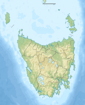
Location of the Edgar Dam in Tasmania
|
|
| Country | Australia |
| Location | South West Tasmania |
| Coordinates | 43°01′52″S 146°17′46″E / 43.03111°S 146.29611°E |
| Purpose | Power |
| Status | Operational |
| Opening date | 1973 |
| Owner(s) | Hydro Tasmania |
| Dam and spillways | |
| Type of dam | Embankment dam |
| Impounds | Huon River |
| Height | 43 metres (141 ft) |
| Length | 1,067 metres (3,501 ft) |
| Dam volume | 584×103 m3 (20.6×10⁶ cu ft) |
| Spillways | 0 |
| Reservoir | |
| Creates | Lake Pedder |
| Total capacity | 2,937,930 ML (103,752×106 cu ft) |
| Catchment area | 734 km2 (283 sq mi) |
| Surface area | 242 km2 (93 sq mi) |
| Maximum water depth | 43 m (141 ft) |
The Scotts Peak Dam is a large dam in the South West part of Tasmania, Australia. It was built using a method called "rockfill embankment," which means it's a huge wall made of rocks and earth. This dam does not have a spillway, which is a channel for water to flow over or around the dam.
The dam helps create a big reservoir called Lake Pedder. This lake was also formed with two other dams, the Edgar Dam and the Serpentine Dam. Lake Pedder even covered a smaller, natural pond called Lake Edgar. The Hydro Electric Corporation (now Hydro Tasmania) built the Scotts Peak Dam in 1973. It was part of a bigger project called the Gordon River Power Development Scheme. The main goal of this project was to make electricity using the power of water at the Gordon Power Station. Water from Lake Pedder travels through a canal to another lake, Lake Gordon, which is held back by the Gordon Dam.
Where is Scotts Peak Dam and What Does It Do?
The Scotts Peak Dam is one of three main dams that help control the water for the Gordon River Power Development Scheme. It is located near the eastern side of Lake Pedder, where the Huon River flows down from the Marsden Range into the Huon Basin. The dam holds back the upper part of the Huon River. The Serpentine Dam, at the northwestern end of Lake Pedder, holds back the Serpentine River.
About 40% of the water used by the Gordon Power Station comes from Lake Pedder. This water flows through a channel called the McPartlan Pass Canal to Lake Gordon. From Lake Gordon, the water then goes through the Gordon Dam, where it helps create electricity.
How Scotts Peak Dam Was Built
The wall of the Scotts Peak Dam is built on a base of rock and soil. It was made using about 584,000 cubic meters (that's a lot!) of rockfill, and its outer surface is covered with asphalt. The dam wall stands about 43 meters (141 feet) high and stretches for 1,067 meters (3,501 feet) long.
When Lake Pedder is completely full, the dam holds back a massive amount of water: about 2,937,930 megalitres. To give you an idea, a megalitre is a million litres! The surface area of Lake Pedder is about 241,330 hectares (932 square miles), and the area that collects water for the lake (called the catchment area) is about 734 square kilometers (283 square miles). As mentioned before, this dam does not have a spillway.
This dam does not directly make electricity itself. Instead, it helps keep water in the new lake, which then flows to Lake Gordon through the McPartlan Pass Canal. In 2001, the Scotts Peak Dam was recognized as an important historical engineering site by Engineers Australia, along with 24 other dams.
Challenges with the Dam
Engineers who worked on the Scotts Peak Dam have shared that there were some issues with leaks right after it was built. Even in the 2010s, there was still evidence of the dam's structure changing shape slightly over time.
|
 | Delilah Pierce |
 | Gordon Parks |
 | Augusta Savage |
 | Charles Ethan Porter |


