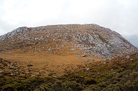
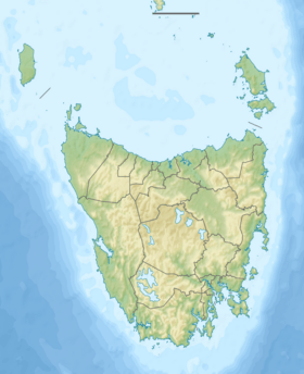
The Frankland Range is a group of mountains found in the south-western part of Tasmania, Australia. These mountains form a natural border on the south-western side of Lake Pedder. This lake was created when the Serpentine and Huon rivers were dammed.
The Frankland Range is part of the South West Wilderness area. It's not as popular for bushwalking as some other famous mountain ranges in Tasmania. This is because it's a very long and isolated area. The land is also quite rough and challenging. Because of this, it's mostly for experienced hikers. You can get to the range by boat from Lake Pedder. You can also use roads from Strathgordon or Scotts Peak Dam.
Other mountain ranges nearby include the Arthur, Companion, Folded, Tribulation, and the Wilmot ranges.
Tallest Mountains in the Frankland Range
The Frankland Range has several important peaks. The tallest one is Frankland Peak. It stands at 1,083 meters (3,553 feet) high. Here is a list of some of the notable peaks in the range:
| Rank |
Name |
Height |
Location |
Notes |
| 1 |
Frankland Peak |
1,083 metres (3,553 ft) |
42°58′48″S 146°08′24″E / 42.98000°S 146.14000°E / -42.98000; 146.14000 (Frankland Peak) |
|
| 2 |
Secheron Peak |
1,068 metres (3,504 ft) |
42°59′14″S 146°09′21″E / 42.98722°S 146.15583°E / -42.98722; 146.15583 (Secheron Peak) |
|
| 3 |
The Lion |
988 metres (3,241 ft) |
42°56′52″S 146°03′11″E / 42.94778°S 146.05306°E / -42.94778; 146.05306 (The Lion) |
|
| 4 |
Mount Lloyd Jones |
982 metres (3,222 ft) |
42°58′48″S 146°10′14″E / 42.98000°S 146.17056°E / -42.98000; 146.17056 (Mount Lloyd Jones) |
|
| 5 |
The Cupola |
970 metres (3,182 ft) |
42°56′16″S 146°03′04″E / 42.93778°S 146.05111°E / -42.93778; 146.05111 (The Cupola) |
|
| 6 |
Right Angle Peak |
954 metres (3,130 ft) |
42°59′40″S 146°08′31″E / 42.99444°S 146.14194°E / -42.99444; 146.14194 (Right Angle Peak) |
|
| 7 |
Cleft Peak |
946 metres (3,104 ft) |
42°57′45″S 146°05′30″E / 42.96250°S 146.09167°E / -42.96250; 146.09167 (Cleft Peak) |
|
| 8 |
Redtop Peak |
935 metres (3,068 ft) |
42°56′10″S 146°02′20″E / 42.93611°S 146.03889°E / -42.93611; 146.03889 (Redtop Peak) |
|
| 9 |
The Citadel |
929 metres (3,048 ft) |
42°57′20″S 146°04′00″E / 42.95556°S 146.06667°E / -42.95556; 146.06667 (The Citadel) |
|
| 10 |
Greycap |
898 metres (2,946 ft) |
42°58′16″S 146°06′25″E / 42.97111°S 146.10694°E / -42.97111; 146.10694 (Greycap) |
|
| 11 |
Murpheys Bluff |
881 metres (2,890 ft) |
42°57′16″S 146°04′48″E / 42.95444°S 146.08000°E / -42.95444; 146.08000 (Murpheys Bluff) |
|
| 12 |
Terminal Peak |
785 metres (2,575 ft) |
42°58′56″S 146°11′59″E / 42.98222°S 146.19972°E / -42.98222; 146.19972 (Terminal Peak) |
|


