Raiatea facts for kids
|
Native name:
Raꞌiātea
|
|
|---|---|
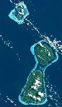
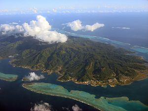
The islands of Bora Bora (top) Tahaa (middle) and Raiatea (bottom). Tahaa and Raiatea share the same lagoon.
|
|
 |
|
| Geography | |
| Location | Pacific Ocean |
| Coordinates | 16°49′S 151°27′W / 16.817°S 151.450°W |
| Archipelago | Society Islands |
| Major islands | Raiatea |
| Area | 167.7 km2 (64.7 sq mi) |
| Highest elevation | 1,017 m (3,337 ft) |
| Highest point | Mount Tefatua |
| Administration | |
|
France
|
|
| Overseas collectivity | French Polynesia |
| Capital and largest city | Uturoa (pop. 3,778) |
| Demographics | |
| Population | 12,545 |
| Pop. density | 72 /km2 (186 /sq mi) |
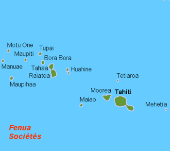
Raiatea (Tahitian: Raꞌiātea) is the second largest island in the Society Islands. These islands are part of French Polynesia in the Pacific Ocean. Raiatea is thought to be a very important place in ancient Polynesia. Many believe that organized trips to places like the Hawaiian Islands and New Zealand started here.
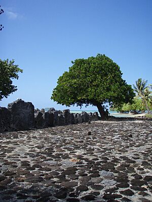
A traditional name for Raiatea is Havai'i. This name is special to the Māori people as their homeland. On the southeast coast, you can find the ancient Taputapuatea marae. This special site was built around 1000 AD. For many centuries, it was a major religious and political center for eastern Polynesia. In 2017, UNESCO added it to the World Heritage List because of its important history.
The main town on Raiatea is Uturoa. It is the main center for the Leeward Islands. Raiatea also has schools that serve students from nearby islands. These include Bora Bora, Tahaa, Huahine, and Maupiti.
Contents
Island Name and History
The name Ra'iātea in the Tahitian language means bright sky. An older way to spell it was "Ulitea" in the 1800s.
A bird called the Raiatea starling used to live on the island. Sadly, it is now extinct. There is only one drawing of this bird left in the world. You can find it at the Natural History Museum in London.
Early History of Raiatea
The Polynesian sailor Tupaia was born in Raiatea around 1725. He sailed with the famous explorer James Cook. Cook visited Raiatea in 1769 and again in 1773–1774. He called the island "Ulitea." Another young man from Raiatea, Omai, traveled to London in 1774. He also helped Captain Cook as an interpreter on his journeys.
In ancient times, the island was known as Havai'i. This name is sacred in Polynesian culture. It is linked to the names of Hawaii and Savai'i in Samoa. Scientists believe the Society Islands were settled around 200 BC. People came from Samoa and Tonga. These islands became a key starting point for people to settle Hawaii and New Zealand.
Raiatea's geography helped different groups of people grow. The island has valleys surrounded by rocky hills that open to the sea. Nine independent groups of people formed here. Each group had its own leaders. Society was divided into different levels. The ariki or ari'i were the noble chiefs. They owned land and were important leaders.
The great temple, or marae, of Taputapuatea was very important. It was dedicated to the god Oro. This temple was the main religious center for the islands. Its influence was so strong that it helped stop tribal wars.
European Arrivals
James Cook was the first European to find Raiatea. He arrived on July 20, 1769, during his first voyage. He sailed into Opoa Bay and landed near the Marae Taputapuatea. Cook claimed the island for the British Crown.
Later, King Charles III of Spain sent ships to the South Pacific. Domingo de Boenechea arrived at Raiatea in 1772. He named the island Princesa and claimed it for Spain. However, this claim did not lead to any lasting changes.
Even though nearby Tahiti came under French control in 1842, Raiatea's people fought against being taken over. Christian missionaries started to gain influence. This led to religious wars between those who followed old traditions and those who became Christians.
With European help, King Pomare II of Tahiti became ruler of the whole area. In 1828, the Marae Taputapuatea was destroyed. France tried to gain more control over the islands.
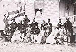
In 1880, France took control of Raiatea and Tahaa. After King Pomaré V gave up his rights to France, the Society Islands became a French colony in March 1888. But people in Raiatea still rebelled. A chief named Teraupo fought against the French until 1897. He was then sent away to New Caledonia.
King Tamatoa VI was the last king of Raiatea. He ruled from 1884 to 1888.
Geography of Raiatea
Raiatea is the second largest island in the Society archipelago. It covers an area of 175 square kilometers. A coral reef surrounds both Raiatea and Tahaa. They even share the same lagoon. The highest point on Raiatea is Mount Tefatoaiti, which is 1,017 meters tall.
The main island was formed by volcanoes. It is made mostly of volcanic rocks. In the lagoon and on the reef, there are many small islands called motu. These motu have white coral sand beaches.
Tahaa is north of Raiatea. The two islands are separated by a 3-kilometer wide channel. A boat trip from Raiatea to Tahaa across the lagoon takes about 20 minutes. Raiatea has rugged mountains and a coastline with many deep bays.
The best sandy beaches are on the motu. The main island of Raiatea does not have many good beaches. From the mountain peaks, steep valleys lead to the sea. Many streams form beautiful waterfalls. The Apoomau River is the only river in Polynesia that you can travel on by boat for a few kilometers.
Most people live and farm along the narrow coastal strip. The inside of Raiatea is mostly empty.
Weather and Climate
Raiatea has a tropical and humid climate. The average temperature is about 26°C all year round. It rains about 1800 mm each year. December is the rainiest month, but the rain usually comes in short, heavy bursts. August and September are the driest months.
Plants and Animals
The plants on French Polynesia are special. Many plants grow only here and nowhere else. But there are not as many different types of plants as on islands further west, like New Guinea. This is because the islands are very isolated.
Over nearly 2,000 years, people have changed Raiatea's plant life. They planted crops in the fertile coastal areas. People grow coconut palms, breadfruit trees, taro, yams, and sweet potatoes. They also grow many tropical fruits, including a very tasty pineapple. Pineapple and vanilla are grown on small family farms and sold to other countries.
Some of the original plants still grow in the wild, hard-to-reach parts of the island. However, new plants like guava bushes and bamboo are now threatening these native plants.
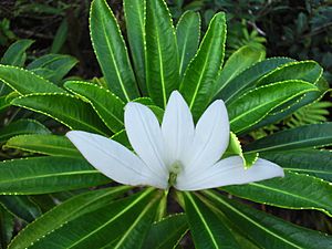
A special plant that only grows on Raiatea is the fragrant tiare apetahi. It is now in danger of disappearing. It only grows on Mount Temehani. There is a legend about this yellowish-white flower: A princess promised to hold her beloved's hand. When he climbed the mountain, he saw flowers with five petals reaching out like hands. He tried to plant one at home, but it died.
Another unique bird, the brown-headed parakeet, was found here by Captain Cook's crew. Sadly, this bird is also now extinct. It is believed that rats and other pests brought by ships caused its disappearance.
Mammals like dogs, pigs, and chickens were brought to the islands by early Polynesian settlers. Europeans later brought goats, cows, and horses. The native land animals are mostly insects, crabs, snails, and lizards. There are no animals on Raiatea that are dangerous to humans. However, sand fleas on the beach and Mosquitoes in the island's interior can be annoying.
The ocean around Raiatea is full of amazing sea life. Divers can see hundreds of different coral fish, mollusks, and crabs. The waters are also known for colorful Nudibranchs. The reefs have many caves where sea creatures hide. The "octopus grotto" between Raiatea and Tahaa is a popular spot for divers. Beyond the reef, you can find sharks, rays, and sea turtles.
Island Administration
Raiatea is part of French Polynesia. This means it is a French overseas territory. It is also connected to the European Union. The island is managed by a local government office.
Raiatea is divided into three main areas called communes (municipalities):
- Uturoa
- Taputapuatea
- Tumaraa
These three communes are part of the Leeward Islands. In 2012, Raiatea had about 12,832 people.
The official language is French. The money used is the CFP franc, which is linked to the euro. France and the EU help pay for the island's government.
The main town is Uturoa in the north. It is the center for business and government.
Island Economy
Raiatea's economy mainly relies on farming. The island exports vanilla, pineapple, and coconuts. The Nono (or noni) plant is also grown. The Fa'aroa Valley is an important farming area. A local research center helps with vanilla farming.
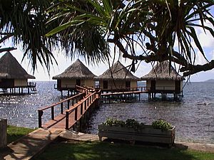
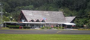
Pearl farming is another important business. However, raising cattle, sheep, and pigs has become less common. Raiatea has less tourism compared to other islands like Tahiti and Bora Bora. The island has guesthouses, two marinas, and a four-star hotel called The Hawaiki Nui. It also has a port for cruise ships. There is a growing business for yacht maintenance and building boats. Many people work for the government or in local shops. Raiatea has a small road that goes around the whole island. Raiatea Airport is located in Uturoa.
Tourism and Attractions
Even though Raiatea has some luxury hotels, it is a quieter island for tourists. It is not as busy as Tahiti or Bora Bora. Raiatea is very popular with sailors. Many companies offer yacht charters here. The island is often called the "nautical center" of Polynesia. There are good marinas in Uturoa and Faaroa Bay. Cruise ships also visit the island sometimes.
Places to Visit
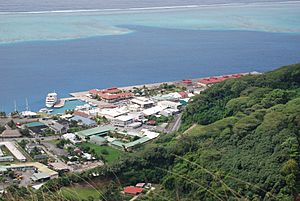
The main town of Uturoa is quiet and does not have many special sights. The port area was recently improved for cruise ship visitors. It now has a small park and paved walkways with beautiful designs. The botanical garden in Uturoa is interesting. It has many rare and unusual plants.
The most important attraction on Raiatea is the Taputapuatea worship site. It has several worship platforms, or marae. These were once in a sacred forest. Some parts of the site have been rebuilt. The largest platform was built in the early 1600s. It is made of huge limestone slabs and was for Oro, the god of war.
Other important ceremonial sites are on the island. In the Avera valley, there is another large platform. Near it, scientists found old homes and stone tool workshops. The ceremonial site at Tainuu is also well-preserved. It has large coral rock slabs and ancient rock carvings. A church was built on this sacred site in the 1800s.
For divers, the wreck of the Nordby is an interesting place. This Danish ship sank around 1900. The wreck is still in good condition. It is about 20 meters deep, near the Pearl Beach Resort.
Island Infrastructure
A 98-kilometer road goes around the island. Another road runs through the middle. Since the 1980s, many improvements have been made. Roads have been paved, and bridges built. Electricity, telephones, and drinking water systems have been added.
The port of Uturoa was updated in the early 2000s. This allows large cruise ships to visit weekly during tourist season. Raiatea is the main administrative center for the Leeward Islands.
The island has a hospital and several schools. There is a general secondary school and a vocational school. There are also three other secondary schools and many primary schools and kindergartens.
Raiatea is the only Polynesian island (besides Tahiti) with a secondary school. So, most students from nearby islands like Bora-Bora, Tahaa, Maupiti, or Huahine come here for high school. The island also has an airport, a commercial port, a market, and two marinas.
See also
 In Spanish: Raiatea para niños
 | Anna J. Cooper |
 | Mary McLeod Bethune |
 | Lillie Mae Bradford |


