
Image: L'Amérique divisée en ses principaux états (1775)

Size of this preview: 800 × 580 pixels. Other resolutions: 320 × 232 pixels | 12,460 × 9,033 pixels.
Original image (12,460 × 9,033 pixels, file size: 18.73 MB, MIME type: image/jpeg)
Description: A chart of the world upon Mercator's projection : describing the tracks of Capt. Cook in the year 1768, 69, 70, 71, and in 1772, 73, 74, 75, with the new discoveries.
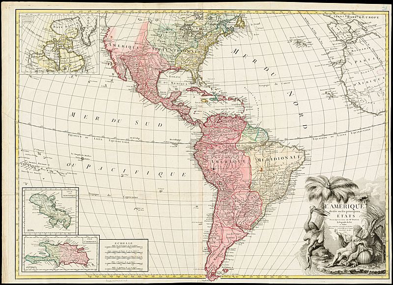
Title: L'Amérique divisée en ses principaux états (1775)
Credit: https://collections.leventhalmap.org/search/commonwealth:3f462x358
Author: Rigobert Bonne
Usage Terms: Public domain
License: Public domain
Attribution Required?: No
Image usage
The following page links to this image:

All content from Kiddle encyclopedia articles (including the article images and facts) can be freely used under Attribution-ShareAlike license, unless stated otherwise.
.jpg)