
Image: La2-demis-cuba

Size of this preview: 800 × 299 pixels. Other resolutions: 320 × 120 pixels | 1,156 × 432 pixels.
Original image (1,156 × 432 pixels, file size: 97 KB, MIME type: image/png)
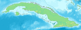
Description: Map of Cuba. Bounding box West -85.3°, South 19.5°, East -73.8°, North 23.5°. Center at 21°30′00″N 79°33′00″W / 21.50000°N 79.55000°W / 21.50000; -79.55000.
Title: La2-demis-cuba
Credit: Demis map server
Author: Demis map server
Usage Terms: Public domain
License: Public domain
Attribution Required?: No
Image usage
The following page links to this image:

All content from Kiddle encyclopedia articles (including the article images and facts) can be freely used under Attribution-ShareAlike license, unless stated otherwise.