Guanahacabibes Peninsula facts for kids
Quick facts for kids Guanahacabibes |
|
|---|---|
|
IUCN Category II (National Park)
|
|

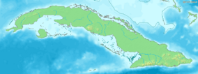
Location of Guanahacabibes in Cuba
|
|
| Location | |
| Nearest city | Sandino |
| Area | 398.26 km2 (153.77 sq mi) |
| Established | 1987 (Biosphere Reserve) |
The Guanahacabibes Peninsula is a very special place at the westernmost tip of Cuba. It is located in the Pinar del Río Province, near the town of Sandino. Not many people live here, making it a quiet and natural area. The waters around the peninsula are famous for fishing, especially for delicious lobster and red snapper. This unique area is also recognized by UNESCO as a Biosphere Reserve since 1987, which means it's a place where nature is protected and studied. The very end of the peninsula is called Cape San Antonio.
Contents
What is a Biosphere Reserve?
A Biosphere Reserve is a special area recognized by UNESCO. These places are chosen because they have unique natural environments. They are also important for showing how people can live and work while protecting nature.
Why Guanahacabibes is a Biosphere Reserve
Guanahacabibes became a Biosphere Reserve in 1987. This means it's a place where scientists study nature and work to keep it healthy. It also helps local people learn how to use the land and sea wisely.
Amazing Wildlife and Nature
The Guanahacabibes Peninsula is home to many different plants and animals. It has beautiful beaches, forests, and wetlands. This variety of habitats helps many species thrive.
Animals of Guanahacabibes
You can find many interesting animals here.
- Birds: Many kinds of birds live in the forests and along the coast. Some birds stop here during their long migrations.
- Reptiles: Different types of lizards and snakes call this place home.
- Sea Turtles: The beaches are important nesting sites for several species of sea turtles. These include the green turtle, loggerhead, and hawksbill turtle. They come ashore to lay their eggs in the sand.
Plants and Forests
The peninsula has different types of forests. These forests are adapted to the local climate. They provide homes and food for the many animals living there.
Exploring the Peninsula
Even though it's sparsely populated, Guanahacabibes offers unique experiences for visitors.
Beaches and Coastline
The coastline of Guanahacabibes is beautiful. It has sandy beaches and rocky areas. These areas are important for both wildlife and for people who visit.
Fishing and Local Life
Fishing is a very important activity for the people living near the peninsula. The waters are rich in seafood, especially lobster and red snapper. This helps support the local communities.
Protecting the Environment
Because Guanahacabibes is a Biosphere Reserve, there are efforts to protect its natural beauty. This includes protecting the animals and plants. It also means making sure people use the resources in a way that doesn't harm the environment.
See also
In Spanish: Península de Guanahacabibes para niños
 | Victor J. Glover |
 | Yvonne Cagle |
 | Jeanette Epps |
 | Bernard A. Harris Jr. |

