
Image: Laos - Division territòriala vèrs 1750 (vuege)
Size of this preview: 468 × 599 pixels. Other resolutions: 187 × 240 pixels | 840 × 1,076 pixels.
Original image (840 × 1,076 pixels, file size: 67 KB, MIME type: image/png)
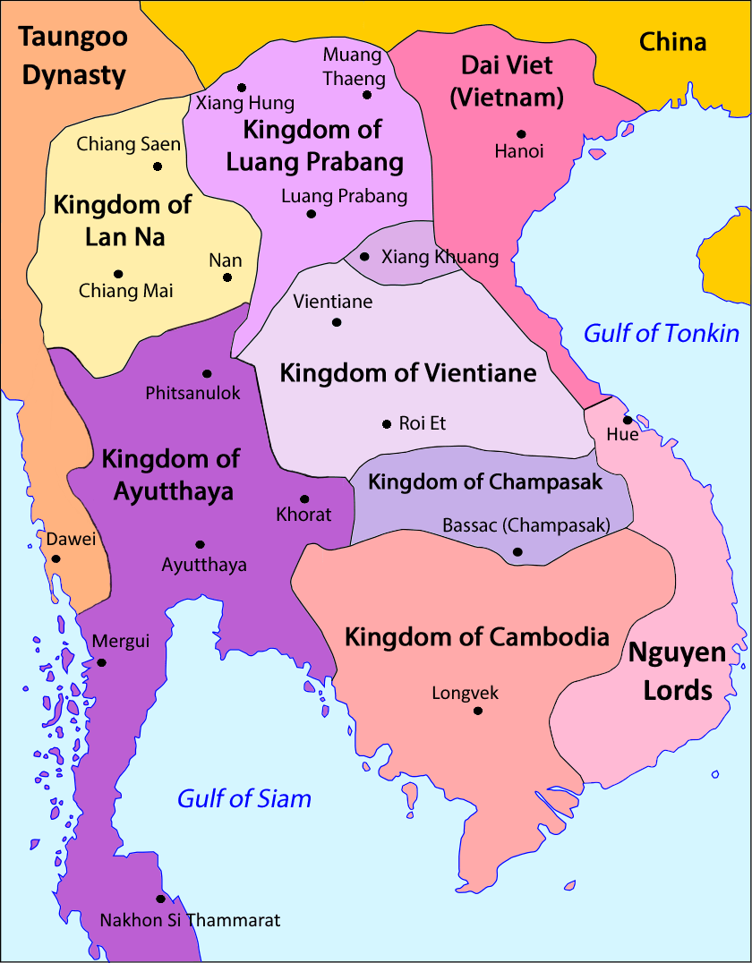
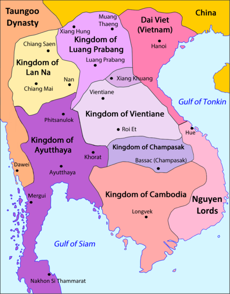
Description: Mainland Southeast Asia in 1707 (excluding most of Myanmar and Malaysia).
Title: Laos - Division territòriala vèrs 1750 (vuege)
Credit: Own work Baker, Chris. Phongpaichit, Pasuk. A History of Ayutthaya: Siam in the Early Modern World. Urban Places in the Seventeenth Century Map. Stuart-Fox, Martin. A History of Laos. Mainland Southeast Asia mid-16th to early-19th centuries Map. https://thesiamsociety.org/wp-content/uploads/1992/03/JSS_080_1l_SunaitChutintaranond_ImageOfBurmeseEnemy.pdf
Author: Nicolas Eynaud
Usage Terms: Creative Commons Attribution-Share Alike 4.0
License: CC BY-SA 4.0
License Link: https://creativecommons.org/licenses/by-sa/4.0
Attribution Required?: Yes
Image usage
The following page links to this image:

All content from Kiddle encyclopedia articles (including the article images and facts) can be freely used under Attribution-ShareAlike license, unless stated otherwise.
.png)