
Image: Laurie island map-en

Size of this PNG preview of this SVG file: 800 × 420 pixels. Other resolution: 320 × 168 pixels.
Original image (SVG file, nominally 867 × 455 pixels, file size: 133 KB)
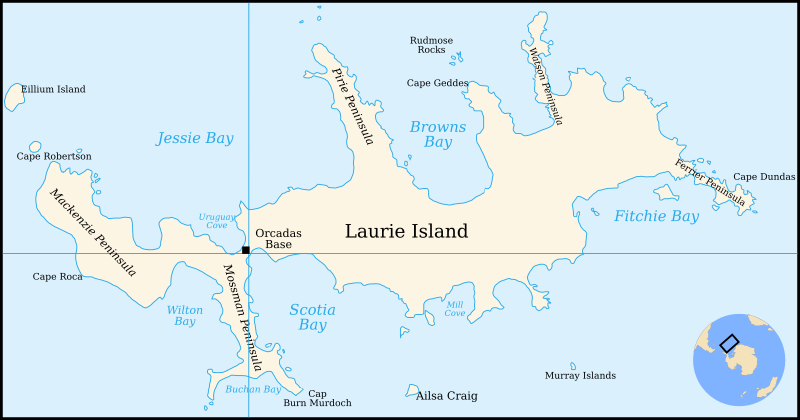
Description: Map of Laurie Island, South Orkney Islands
Title: Laurie island map-en
Credit: Translation of File:Laurie island map-fr.svg
Author: Original by Pinpin, translated to English by 4ing
Usage Terms: Creative Commons Attribution-Share Alike 3.0
License: CC BY-SA 3.0
License Link: http://creativecommons.org/licenses/by-sa/3.0/
Attribution Required?: Yes
Image usage
The following page links to this image:

All content from Kiddle encyclopedia articles (including the article images and facts) can be freely used under Attribution-ShareAlike license, unless stated otherwise.