
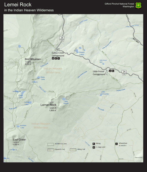
Image: Lemei Rock in the Indian Heaven Wilderness Visitor Map

Description: Map shows trails, major landforms, major lakes, and recreational facilities centering around the shield volcano called Lemei Rock, the highest point in the Indian Heaven Wilderness and the Indian Heaven Volcanic Field, located in the South Cascades region within Skamina County and the Gifford Pinchot National Forest in southern Washington. Map highlights includes: Bird Mountain, East Crater, Cultus Creek Campground, Little Goose Campground, and many lakes.
Title: Lemei Rock in the Indian Heaven Wilderness Visitor Map
Credit: Own work
Author: AdorableFluttershy
Usage Terms: Creative Commons Attribution-Share Alike 3.0
License: CC BY-SA 3.0
License Link: https://creativecommons.org/licenses/by-sa/3.0
Attribution Required?: Yes
Image usage
The following page links to this image:
