
Image: Lexington II Battlefield Missouri
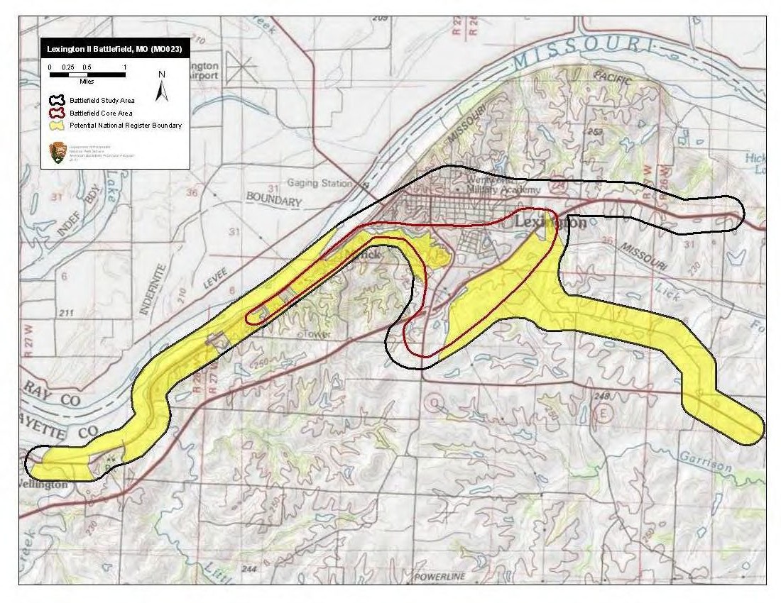
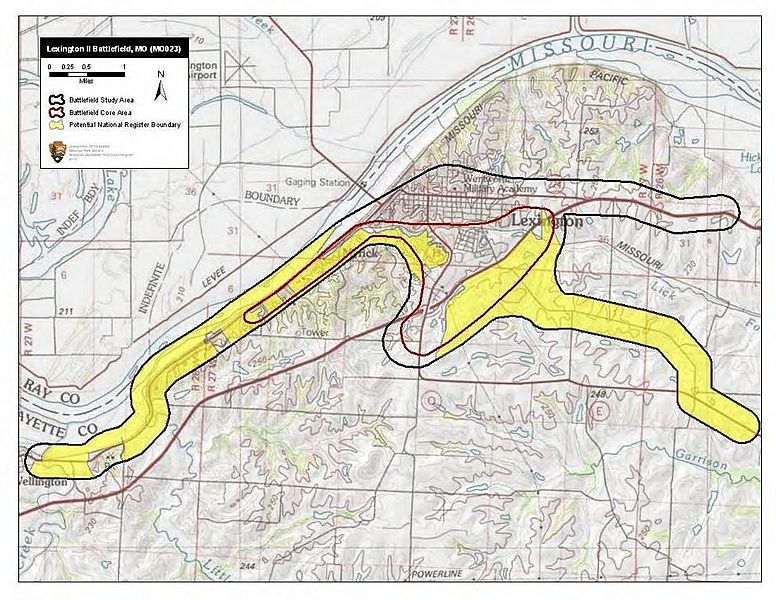
Description: Map of battlefield core and study areas. The ABPP expanded the 1993 Study Area to include the Union encampment, troop movements from the encampment down to the Old Fair Grounds south of town, the two Confederate approach routes from the east, and the routes of withdrawal used by Union and Confederate forces to the west (the routes of withdrawal end at a road intersection described in the reports of the engagement found in The War of the Rebellion: a Compilation of the Official Records of the Union and Confederate Armies). The ABPP reduced the 1993 Core Area slightly in the north and south to illustrate more accurately where fighting occurred. The Core Area was extended to the west to reflect the extent of the fighting during the Federal retreat.
Title: Lexington II Battlefield Missouri
Credit: National Park Service
Author: American Battlefield Protection Program
Usage Terms: Public domain
License: Public domain
Attribution Required?: No
Image usage
The following page links to this image:
