
Image: Ley Lands 1726 John Cossins detail 2
Size of this preview: 655 × 599 pixels. Other resolutions: 262 × 240 pixels | 811 × 742 pixels.
Original image (811 × 742 pixels, file size: 326 KB, MIME type: image/jpeg)
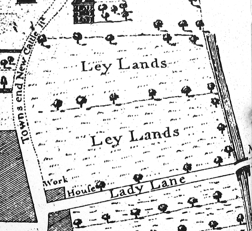
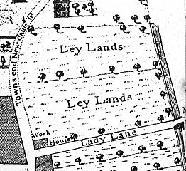
Description: Detail from the 1726 map of John Cossins "A New & Exact PLAN of the Town of LEEDES". Showing the Ley Lands and Lady Lane (still exists today). The road on the left has now been renamed as Vicar Lane, being an extension of the original Vicar Lane to the South.
Title: Ley Lands 1726 John Cossins detail 2
Credit: Own work
Author: Chemical Engineer
Usage Terms: Creative Commons Attribution-Share Alike 4.0
License: CC BY-SA 4.0
License Link: https://creativecommons.org/licenses/by-sa/4.0
Attribution Required?: Yes
Image usage
The following page links to this image:

All content from Kiddle encyclopedia articles (including the article images and facts) can be freely used under Attribution-ShareAlike license, unless stated otherwise.