
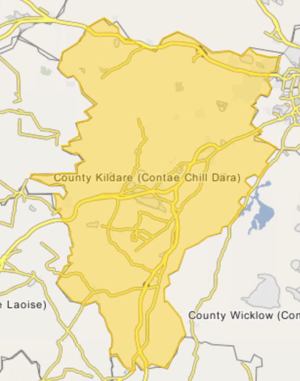
Image: Location map Ireland County Kildare
Size of this preview: 473 × 600 pixels. Other resolutions: 189 × 240 pixels | 615 × 780 pixels.
Original image (615 × 780 pixels, file size: 123 KB, MIME type: image/png)
Description: Map of County Kildare Geographical Limits: N: 53.484° S: 52.8376° W: -7.2455° E: -6.4201°
Title: Location map Ireland County Kildare
Credit: http://www.wikimapia.org
Author: Wikimapia
Usage Terms: Creative Commons Attribution-Share Alike 4.0
License: CC BY-SA 4.0
License Link: https://creativecommons.org/licenses/by-sa/4.0
Attribution Required?: Yes
Image usage
The following 2 pages link to this image:

All content from Kiddle encyclopedia articles (including the article images and facts) can be freely used under Attribution-ShareAlike license, unless stated otherwise.