
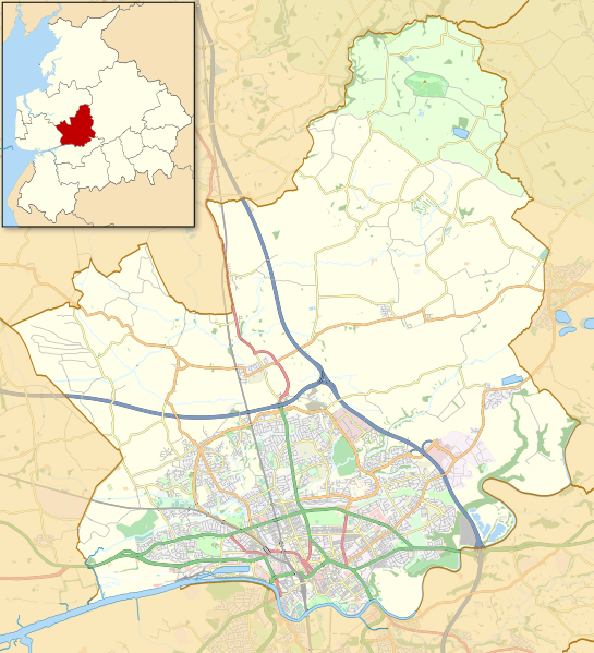
Image: Location map United Kingdom City of Preston

Description: Map of the City of Preston district, Lancashire, England Part of the Forest of Bowland Area of Outstanding Natural Beauty Equirectangular map projection on WGS 84 datum, with N/S stretched 165% Geographic limits: West: 2.83W East: 2.59W North: 53.90N South: 53.74N
Title: Location map United Kingdom City of Preston
Credit: This file was derived from: Preston UK ward map 2010 (blank).svg: Forest of Bowland AONB locator map.svg: http://www.openstreetmap.org/?lat=53.82&lon=-2.71&zoom=11&layers=M
Author: Preston_UK_ward_map_2010_(blank).svg: Nilfanion, created using Ordnance Survey data Forest of Bowland AONB locator map.svg: Nilfanion, created using Ordnance Survey data and Natural England data OpenStreetMap: OpenStreetMap contributors derivative work: Dr Greg
Usage Terms: Creative Commons Attribution-Share Alike 2.0
License: CC BY-SA 2.0
License Link: https://creativecommons.org/licenses/by-sa/2.0
Attribution Required?: Yes
Image usage
The following page links to this image:
