
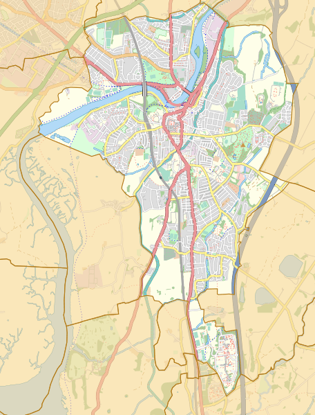
Image: Location map United Kingdom Lancaster 2018

Description: Street map of the unparished area of Lancaster, Lancashire, England, in 2018. Geographic limits: West: 2.850 W East: 2.760 W North: 54.070 N South: 54.000 N
Title: Location map United Kingdom Lancaster 2018
Credit: This file was derived from: Lancaster unparished area UK locator map.svg: http://www.openstreetmap.org/#map=13/54.0441/-2.7980 accessed 15 April 2018
Author: Lancaster unparished area UK locator map.svg: Nilfanion, created using Ordnance Survey data OpenStreetMap: OpenStreetMap contributors derivative work: Dr Greg
Usage Terms: Creative Commons Attribution-Share Alike 4.0
License: CC BY-SA 4.0
License Link: https://creativecommons.org/licenses/by-sa/4.0
Attribution Required?: Yes
Image usage
The following 2 pages link to this image:
