
Image: Loch Bràigh na h-Aoidhe - geograph.org.uk - 923770
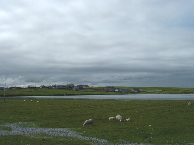
Description: Loch Bràigh na h-Aoidhe This picture of Loch Bràigh na h-Aoidhe was taken from the A866 which connects the Eye Peninsula to Stornoway and the rest of the island, just behind the loch is the village and Stornoway Airport and in front the sheep are grazing. The light coloured area at the bottom of the picture is actually pebbles and shale that was washed over the Bràigh wall during a Hurricane that hit us in January of that year, the Eye Peninsula was totally cut of for 20 hours till the wind and sea subsided enough for a team of diggers and lorries could move in to clear thousands of tons of rubble of the road
Title: Loch Bràigh na h-Aoidhe - geograph.org.uk - 923770
Credit: From geograph.org.uk
Author: Angus Peck
Usage Terms: Creative Commons Attribution-Share Alike 2.0
License: CC BY-SA 2.0
License Link: https://creativecommons.org/licenses/by-sa/2.0
Attribution Required?: Yes
Image usage
