
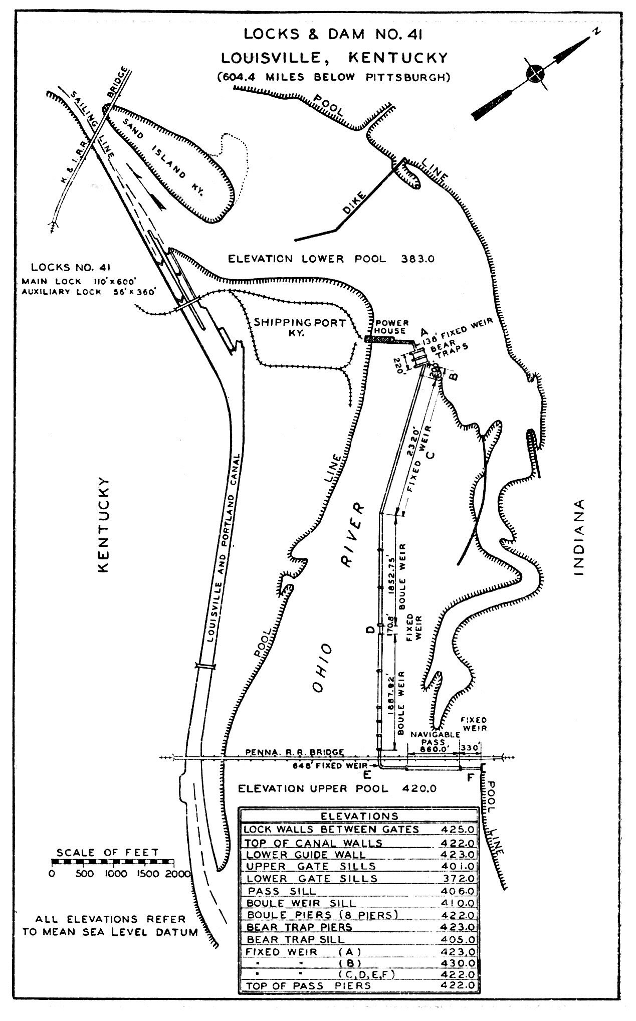
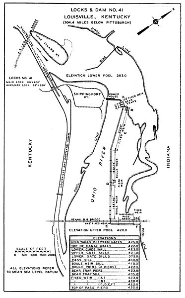
Image: Locks and Dam No 41 navigation chart from 1934
Size of this preview: 373 × 599 pixels. Other resolutions: 149 × 240 pixels | 1,269 × 2,037 pixels.
Original image (1,269 × 2,037 pixels, file size: 442 KB, MIME type: image/jpeg)
Description: Locks and Dam No. 41 navigation chart Louisville, Kentucky
Title: Locks and Dam No 41 navigation chart from 1934
Credit: The Ohio River, Fifth Edition (1935), p.208
Author: War Department, Office of the Chief of Engineers
Usage Terms: Public domain
License: Public domain
Attribution Required?: No
Image usage
The following page links to this image:

All content from Kiddle encyclopedia articles (including the article images and facts) can be freely used under Attribution-ShareAlike license, unless stated otherwise.