
Image: Lollardmap

Size of this preview: 454 × 600 pixels. Other resolutions: 182 × 240 pixels | 620 × 819 pixels.
Original image (620 × 819 pixels, file size: 399 KB, MIME type: image/jpeg)
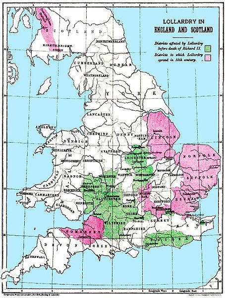
Description: Map of Lollardy's influence: areas of influence before the death of Richard II are in green; areas where Lollardy spread in the 15th century are in red.
Title: Lollardmap
Credit: Originally published in: G.M. Trevelyan, England in the Age of Wycliffe (London: Longmans, Green, 1909). From: http://www.lollardsociety.org/map.html
Usage Terms: Public domain in the United States
License: PD-US
License Link: //en.wikipedia.org/wiki/File:Lollardmap.jpg
Image usage
The following 3 pages link to this image:

All content from Kiddle encyclopedia articles (including the article images and facts) can be freely used under Attribution-ShareAlike license, unless stated otherwise.