
Image: Looking north at LEnfant Plaza - Washington DC
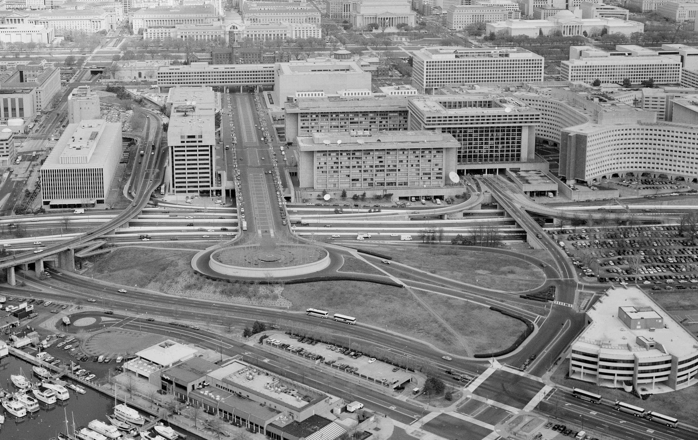
Description: Aerial photograph looking north at L'Enfant Plaza, L'Enfant Promenade, and part of Southwest, Washington, D.C. (1992). The Potomac River waterfront is at the bottom of the image. The six-lane divided street that is Maine Avenue SW can be seen just above the waterfront and its buildings. L'Enfant Promenade is the prominent street extending north from Benjamin Banneker Park and Overlook (in the lower-center of the photograph); the James V. Forrestal Building appears to block it off, and the Smithsonian Castle can just be seen beyond the Forrestal Building. To the left of L'Enfant Promenade is the U.S. Postal Service headquarters. To the right (forming a U-shape around the plaza itself) are the North Building, South Building, and L'Enfant Plaza Hotel (9th Street SW passes beneath it). The Robert C. Weaver Federal Building (curving X-shaped building), headquarters of the U.S. Department of Housing and Urban Development, can be seen to the right of the L'Enfant Plaza Hotel. The wedge-shaped building in the lower right corner is 800 9th Street SW, the U.S. Department of Agriculture's Cooperative State Research, Education, and Extensive Service (CSREES) building. Image (1992): HABS−Historic American Building Survey images of Washington, D.C..
Title: Looking north at LEnfant Plaza - Washington DC
Credit: http://lcweb2.loc.gov/cgi-bin/displayPhoto.pl?path=/pnp/habshaer/dc/dc0700/dc0776/photos&topImages=042585pr.jpg
Author: U.S. National Park Service, Historic American Building Survey. John McWilliams, photographer.
Usage Terms: Public domain
License: Public domain
Attribution Required?: No
Image usage
The following 2 pages link to this image:
