
Image: Lucas County, Ohio historical map, 1899 - DPLA - 15d00f03bb083bbc2dfeccd83c293084 (cropped)
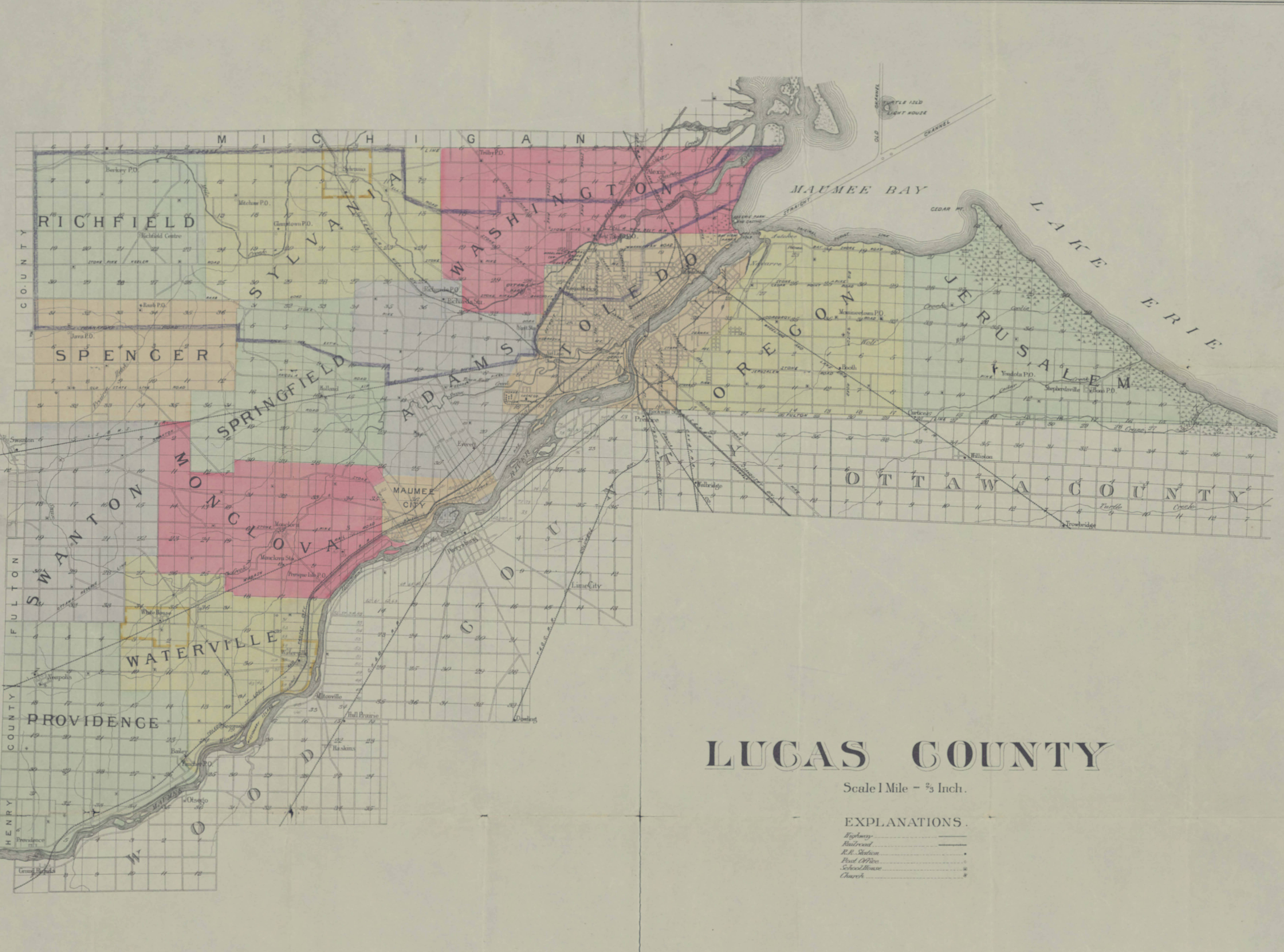
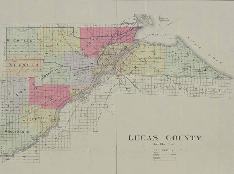
Description: Historical map of Lucas County, Ohio copyrighted 1899 by the Uhl Brothers Company. Map shows townships, railroads, post offices, schools, churches, and the straight channel in Maumee Bay.
Title: Lucas County, Ohio historical map, 1899
Credit: This file was contributed to Wikimedia Commons by Toledo-Lucas County Public Library as part of a cooperation project. The donation was facilitated by the Digital Public Library of America, via its partner Ohio Digital Network. Record in source catalog DPLA identifier: 15d00f03bb083bbc2dfeccd83c293084
Permission: This image might not be in the public domain outside of the United States; this especially applies in the countries and areas that do not apply the rule of the shorter term for US works, such as Canada, Mainland China (not Hong Kong or Macao), Germany, Mexico, and Switzerland. The creator and year of publication are essential information and must be provided. See Wikipedia:Public domain and Wikipedia:Copyrights for more details.
Usage Terms: Public domain
License: Public domain
Attribution Required?: No
Image usage
The following page links to this image:

.jpg)