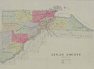
Lucas County, Ohio facts for kids
Quick facts for kids
Lucas County
|
|||
|---|---|---|---|
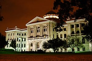
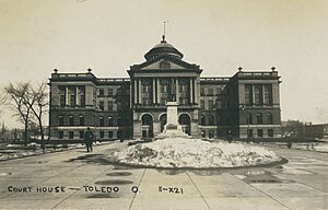
The Lucas County Courthouse in Toledo
|
|||
|
|||
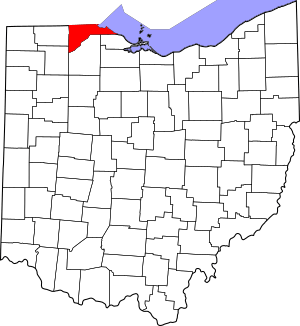
Location within the U.S. state of Ohio
|
|||
 Ohio's location within the U.S. |
|||
| Country | |||
| State | |||
| Founded | June 20, 1835 | ||
| Named for | Robert Lucas | ||
| Seat | Toledo | ||
| Largest city | Toledo | ||
| Area | |||
| • Total | 596 sq mi (1,540 km2) | ||
| • Land | 341 sq mi (880 km2) | ||
| • Water | 255 sq mi (660 km2) 43%% | ||
| Population
(2020)
|
|||
| • Total | 431,279 | ||
| • Estimate
(2021)
|
429,191 |
||
| • Density | 723.6/sq mi (279.39/km2) | ||
| Time zone | UTC−5 (Eastern) | ||
| • Summer (DST) | UTC−4 (EDT) | ||
| Congressional district | 9th | ||
Lucas County is a county located in the northwestern part of Ohio. It sits next to Lake Erie on its east side and the Maumee River on its southeast. The river flows into the lake.
In 2020, about 431,279 people lived here. The main city and county seat is Toledo. Toledo is right where the Maumee River meets Lake Erie.
The county was named after Robert Lucas. He was the 12th governor of Ohio. This happened in 1835 during his second term. When Lucas County was created, it caused a disagreement called the Toledo War. This was a border dispute with the Michigan Territory, which also claimed some of this land. Lucas County is the main part of the Toledo Metropolitan Statistical Area.
Contents
A Look Back: Lucas County's Story
A long time ago, on August 20, 1794, a big battle happened near where the town of Maumee is today. This was the Battle of Fallen Timbers. American forces, led by General Anthony Wayne, won against Native American groups. This battle was part of the Northwest Indian War. After this victory, the Northwest Territory was opened up for more settlers.
Before this, the Odawa people mainly lived in Northwest Ohio. They had traded with the French at Fort Detroit since 1701. Other Odawa lived in Michigan. They gave up a lot of their land in the Treaty of Greenville. But they kept control of lands along the Maumee River until after the War of 1812. The last Odawa group, led by Ottokee (grandson of Chief Pontiac), left the Maumee River area for Kansas in 1839.
Lucas County was officially started in 1835. At that time, both Ohio and the Michigan Territory claimed a piece of land along their border. This area was about 468 square miles. This disagreement is known as the Toledo War.
When Michigan asked the U.S. Congress to become a state in 1835, it wanted this disputed land to be part of Michigan. To respond, the Ohio General Assembly officially made part of this area into Lucas County. They named it after Ohio's governor at the time, Robert Lucas.
Where is Lucas County?
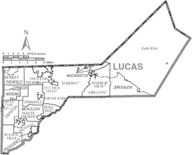
The United States Census Bureau says Lucas County covers 596 square miles in total. About 341 square miles is land, and 255 square miles (43%) is water. It's the fourth-smallest county in Ohio by land area. A large part of the county used to be a huge area of forests, wetlands, and grasslands. This was known as the Great Black Swamp.
Important Rivers
Neighboring Counties
- Monroe County, Michigan (north)
- Essex County, Ontario (northeast)
- Ottawa County (southeast)
- Wood County (south)
- Henry County (southwest)
- Fulton County (west)
- Lenawee County, Michigan (northwest)
Special Nature Areas
- Cedar Point National Wildlife Refuge
- Ottawa National Wildlife Refuge (part)
- West Sister Island National Wildlife Refuge
Main Roads and Highways
 I-73 (future)
 I-75
I-75

 I-80 / I-90 / Ohio Turnpike
 I-280
I-280 I-475
I-475 US 20
US 20 US 20A
 US 23
US 23 US 24
US 24 US 223
 SR 2
SR 2 SR 25
SR 25 SR 51
SR 51 SR 64
SR 64 SR 65
SR 65 SR 120
 SR 184
 SR 246
 SR 295
Who Lives in Lucas County?
| Historical population | |||
|---|---|---|---|
| Census | Pop. | %± | |
| 1840 | 9,382 | — | |
| 1850 | 12,363 | 31.8% | |
| 1860 | 25,831 | 108.9% | |
| 1870 | 46,722 | 80.9% | |
| 1880 | 67,377 | 44.2% | |
| 1890 | 102,296 | 51.8% | |
| 1900 | 153,559 | 50.1% | |
| 1910 | 192,728 | 25.5% | |
| 1920 | 275,721 | 43.1% | |
| 1930 | 347,709 | 26.1% | |
| 1940 | 344,333 | −1.0% | |
| 1950 | 395,551 | 14.9% | |
| 1960 | 456,931 | 15.5% | |
| 1970 | 484,370 | 6.0% | |
| 1980 | 471,741 | −2.6% | |
| 1990 | 462,361 | −2.0% | |
| 2000 | 455,054 | −1.6% | |
| 2010 | 441,815 | −2.9% | |
| 2020 | 431,279 | −2.4% | |
| 2021 (est.) | 429,191 | −2.9% | |
| U.S. Decennial Census 1790–1960 1900–1990 1990–2000 2010–2020 |
|||
In 2010, there were 441,815 people living in Lucas County. There were 180,267 households. The population density was about 1,296 people per square mile. The average household had 2.39 people. The average family had 3.01 people. The median age was 37.0 years.
What People Do Here: The Economy
This section shows some of the biggest employers in Lucas County. These are the companies and organizations that provide the most jobs.
Top Job Providers
| # | Employer | # of employees |
|---|---|---|
| 1 | Promedica Health Services | 11,517 |
| 2 | University of Toledo | 8,502 |
| 3 | Fiat Chrysler - Toledo North Plant; Toledo South Plant | 6,759 |
| 4 | Mercy Health Partners | 5,880 |
| 5 | Toledo Public Schools | 3,193 |
| 6 | Lucas County | 2,821 |
| 7 | City of Toledo | 2,748 |
| 8 | Kroger | 2,300 |
| 9 | Walmart | 1,954 |
| 10 | General Motors - Powertrain | 1,778 |
Towns and Villages
Cities
- Maumee
- Oregon
- Sylvania
- Toledo (the county seat)
- Waterville
Villages
- Berkey
- Harbor View
- Holland
- Ottawa Hills
- Swanton (mostly in Fulton County)
- Whitehouse
Townships
- Harding
- Jerusalem
- Monclova
- Providence
- Richfield
- Spencer
- Springfield
- Swanton
- Sylvania
- Washington
- Waterville
Census-designated places
Unincorporated communities
Ghost towns
See also
 In Spanish: Condado de Lucas (Ohio) para niños
 | Audre Lorde |
 | John Berry Meachum |
 | Ferdinand Lee Barnett |


