Maumee, Ohio facts for kids
Quick facts for kids
Maumee, Ohio
|
|||
|---|---|---|---|
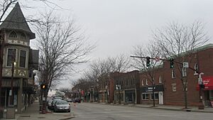
Maumee Historic District
|
|||
|
|||
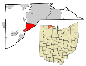
Location in Lucas County and the state of Ohio.
|
|||
| Country | United States | ||
| State | Ohio | ||
| County | Lucas | ||
| Area | |||
| • Total | 10.79 sq mi (27.93 km2) | ||
| • Land | 10.04 sq mi (26.02 km2) | ||
| • Water | 0.74 sq mi (1.92 km2) | ||
| Elevation | 633 ft (193 m) | ||
| Population
(2020)
|
|||
| • Total | 13,896 | ||
| • Density | 1,383.37/sq mi (534.11/km2) | ||
| Time zone | UTC−5 (EST) | ||
| • Summer (DST) | UTC−4 (EDT) | ||
| ZIP code |
43537
|
||
| Area code(s) | 419/567 | ||
| FIPS code | 39-48342 | ||
| GNIS feature ID | 1086527 | ||
| Website | www.maumee.org | ||
Maumee (pronounced maw-MEE) is a city in Lucas County, Ohio, United States. It's located right next to the Maumee River, about 10 miles (16 km) southwest of Toledo. In 2020, about 13,896 people lived there. Maumee was even named an "All-America City" in 2006!
Contents
History of Maumee
Long ago, before Europeans arrived, Native American tribes like the Ottawa lived in the Maumee River valley. They used the rich natural resources of the area. For much of the 1700s, French, British, and American groups fought for control of the lower Maumee River. This river was a key route for travel and trade. It connected the East to the West through Lake Erie.
After the American Revolutionary War, Native American tribes in the Northwest Territory formed alliances. These included the Odawa, Ojibwe, Potawatomi, and Shawnee. The United States claimed this land from the British. The Northwest Indian War was a series of battles from 1785 to 1795. It ended with a big American victory over the British and their Native American allies. This happened at the Battle of Fallen Timbers in Maumee in 1794.
Maumee is also where General "Mad" Anthony Wayne built his last fort, Fort Deposit. He built it in August 1794 on his way to the Battle of Fallen Timbers. After the War of 1812, fighting ended. This opened the way for Americans to move into what is now Ohio. Many people came, hoping to make money by selling and developing land.
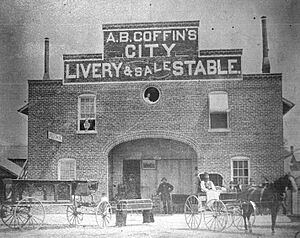
In 1817, a town was planned at the "Foot of the Rapids" of the Maumee River. Within ten years, this settlement became known as an important shipping point. It connected Lake Erie with the lands to the west. The Erie Canal opened in New York in 1825. This helped more people move to Ohio. It linked Great Lakes towns to the Hudson River and New York City.
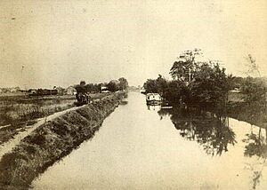
The Wabash and Erie Canal was finished in 1840. This helped the economy even more. Jessup Scott, a town promoter, believed Maumee would become the "great city of the West." He thought it would be bigger than all other cities. By the mid-1800s, Maumee was a busy center for river trade, business, and shipbuilding. Almost twenty trading companies were active along the three miles (5 km) of ship docks. They competed for both local and wholesale business.
In 1840, Maumee became the county seat. This meant it was the main town for government business. Lawyers came from far away to work in the impressive Lucas County Courthouse. This building was paid for by private donations. Court days were also a time for trade and business. The federal customs office and post office were also in Maumee.
Maumee's dreams of becoming a huge city started to fade in the 1850s. This was because new, larger ships were built for the Great Lakes. These ships were too big to travel up the Maumee River. Also, railroads became a faster and cheaper way to transport goods. This took away a lot of business from river trade. As people moved further west, Maumee lost its county seat status in 1854.
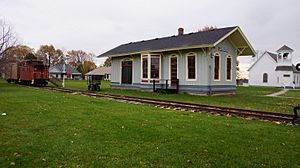
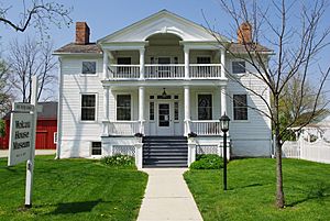
About a century later, in the 1970s, Maumee started to grow again. Today, the city is one of the biggest business centers in Northwest Ohio. The Arrowhead Business Park and Maumee's older business areas create over 30,000 jobs. Maumee has grown beyond its original borders. Its population is now over 13,700 residents. Many historic homes and buildings still stand along the tree-lined streets. These areas show the city's rich architectural history.
Geography of Maumee
Maumee is located about 11 miles (18 km) upriver from Toledo. Toledo is where the Maumee River meets Maumee Bay. Maumee is shaped roughly like a triangle. Its borders are Interstate 80/90 to the north. To the west, it's bordered by Interstate 475/U.S. Route 23. The Maumee River forms its border to the southeast. It is just downriver from the town of Waterville.
The United States Census Bureau states that the city covers a total area of 10.61 square miles (27.48 km2). Of this, 9.89 square miles (25.61 km2) is land. The remaining 0.72 square miles (1.86 km2) is water.
Population Information
| Historical population | |||
|---|---|---|---|
| Census | Pop. | %± | |
| 1840 | 840 | — | |
| 1850 | 1,465 | 74.4% | |
| 1860 | 1,691 | 15.4% | |
| 1870 | 1,779 | 5.2% | |
| 1880 | 1,780 | 0.1% | |
| 1890 | 1,645 | −7.6% | |
| 1900 | 1,856 | 12.8% | |
| 1910 | 2,307 | 24.3% | |
| 1920 | 3,195 | 38.5% | |
| 1930 | 4,588 | 43.6% | |
| 1940 | 4,683 | 2.1% | |
| 1950 | 5,548 | 18.5% | |
| 1960 | 12,063 | 117.4% | |
| 1970 | 15,937 | 32.1% | |
| 1980 | 15,747 | −1.2% | |
| 1990 | 15,561 | −1.2% | |
| 2000 | 15,237 | −2.1% | |
| 2010 | 14,286 | −6.2% | |
| 2020 | 13,896 | −2.7% | |
| 2021 (est.) | 13,810 | −3.3% | |
| Sources: | |||
2010 Census Details
In 2010, the city had 14,286 people living there. There were 6,037 households and 3,854 families. The population density was about 1,444.5 people per square mile (557.7/km2).
Most of the people in Maumee were White (94.7%). Other groups included African American (1.8%), Native American (0.2%), and Asian (0.9%). About 3.4% of the population was Hispanic or Latino.
About 30% of households had children under 18. Nearly half (49.2%) were married couples living together. The average household had 2.37 people. The average family had 2.98 people. The median age in the city was 39.7 years.
Economy and Jobs
Maumee is home to many businesses. Here are some of the top employers in the city, based on a 2017 report:
| No. | Employer | No. of employees |
|---|---|---|
| 1 | United Parcel Service | 3,382 |
| 2 | St. Luke's Hospital | 1,597 |
| 3 | Dana Incorporated | 1,232 |
| 4 | The Andersons | 744 |
| 5 | Maumee City School District | 624 |
| 6 | Paramount Care Inc. | 586 |
| 7 | Matrix Technologies Inc. | 251 |
| 8 | Therma Tru Corp. | 211 |
| 9 | Spartan Chemical Co. | 208 |
| 10 | ProMedica Health System | 197 |
Please note that St. Luke's Hospital closed in May 2023.
Education in Maumee
Maumee's public schools are part of the Maumee City School District. This district is the oldest chartered school district in Ohio. It was rated "Effective" by the state for the 2008–09 school year.
The school system has different levels:
- Elementary Schools (Kindergarten to 3rd grade): Fairfield and Fort Miami Elementaries.
- Maumee Intermediate School (4th and 5th grades).
- Maumee Middle School (6th to 8th grades).
- Maumee High School (9th to 12th grades). This is the only high school in Maumee.
There are also several private schools in the area. These include Maumee Valley Country Day School, St. John's Jesuit High School, Toledo Christian Schools, St. Joseph Catholic School & Preparatory, and St. Patrick of Heatherdowns School.
Maumee also has a public library. It is a branch of the Toledo-Lucas County Public Library.
Famous People from Maumee
- James W. Forsyth: A U.S. Army general.
- Richard Kazmaier: He won the 1951 Heisman Trophy. He gave his trophy to Maumee High School.
- Robert Knepper: An actor, known for playing Theodore "T-Bag" Bagwell in Prison Break.
- Henry Ware Lawton: A U.S. Army officer who served in the Civil War, Apache Wars, and Spanish–American War.
- Necros: One of the first hardcore punk bands.
- Larry Nuber: An auto racing announcer for ESPN.
- Dane Sanzenbacher: A wide receiver for the Cincinnati Bengals in the NFL.
- Soledad Brothers: A punk blues music group.
- Harold Anderson: The person who started The Andersons company.
See also
 In Spanish: Maumee (Ohio) para niños
 | Janet Taylor Pickett |
 | Synthia Saint James |
 | Howardena Pindell |
 | Faith Ringgold |


