
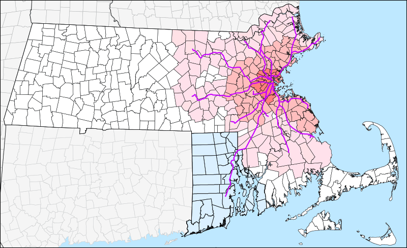
Image: MBTA Commuter Rail and funding district map

Description: Geographic map of the MBTA Commuter Rail system and the MBTA funding district. The original 14-town MTA district is shown in darkest pink, the 78-town MBTA district established in 1964 in medium pink, and the 175-town "forward funding" district established in 1999 as light pink. White areas are not part of the MBTA district but still pay state sales taxes which are partially used to fund the MBTA. Rhode Island, which is not part of the district but pays for service to 3 stations under the 1988 Pilgrim Partnership, is shown in light blue.
Title: MBTA Commuter Rail and funding district map
Credit: Own work by User:Pi.1415926535 Geographic data is from MassGIS, state outlines from USGS STATE_BOUNDS dataset, and commuter rail lines from en:Template:Attached KML/MBTA Commuter Rail.
Author: User:Pi.1415926535 (version 2) SPUI (version 1)
Usage Terms: Public domain
License: Public domain
Attribution Required?: No
Image usage
The following 2 pages link to this image:
