
Image: Maatsuyker Islands
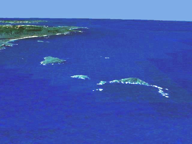
Description: Aerial view of the southern coast of Tasmania. In the background South East Cape, in the foreground the Maatsuyker Islands (Needle Rocks are on the right; just to the left of them is Maatsuyker Island; De Witt is the larger island on the left). Artificial view generated from satellite data.
Title: Maatsuyker Islands
Credit: Transferred from en.wikipedia to Commons.
Author: The original uploader was Phaedrus86 at English Wikipedia.
Permission: I extracted this image from en:NASA World Wind, which makes it public domain because of US Government policies. It is an artificial view generated from satellite data. --Phaedrus86 03:21, 22 July 2006 (UTC)
Usage Terms: Public domain
License: Public domain
Attribution Required?: No
Image usage
The following page links to this image:
