
Image: Maerschalk-Map-Collect Pond Negros Burial Ground 2-1754
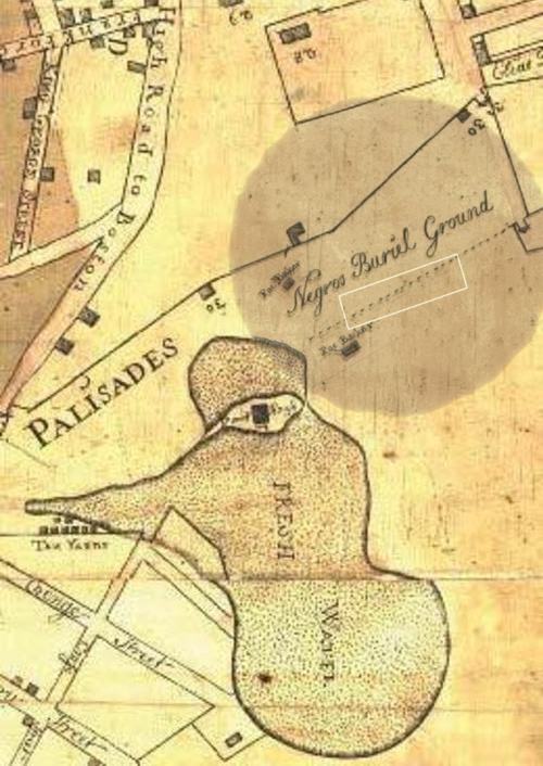
Description: Area of archaeological excavation by Howard university marked on a map by Francis Maerschalck (d. 1776). A Plan of the City of New York from an Actual Survey, anno Domini M{D}CCLV .Section showing the Collect Pond and "Negros Burial Ground". New York City in 1754; map was published in 1755 by Gerardus Duyckink II (1723-1797). Edward Holland was mayor.
Title: Maerschalk-Map-Collect Pond Negros Burial Ground 2-1754
Credit: http://geographer-at-large.blogspot.com/2011/01/african-burial-grounds-update-and.html
Author: Francis Maerschalk/Area of excavation marked by Howard University for the General Services Administration/big fat circle-7mike5000
Usage Terms: Public domain
License: Public domain
Attribution Required?: No
Image usage
The following page links to this image:
